

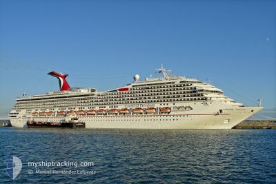
CARNIVAL FREEDOM
Passengers Ship

Current Trip
DOAMB
| Time Travelled | 8 h, 2 mins |
|---|---|
| Remaining Time | --- |
| Distance Travelled | 80.05 nm |
| Remaining Distance | --- |
| AVG Speed | 12.4 Noeuds |
| MAX Speed | 16.8 Noeuds |
| AVG Wind | 16.3 knots |
| MAX Wind | 18 knots |
| MIN Temp | 20.8°C / 69.44°F |
| MAX Temp | 25.9°C / 78.62°F |
| Tirant d eau | 8.4 m |
| Position reçue | 1 d depuis |
Current Position
| Longitude | --- |
|---|---|
| Latitude | --- |
| Etat | Under way using engine |
| Vitesse | 19 Noeuds |
| Parcours | 138.1° |
| Zone | North Atlantic Ocean |
| Station | T-AIS |
| Position reçue | 1 d depuis |
Information
The current position of CARNIVAL FREEDOM is in North Atlantic Ocean with coordinates 26.60325° / -76.83190° as reported on 2025-02-16 09:48 by AIS to our vessel tracker app. The vessel's current speed is 19 Noeuds
The vessel CARNIVAL FREEDOM (IMO: 9333149, MMSI: 371154000) is a Passengers Ship that was built in 2007 ( 18 Age ). It's sailing under the flag of [PA] Panama.
In this page you can find informations about the vessels current position, last detected port calls, and current voyage information. If the vessels is not in coverage by AIS you will find the latest position.
The current position of CARNIVAL FREEDOM is detected by our AIS receivers and we are not responsible for the reliability of the data. The last position was recorded while the vessel was in Coverage by the Ais receivers of our vessel tracking app.
The current draught of CARNIVAL FREEDOM as reported by AIS is 8.4 meters
Weather
| Temperature | 25.6°C / 78.08°F |
|---|---|
| Wind Speed | 18 knots |
| Direction | 102° ESE |
| Pressure | 1015.4 hPa |
| Humidity | 73.3 % |
| Cloud Coverage | 59 % |


Featured Company
Last Port Calls
| Port | Arrival | Departure | Time In Port |
|---|---|---|---|
| 2025-02-17 11:31 | 2025-02-17 19:32 | 8 h | |
| 2025-02-15 06:00 | 2025-02-15 16:05 | 10 h | |
| 2025-02-14 06:15 | 2025-02-14 15:38 | 9 h | |
| 2025-02-12 08:03 | 2025-02-12 17:18 | 9 h | |
| 2025-02-10 04:37 | 2025-02-10 16:06 | 11 h | |
| 2025-02-08 06:43 | 2025-02-08 16:23 | 9 h | |
| 2025-02-06 05:56 | 2025-02-06 15:48 | 9 h | |
| 2025-02-05 07:35 | 2025-02-05 16:23 | 8 h | |
| 2025-02-04 09:02 | 2025-02-04 17:14 | 8 h | |
| 2025-02-03 06:44 | 2025-02-03 14:35 | 7 h |
Most Visited Ports (Last year)
| Port | Arrivals | |
|---|---|---|
| 77 | ||
| 48 | ||
| 38 | ||
| 27 | ||
| 18 | ||
| 8 |
Last Trips
| Origin | Departure | Destination | Arrival | Distance | |
|---|---|---|---|---|---|
| 2025-02-15 16:05 | 2025-02-17 11:31 | 764.76 nm | |||
| 2025-02-14 15:38 | 2025-02-15 06:00 | 274.26 nm | |||
| 2025-02-12 17:18 | 2025-02-14 06:15 | 452.70 nm | |||
| 2025-02-10 16:06 | 2025-02-12 08:03 | 669.24 nm | |||
| 2025-02-08 16:23 | 2025-02-10 04:37 | 345.80 nm | |||
| 2025-02-06 15:48 | 2025-02-08 06:43 | 346.99 nm | |||
| 2025-02-05 16:23 | 2025-02-06 05:56 | 158.49 nm | |||
| 2025-02-04 17:14 | 2025-02-05 07:35 | 245.22 nm | |||
| 2025-02-03 14:35 | 2025-02-04 09:02 | 347.40 nm | |||
| 2025-02-01 16:01 | 2025-02-03 06:44 | 668.57 nm |
Events
| Heure | Evenement | Détails | Position/ Destination | Info |
|---|---|---|---|---|
| 2025-02-17 23:43 | Démarrage | 2.39 nm, North East of AMBER COVE |
19.86754 / -70.75309
DOAMB
|
Vitesse: 13.2 kn Parcours: 37° |
| 2025-02-17 23:32 | PORT DE DEPART |
|
19.86754 / -70.75309
DOAMB
|
Vitesse: Parcours: 33° |
| 2025-02-17 15:47 | Arret |
19.83512 / -70.77481
[DO] AMBER COVE
|
Vitesse: Parcours: 32° |
|
| 2025-02-17 15:31 | Port d'arrivée |
|
19.83716 / -70.77326
[DO] AMBER COVE
|
Vitesse: 6.9 kn Parcours: 207° |
| 2025-02-16 09:53 | Etat Changé | Default Under way using engine |
26.58489 / -76.81349
DOAMB
|
Vitesse: 19 kn Parcours: 138.1° |
| 2025-02-16 09:48 | Hors de la zone couverte |
26.60325 / -76.83190
North Atlantic Ocean
DOAMB
|
Vitesse: 19 kn Parcours: 138.1° |
|
| 2025-02-16 08:54 | Detecté en mer | Bahamas part of the North Atlantic Ocean |
26.78725 / -77.07582
North Atlantic Ocean
DOAMB
|
Vitesse: 18.9 kn Parcours: 127.5° |
| 2025-02-16 08:54 | Etat Changé | Under way using engine Default |
26.78725 / -77.07582
DOAMB
|
Vitesse: 18.3 kn Parcours: 127° |
| 2025-02-16 08:54 | Dans la zone couverte |
26.78725 / -77.07582
North Atlantic Ocean
DOAMB
|
Vitesse: 18.9 kn Parcours: 127.5° |
|
| 2025-02-15 22:03 | Hors de la zone couverte |
28.31068 / -80.38134
North Atlantic Ocean
DOAMB
|
Vitesse: 18.3 kn Parcours: 116.8° |