

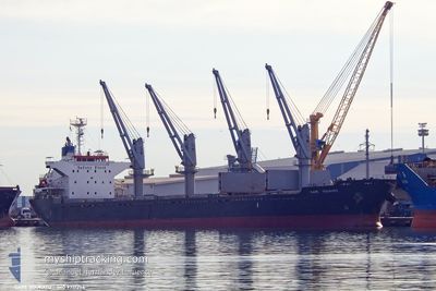
CAPE DOUKATO
Cargo

Current Trip
| Time Travelled | 26 days |
|---|---|
| Remaining Time | 2 days |
| Distance Travelled | 7349.87 nm |
| Remaining Distance | 697.93 nm |
| AVG Speed | 11.6 Noeuds |
| MAX Speed | 14.8 Noeuds |
| AVG Wind | 11.6 knots |
| MAX Wind | 35 knots |
| MIN Temp | 11.8°C / 53.24°F |
| MAX Temp | 28.4°C / 83.12°F |
| Tirant d eau | 9.7 m |
| Position reçue | 7 h, 17 m depuis |
Current Position
| Longitude | --- |
|---|---|
| Latitude | --- |
| Etat | Under way using engine |
| Vitesse | 10.4 Noeuds |
| Parcours | 89.5° |
| Zone | Mediterranean Sea - Eastern Basin |
| Station | T-AIS |
| Position reçue | 7 h, 17 m depuis |
Information
The current position of CAPE DOUKATO is in Mediterranean Sea - Eastern Basin with coordinates 36.36016° / 20.89066° as reported on 2025-03-13 08:10 by AIS to our vessel tracker app. The vessel's current speed is 10.4 Noeuds and is heading at the port of MERSIN. The estimated time of arrival as calculated by MyShipTracking vessel tracking app is 2025-03-16 06:32 LT
The vessel CAPE DOUKATO (IMO: 9717254, MMSI: 538010376) is a Cargo It's sailing under the flag of [MH] Marshall Is.
In this page you can find informations about the vessels current position, last detected port calls, and current voyage information. If the vessels is not in coverage by AIS you will find the latest position.
The current position of CAPE DOUKATO is detected by our AIS receivers and we are not responsible for the reliability of the data. The last position was recorded while the vessel was in Coverage by the Ais receivers of our vessel tracking app.
The current draught of CAPE DOUKATO as reported by AIS is 9.7 meters
Weather
| Temperature | 16.7°C / 62.06°F |
|---|---|
| Wind Speed | 17 knots |
| Direction | 174° S |
| Pressure | 1011.5 hPa |
| Humidity | 89.1 % |
| Cloud Coverage | 70 % |


Featured Company
Last Port Calls
| Port | Arrival | Departure | Time In Port |
|---|---|---|---|
| 2025-02-11 19:47 | 2025-02-15 08:06 | 3 d | |
| 2025-01-21 04:08 | 2025-01-26 09:24 | 5 d |
Most Visited Ports (Last year)
| Port | Arrivals | |
|---|---|---|
| 1 | ||
| 1 | ||
| 1 | ||
| 1 | ||
| 1 | ||
| 1 |
Last Trips
| Origin | Departure | Destination | Arrival | Distance | |
|---|---|---|---|---|---|
| 2025-01-26 09:24 | 2025-02-11 19:47 | 1586.78 nm | |||
| 2024-12-26 17:08 | 2025-01-21 04:08 | 4261.55 nm |
Events
| Heure | Evenement | Détails | Position/ Destination | Info |
|---|---|---|---|---|
| 2025-03-13 08:19 | Etat Changé | Default Under way using engine |
36.36093 / 20.92050
MERSIN
|
Vitesse: 10.4 kn Parcours: 89.5° |
| 2025-03-13 08:10 | Hors de la zone couverte |
36.36016 / 20.89066
Mediterranean Sea - Eastern Basin
MERSIN
|
Vitesse: 10.4 kn Parcours: 89.5° |
|
| 2025-03-13 07:47 | Etat Changé | Under way using engine Default |
36.35871 / 20.80894
MERSIN
|
Vitesse: 10.3 kn Parcours: 90° |
| 2025-03-13 07:44 | Etat Changé | Default Under way using engine |
36.35889 / 20.79964
MERSIN
|
Vitesse: 9.9 kn Parcours: 91.8° |
| 2025-03-13 07:24 | Etat Changé | Under way using engine Default |
36.36038 / 20.72954
MERSIN
|
Vitesse: 10.1 kn Parcours: 91° |
| 2025-03-13 07:20 | Etat Changé | Default Under way using engine |
36.36074 / 20.71583
MERSIN
|
Vitesse: 10.2 kn Parcours: 91° |
| 2025-03-13 06:56 | Etat Changé | Under way using engine Default |
36.36257 / 20.63151
MERSIN
|
Vitesse: 10.2 kn Parcours: 88° |
| 2025-03-13 06:28 | Etat Changé | Default Under way using engine |
36.36006 / 20.53483
MERSIN
|
Vitesse: 10 kn Parcours: 88.4° |
| 2025-03-13 05:23 | Etat Changé | Under way using engine Default |
36.36008 / 20.30234
MERSIN
|
Vitesse: 10.5 kn Parcours: 89° |
| 2025-03-13 05:16 | Etat Changé | Default Under way using engine |
36.36008 / 20.27851
MERSIN
|
Vitesse: 10.5 kn Parcours: 92.2° |