
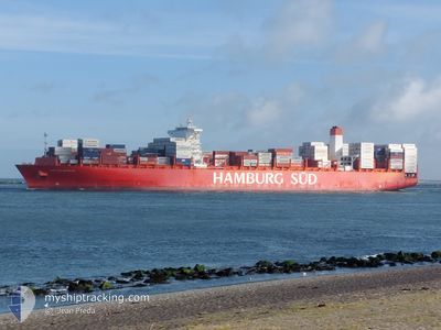
SAN NICOLAS MAERSK
Container Ship
Current Trip
BRSSZ>MAPTM2
| Time Travelled | 9 days |
|---|---|
| Remaining Time | --- |
| Distance Travelled | 4244.46 nm |
| Remaining Distance | --- |
| AVG Speed | 17.7 Noeuds |
| MAX Speed | 18.9 Noeuds |
| AVG Wind | 13.5 knots |
| MAX Wind | 21 knots |
| MIN Temp | 18°C / 64.4°F |
| MAX Temp | 29.3°C / 84.74°F |
| Tirant d eau | 14.3 m |
| Position reçue | 22 m depuis |
Current Position
| Longitude | -8.14296° |
|---|---|
| Latitude | 34.24680° |
| Etat | Under way using engine |
| Vitesse | 17.6 Noeuds |
| Parcours | 48.3° |
| Zone | North Atlantic Ocean |
| Station | T-AIS |
| Position reçue | 22 m depuis |
Info
Information
The current position of SAN NICOLAS MAERSK is in North Atlantic Ocean with coordinates 34.24680° / -8.14296° as reported on 2024-05-05 02:43 by AIS to our vessel tracker app. The vessel's current speed is 17.6 Noeuds
The vessel SAN NICOLAS MAERSK (IMO: 9622203, MMSI: 219102000) is a Container Ship that was built in 2013 ( 11 Age ). It's sailing under the flag of [DK] Denmark.
In this page you can find informations about the vessels current position, last detected port calls, and current voyage information. If the vessels is not in coverage by AIS you will find the latest position.
The current position of SAN NICOLAS MAERSK is detected by our AIS receivers and we are not responsible for the reliability of the data. The last position was recorded while the vessel was in Coverage by the Ais receivers of our vessel tracking app.
The current draught of SAN NICOLAS MAERSK as reported by AIS is 14.3 meters
Weather
| Temperature | 18°C / 64.4°F |
|---|---|
| Wind Speed | 9 knots |
| Direction | 6° N |
| Pressure | 1018.6 hPa |
| Humidity | 75.9 % |
| Cloud Coverage | 3 % |
Featured Company
Last Port Calls
| Port | Arrival | Departure | Time In Port |
|---|---|---|---|
| 2024-04-23 16:11 | 2024-04-25 05:36 | 1 d | |
| 2024-04-21 05:54 | 2024-04-21 23:48 | 17 h | |
| 2024-04-14 14:51 | 2024-04-15 22:16 | 1 d | |
| 2024-04-12 16:18 | 2024-04-14 03:44 | 1 d | |
| 2024-04-09 00:06 | 2024-04-09 19:33 | 19 h | |
| 2024-04-06 18:03 | 2024-04-08 00:12 | 1 d | |
| 2024-03-25 14:02 | 2024-03-26 14:43 | 1 d | |
| 2024-03-18 15:33 | 2024-03-19 10:39 | 19 h | |
| 2024-03-16 17:02 | 2024-03-17 17:37 | 1 d | |
| 2024-03-14 05:19 | 2024-03-15 05:32 | 1 d |
Most Visited Ports (Last year)
| Port | Arrivals | |
|---|---|---|
| 12 | ||
| 12 | ||
| 6 | ||
| 6 | ||
| 6 | ||
| 5 |
Last Trips
| Origin | Departure | Destination | Arrival | Distance | |
|---|---|---|---|---|---|
| 2024-04-21 20:48 | 2024-04-23 13:11 | 201.57 nm | |||
| 2024-04-15 19:16 | 2024-04-21 02:54 | 853.27 nm | |||
| 2024-04-14 00:44 | 2024-04-14 11:51 | 141.45 nm | |||
| 2024-04-09 16:33 | 2024-04-12 13:18 | 902.84 nm | |||
| 2024-04-07 21:12 | 2024-04-08 21:06 | 177.67 nm | |||
| 2024-03-26 14:43 | 2024-04-06 15:03 | 4413.31 nm | |||
| 2024-03-19 10:39 | 2024-03-25 14:02 | 1495.78 nm | |||
| 2024-03-17 18:37 | 2024-03-18 15:33 | 201.59 nm | |||
| 2024-03-15 06:32 | 2024-03-16 18:02 | 373.89 nm | |||
| 2024-03-13 19:42 | 2024-03-14 06:19 | 123.47 nm |
Events
| Heure | Evenement | Détails | Position/ Destination | Info |
|---|---|---|---|---|
| 2024-05-05 02:50 | Etat Changé | Default Under way using engine |
34.26926 / -8.11295
BRSSZ>MAPTM2
|
Vitesse: 17.6 kn Parcours: 48.3° |
| 2024-05-05 02:43 | Etat Changé | Under way using engine Default |
34.24680 / -8.14296
BRSSZ>MAPTM2
|
Vitesse: 17.6 kn Parcours: 48° |
| 2024-05-05 02:22 | Etat Changé | Default Under way using engine |
34.17562 / -8.23813
BRSSZ>MAPTM2
|
Vitesse: 17.7 kn Parcours: 47.2° |
| 2024-05-04 20:46 | Etat Changé | Under way using engine Default |
33.03867 / -9.61534
BRSSZ>MAPTM2
|
Vitesse: 16 kn Parcours: 34° |
| 2024-05-04 20:25 | Etat Changé | Default Under way using engine |
32.95500 / -9.68167
BRSSZ>MAPTM2
|
Vitesse: 16.9 kn Parcours: 34.4° |
| 2024-05-04 16:59 | Etat Changé | Under way using engine Default |
32.16637 / -10.32875
BRSSZ>MAPTM2
|
Vitesse: 16.8 kn Parcours: 34° |
| 2024-05-04 16:59 | Etat Changé | Default Under way using engine |
32.16402 / -10.33061
BRSSZ>MAPTM2
|
Vitesse: 16.9 kn Parcours: 34° |
| 2024-05-04 15:28 | Etat Changé | Under way using engine Default |
31.81065 / -10.60296
BRSSZ>MAPTM2
|
Vitesse: 16.8 kn Parcours: 33° |
| 2024-05-04 15:26 | Etat Changé | Default Under way using engine |
31.80273 / -10.60898
BRSSZ>MAPTM2
|
Vitesse: 16.7 kn Parcours: 32.3° |
| 2024-05-04 14:41 | Etat Changé | Under way using engine Default |
31.63165 / -10.75137
BRSSZ>MAPTM2
|
Vitesse: 16.8 kn Parcours: 41° |