
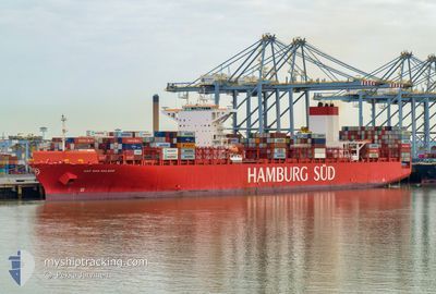
CAP SAN MALEAS
Container Ship
Current Trip
| Time Travelled | 2 days |
|---|---|
| Remaining Time | --- |
| Distance Travelled | 344.92 nm |
| Remaining Distance | 4.57 nm |
| AVG Speed | 9.7 Noeuds |
| MAX Speed | 13.9 Noeuds |
| AVG Wind | 11.6 knots |
| MAX Wind | 32 knots |
| MIN Temp | 12.7°C / 54.86°F |
| MAX Temp | 22.3°C / 72.14°F |
| Tirant d eau | 9.9 m |
| Position reçue | 3 m depuis |
Current Position
| Longitude | -52.10211° |
|---|---|
| Latitude | -32.12368° |
| Etat | Moored |
| Vitesse | |
| Parcours | 4° |
| Zone | South Atlantic Ocean |
| Station | T-AIS |
| Position reçue | 3 m depuis |
Info
Information
The current position of CAP SAN MALEAS is in South Atlantic Ocean with coordinates -32.12368° / -52.10211° as reported on 2024-05-02 00:57 by AIS to our vessel tracker app. The vessel's current speed is 0 Noeuds and is heading at the port of RIO GRANDE. The estimated time of arrival as calculated by MyShipTracking vessel tracking app is 2024-04-30 16:05 LT
The vessel CAP SAN MALEAS (IMO: 9633941, MMSI: 353365000) is a Container Ship that was built in 2014 ( 10 Age ). It's sailing under the flag of [PA] Panama.
In this page you can find informations about the vessels current position, last detected port calls, and current voyage information. If the vessels is not in coverage by AIS you will find the latest position.
The current position of CAP SAN MALEAS is detected by our AIS receivers and we are not responsible for the reliability of the data. The last position was recorded while the vessel was in Coverage by the Ais receivers of our vessel tracking app.
The current draught of CAP SAN MALEAS as reported by AIS is 9.9 meters
Weather
| Temperature | 19.6°C / 67.28°F |
|---|---|
| Wind Speed | 3 knots |
| Direction | 85° E |
| Pressure | 1006.3 hPa |
| Humidity | 96.7 % |
| Cloud Coverage | 100 % |
Featured Company
Last Port Calls
| Port | Arrival | Departure | Time In Port |
|---|---|---|---|
| 2024-04-28 00:41 | 2024-04-29 05:01 | 1 d | |
| 2024-04-25 19:22 | 2024-04-27 05:18 | 1 d | |
| 2024-04-22 07:08 | 2024-04-22 22:56 | 15 h | |
| 2024-04-20 10:57 | 2024-04-21 18:27 | 1 d | |
| 2024-04-08 09:07 | 2024-04-08 22:15 | 13 h |
Most Visited Ports (Last year)
| Port | Arrivals | |
|---|---|---|
| 10 | ||
| 10 | ||
| 5 | ||
| 5 | ||
| 4 | ||
| 4 |
Last Trips
| Origin | Departure | Destination | Arrival | Distance | |
|---|---|---|---|---|---|
| 2024-04-27 02:18 | 2024-04-27 21:41 | 148.33 nm | |||
| 2024-04-22 19:56 | 2024-04-25 16:22 | 903.39 nm | |||
| 2024-04-21 15:27 | 2024-04-22 04:08 | 167.38 nm | |||
| 2024-04-08 22:15 | 2024-04-20 07:57 | 4462.38 nm |
Events
| Heure | Evenement | Détails | Position/ Destination | Info |
|---|---|---|---|---|
| 2024-05-02 00:18 | Etat Changé | Moored Default |
-32.12375 / -52.10218
BRRIG
|
Vitesse: Parcours: 4° |
| 2024-05-02 00:15 | Dans la zone couverte |
-32.12375 / -52.10218
South Atlantic Ocean
|
Vitesse: Parcours: 11.1° |
|
| 2024-05-01 22:12 | Etat Changé | Default Moored |
-32.12360 / -52.10213
BRRIG
|
Vitesse: Parcours: 4° |
| 2024-05-01 22:06 | Hors de la zone couverte |
-32.12368 / -52.10214
South Atlantic Ocean
|
Vitesse: Parcours: 9.8° |
|
| 2024-05-01 21:09 | Etat Changé | Moored Default |
-32.12374 / -52.10211
BRRIG
|
Vitesse: Parcours: 4° |
| 2024-05-01 20:51 | Etat Changé | Default Moored |
-32.12402 / -52.10207
BRRIG
|
Vitesse: 0.1 kn Parcours: 4° |
| 2024-05-01 20:06 | Changement d'ETA | 2025/04/30 22:30 2024/04/30 16:05 |
-32.12373 / -52.10212
BRRIG
|
Vitesse: Parcours: 4° |
| 2024-05-01 19:48 | Etat Changé | Moored Default |
-32.12376 / -52.10208
BRRIG
|
Vitesse: Parcours: 4° |
| 2024-05-01 19:48 | Dans la zone couverte |
-32.12376 / -52.10208
South Atlantic Ocean
|
Vitesse: Parcours: 298.2° |
|
| 2024-05-01 00:10 | Arret | 5.77 nm, South of RIO GRANDE |
-32.12362 / -52.10199
BRRIG
|
Vitesse: 0.3 kn Parcours: 4° |