
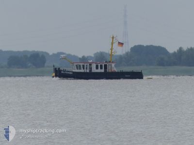
BUXTEHUDE
Other Type
Current Trip
WSA ELBE-NORDSEE
| Time Travelled | 18 h, 6 mins |
|---|---|
| Remaining Time | --- |
| Distance Travelled | 9.46 nm |
| Remaining Distance | --- |
| AVG Speed | 4.5 Noeuds |
| MAX Speed | 6 Noeuds |
| AVG Wind | 2.1 knots |
| MAX Wind | 4.8 knots |
| MIN Temp | 11.1°C / 51.98°F |
| MAX Temp | 15.7°C / 60.26°F |
| Tirant d eau | 1 m |
| Position reçue | 1 m depuis |
Current Position
| Longitude | --- |
|---|---|
| Latitude | --- |
| Etat | Under way using engine |
| Vitesse | |
| Parcours | --- |
| Zone | North Sea |
| Station | T-AIS |
| Position reçue | 1 m depuis |
Information
The current position of BUXTEHUDE is in North Sea with coordinates 53.50259° / 9.73122° as reported on 2025-03-25 02:57 by AIS to our vessel tracker app. The vessel's current speed is 0 Noeuds
The vessel BUXTEHUDE (MMSI: 211182030) is a Other Type It's sailing under the flag of [DE] Germany.
In this page you can find informations about the vessels current position, last detected port calls, and current voyage information. If the vessels is not in coverage by AIS you will find the latest position.
The current position of BUXTEHUDE is detected by our AIS receivers and we are not responsible for the reliability of the data. The last position was recorded while the vessel was in Coverage by the Ais receivers of our vessel tracking app.
The current draught of BUXTEHUDE as reported by AIS is 1 meters
Weather
| Temperature | 3.4°C / 38.12°F |
|---|---|
| Wind Speed | 5 knots |
| Direction | 272° W |
| Pressure | 1016.5 hPa |
| Humidity | 95.3 % |
| Cloud Coverage | 12 % |
Featured Company
Last Port Calls
| Port | Arrival | Departure | Time In Port |
|---|---|---|---|
| 2025-03-24 07:47 | 2025-03-24 08:52 | 1 h | |
| 2025-03-20 12:38 | 2025-03-24 07:08 | 3 d | |
| 2025-03-20 09:34 | 2025-03-20 11:59 | 2 h | |
| 2025-03-19 10:32 | 2025-03-20 05:50 | 19 h | |
| 2025-03-18 13:56 | 2025-03-19 05:58 | 16 h | |
| 2025-03-18 07:15 | 2025-03-18 09:16 | 2 h | |
| 2025-03-17 07:55 | 2025-03-18 06:06 | 22 h | |
| 2025-03-14 06:46 | 2025-03-17 05:52 | 2 d | |
| 2025-03-12 13:28 | 2025-03-14 05:42 | 1 d | |
| 2025-03-12 07:27 | 2025-03-12 12:37 | 5 h |
Most Visited Ports (Last year)
| Port | Arrivals | |
|---|---|---|
| 106 | ||
| 56 | ||
| 11 | ||
| 3 | ||
| 2 | ||
| 1 |
Last Trips
| Origin | Departure | Destination | Arrival | Distance | |
|---|---|---|---|---|---|
| 2025-03-24 08:08 | 2025-03-24 08:47 | 6.52 nm | |||
| 2025-03-20 12:59 | 2025-03-20 13:38 | 5.93 nm | |||
| 2025-03-20 06:50 | 2025-03-20 10:34 | 14.26 nm | |||
| 2025-03-19 06:58 | 2025-03-19 11:32 | 10.73 nm | |||
| 2025-03-18 10:16 | 2025-03-18 14:56 | 6.23 nm | |||
| 2025-03-18 07:06 | 2025-03-18 08:15 | 6.62 nm | |||
| 2025-03-17 06:52 | 2025-03-17 08:55 | 7.52 nm | |||
| 2025-03-14 06:42 | 2025-03-14 07:46 | 7.54 nm | |||
| 2025-03-12 13:37 | 2025-03-12 14:28 | 6.35 nm | |||
| 2025-03-06 08:18 | 2025-03-12 08:27 | 40.01 nm |
Events
| Heure | Evenement | Détails | Position/ Destination | Info |
|---|---|---|---|---|
| 2025-03-24 13:36 | Etat Changé | Under way using engine Moored |
53.50256 / 9.73124
WSA ELBE-NORDSEE
|
Vitesse: Parcours: 181° |
| 2025-03-24 12:04 | Arret | 4.1 nm, South of WEDEL |
53.50254 / 9.73119
WSA ELBE-NORDSEE
|
Vitesse: 0.1 kn Parcours: 176° |
| 2025-03-24 11:33 | Démarrage | 3.18 nm, South of WEDEL |
53.51804 / 9.72815
WSA ELBE-NORDSEE
|
Vitesse: 3.4 kn Parcours: 242° |
| 2025-03-24 10:58 | Arret | 3.08 nm, South of WEDEL |
53.52042 / 9.73102
WSA ELBE-NORDSEE
|
Vitesse: Parcours: 214° |
| 2025-03-24 08:52 | PORT DE DEPART |
|
53.56616 / 9.68773
WSA ELBE-NORDSEE
|
Vitesse: 6.4 kn Parcours: 174° |
| 2025-03-24 08:50 | Démarrage |
53.56996 / 9.68631
[DE] WEDEL
|
Vitesse: 5.4 kn Parcours: 137° |
|
| 2025-03-24 07:52 | Arret |
53.57109 / 9.68381
[DE] WEDEL
|
Vitesse: Parcours: 8° |
|
| 2025-03-24 07:47 | Port d'arrivée |
|
53.56891 / 9.67999
[DE] WEDEL
|
Vitesse: 8.9 kn Parcours: 53.3° |
| 2025-03-24 07:08 | PORT DE DEPART |
|
53.62245 / 9.54020
WSA ELBE-NORDSEE
|
Vitesse: 10.2 kn Parcours: 135° |
| 2025-03-24 07:03 | Démarrage |
53.62855 / 9.52635
[DE] STADERSAND
|
Vitesse: 5.8 kn Parcours: 34° |