

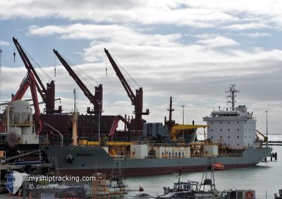
BUFFALO
Cement Carrier

Current Trip
| Trip Time | 11 h, 53 mins |
|---|---|
| Trip Distance | 110.99 nm |
| AVG Speed | 9.7 Noeuds |
| MAX Speed | 11.6 Noeuds |
| Tirant d eau | 5.3 m |
| AVG Wind | 3.5 knots |
| MAX Wind | 11 knots |
| MIN Temp | 14.7°C / 58.46°F |
| MAX Temp | 16.8°C / 62.24°F |
| Position reçue | 6 d depuis |
Current Position
| Longitude | --- |
|---|---|
| Latitude | --- |
| Etat | Under way using engine |
| Vitesse | 10.5 Noeuds |
| Parcours | 220.3° |
| Zone | South Pacific Ocean |
| Station | T-AIS |
| Position reçue | 6 d depuis |
Information
The current position of BUFFALO is in South Pacific Ocean with coordinates -44.13164° / 172.81344° as reported on 2025-03-20 08:09 by AIS to our vessel tracker app. The vessel's current speed is 10.5 Noeuds and is currently inside the port of TIMARU.
The vessel BUFFALO (IMO: 9149201, MMSI: 512432000) is a Cement Carrier that was built in 1998 ( 27 Age ). It's sailing under the flag of [NZ] New Zealand.
In this page you can find informations about the vessels current position, last detected port calls, and current voyage information. If the vessels is not in coverage by AIS you will find the latest position.
The current position of BUFFALO is detected by our AIS receivers and we are not responsible for the reliability of the data. The last position was recorded while the vessel was in Coverage by the Ais receivers of our vessel tracking app.
The current draught of BUFFALO as reported by AIS is 5.3 meters
Weather
| Temperature | 14.6°C / 58.28°F |
|---|---|
| Wind Speed | 7 knots |
| Direction | 212° SSW |
| Pressure | 1014.6 hPa |
| Humidity | 80.4 % |
| Cloud Coverage | 80 % |


Featured Company
Last Port Calls
| Port | Arrival | Departure | Time In Port |
|---|---|---|---|
| 2025-03-23 07:02 | |||
| 2025-03-21 12:00 | 2025-03-22 19:09 | 1 d | |
| 2025-03-17 11:42 | 2025-03-19 13:02 | 2 d | |
| 2025-03-13 17:01 | 2025-03-14 17:19 | 1 d | |
| 2025-03-05 09:35 | 2025-03-12 16:33 | 7 d | |
| 2025-03-03 07:12 | 2025-03-04 19:33 | 1 d | |
| 2025-02-21 06:54 | 2025-03-02 17:48 | 9 d | |
| 2025-02-17 09:52 | 2025-02-20 17:48 | 3 d | |
| 2025-02-13 09:06 | 2025-02-14 23:51 | 1 d | |
| 2025-02-09 14:58 | 2025-02-11 06:25 | 1 d |
Most Visited Ports (Last year)
| Port | Arrivals | |
|---|---|---|
| 29 | ||
| 19 | ||
| 16 | ||
| 14 | ||
| 13 | ||
| 3 |
Last Trips
| Origin | Departure | Destination | Arrival | Distance | |
|---|---|---|---|---|---|
| 2025-03-22 19:09 | 2025-03-23 07:02 | 110.99 nm | |||
| 2025-03-19 13:02 | 2025-03-21 12:00 | 443.39 nm | |||
| 2025-03-14 17:19 | 2025-03-17 11:42 | 142.83 nm | |||
| 2025-03-12 16:33 | 2025-03-13 17:01 | 264.77 nm | |||
| 2025-03-04 19:33 | 2025-03-05 09:35 | 122.29 nm | |||
| 2025-03-02 17:48 | 2025-03-03 07:12 | 128.32 nm | |||
| 2025-02-20 17:48 | 2025-02-21 06:54 | 129.90 nm | |||
| 2025-02-14 23:51 | 2025-02-17 09:52 | 576.19 nm | |||
| 2025-02-11 06:25 | 2025-02-13 09:06 | 128.61 nm | |||
| 2025-02-08 12:31 | 2025-02-09 14:58 | 273.58 nm |
Events
| Heure | Evenement | Détails | Position/ Destination | Info |
|---|---|---|---|---|
| 2025-03-22 18:20 | Arret |
-44.39228 / 171.25653
[NZ] TIMARU
|
Vitesse: Parcours: 227° |
|
| 2025-03-22 18:02 | Port d'arrivée |
|
-44.38784 / 171.26195
[NZ] TIMARU
|
Vitesse: 4.8 kn Parcours: 266° |
| 2025-03-22 06:09 | PORT DE DEPART |
|
-45.87179 / 170.54149
DUNEDIN
|
Vitesse: 6.7 kn Parcours: 72° |
| 2025-03-22 06:01 | Démarrage |
-45.87631 / 170.52077
[NZ] DUNEDIN
|
Vitesse: 6.1 kn Parcours: 71° |
|
| 2025-03-20 23:00 | Port d'arrivée |
|
-45.87780 / 170.51459
[NZ] DUNEDIN
|
Vitesse: 8.9 kn Parcours: 201° |
| 2025-03-20 08:13 | Etat Changé | Default Under way using engine |
-44.13992 / 172.80307
DUNEDIN
|
Vitesse: 10.5 kn Parcours: 220.3° |
| 2025-03-20 08:09 | Hors de la zone couverte |
-44.13164 / 172.81344
South Pacific Ocean
DUNEDIN
|
Vitesse: 10.5 kn Parcours: 220.3° |
|
| 2025-03-20 08:09 | Dans la zone couverte |
-44.13164 / 172.81344
South Pacific Ocean
DUNEDIN
|
Vitesse: 10.5 kn Parcours: 220.3° |
|
| 2025-03-20 08:08 | Etat Changé | Under way using engine Default |
-44.12875 / 172.81704
DUNEDIN
|
Vitesse: 10.5 kn Parcours: 223° |
| 2025-03-19 20:56 | Hors de la zone couverte |
-42.42751 / 173.82276
South Pacific Ocean
DUNEDIN
|
Vitesse: 9.9 kn Parcours: 212.5° |