
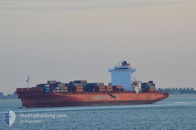
BSG BAHAMAS
Container Ship
Current Trip
| Time Travelled | 5 h, 10 mins |
|---|---|
| Remaining Time | --- |
| Distance Travelled | 98.12 nm |
| Remaining Distance | --- |
| AVG Speed | 17 Noeuds |
| MAX Speed | 22.6 Noeuds |
| AVG Wind | 15.3 knots |
| MAX Wind | 23 knots |
| MIN Temp | 16°C / 60.8°F |
| MAX Temp | 19.8°C / 67.64°F |
| Tirant d eau | 9.5 m |
| Position reçue | 3 m depuis |
Current Position
| Longitude | -76.17621° |
|---|---|
| Latitude | 37.69331° |
| Etat | Under way using engine |
| Vitesse | 20.2 Noeuds |
| Parcours | 155.8° |
| Zone | North Atlantic Ocean |
| Station | T-AIS |
| Position reçue | 3 m depuis |
Info
Information
The current position of BSG BAHAMAS is in North Atlantic Ocean with coordinates 37.69331° / -76.17621° as reported on 2024-09-08 07:46 by AIS to our vessel tracker app. The vessel's current speed is 20.2 Noeuds
The vessel BSG BAHAMAS (IMO: 9439498, MMSI: 636093031) is a Container Ship that was built in 2009 ( 15 Age ). It's sailing under the flag of [LR] Liberia.
In this page you can find informations about the vessels current position, last detected port calls, and current voyage information. If the vessels is not in coverage by AIS you will find the latest position.
The current position of BSG BAHAMAS is detected by our AIS receivers and we are not responsible for the reliability of the data. The last position was recorded while the vessel was in Coverage by the Ais receivers of our vessel tracking app.
The current draught of BSG BAHAMAS as reported by AIS is 9.5 meters
Weather
| Temperature | --- |
|---|---|
| Wind Speed | --- |
| Direction | --- |
| Pressure | --- |
| Humidity | --- |
| Cloud Coverage | --- |
Featured Company
Last Port Calls
| Port | Arrival | Departure | Time In Port |
|---|---|---|---|
| 2024-09-07 04:35 | 2024-09-08 02:39 | 22 h | |
| 2024-09-04 20:10 | 2024-09-05 20:36 | 1 d | |
| 2024-08-28 21:29 | 2024-08-29 05:29 | 7 h | |
| 2024-08-28 20:56 | 2024-08-28 21:08 | 11 m | |
| 2024-08-24 01:44 | 2024-08-26 00:15 | 1 d | |
| 2024-08-20 10:20 | 2024-08-21 14:42 | 1 d | |
| 2024-08-17 18:23 | 2024-08-17 18:30 | 7 m | |
| 2024-08-16 16:29 | 2024-08-17 18:13 | 1 d | |
| 2024-08-12 14:04 | 2024-08-13 13:16 | 23 h | |
| 2024-08-06 10:38 | 2024-08-07 23:54 | 1 d |
Most Visited Ports (Last year)
| Port | Arrivals | |
|---|---|---|
| 21 | ||
| 13 | ||
| 12 | ||
| 11 | ||
| 10 | ||
| 9 |
Last Trips
| Origin | Departure | Destination | Arrival | Distance | |
|---|---|---|---|---|---|
| 2024-09-05 16:36 | 2024-09-07 00:35 | 437.90 nm | |||
| 2024-08-29 01:29 | 2024-09-04 16:10 | 1094.01 nm | |||
| 2024-08-28 17:08 | 2024-08-28 17:29 | 0.52 nm | |||
| 2024-08-25 19:15 | 2024-08-28 16:56 | 1277.75 nm | |||
| 2024-08-21 09:42 | 2024-08-23 20:44 | 289.49 nm | |||
| 2024-08-17 14:30 | 2024-08-20 05:20 | 1165.58 nm | |||
| 2024-08-17 14:13 | 2024-08-17 14:23 | 0.40 nm | |||
| 2024-08-13 09:16 | 2024-08-16 12:29 | 1023.12 nm | |||
| 2024-08-07 18:54 | 2024-08-12 10:04 | 2028.19 nm | |||
| 2024-08-04 19:25 | 2024-08-06 05:38 | 301.68 nm |
Events
| Heure | Evenement | Détails | Position/ Destination | Info |
|---|---|---|---|---|
| 2024-09-08 07:24 | Etat Changé | Under way using engine Default |
37.82464 / -76.17069
USCHS
|
Vitesse: 22.1 kn Parcours: 190° |
| 2024-09-08 07:20 | Etat Changé | Default Under way using engine |
37.84508 / -76.16632
USCHS
|
Vitesse: 22.1 kn Parcours: 189.2° |
| 2024-09-08 06:52 | Etat Changé | Under way using engine Default |
38.01433 / -76.21069
USCHS
|
Vitesse: 22 kn Parcours: 175° |
| 2024-09-08 06:51 | Etat Changé | Default Under way using engine |
38.01615 / -76.21088
USCHS
|
Vitesse: 22 kn Parcours: 175.4° |
| 2024-09-08 06:24 | Etat Changé | Under way using engine Default |
38.17959 / -76.23756
USCHS
|
Vitesse: 22.5 kn Parcours: 169° |
| 2024-09-08 06:23 | Etat Changé | Default Under way using engine |
38.18330 / -76.23843
USCHS
|
Vitesse: 22.5 kn Parcours: 162.2° |
| 2024-09-08 06:16 | Etat Changé | Under way using engine Default |
38.22559 / -76.25677
USCHS
|
Vitesse: 21.8 kn Parcours: 160° |
| 2024-09-08 06:15 | Etat Changé | Default Under way using engine |
38.23015 / -76.25893
USCHS
|
Vitesse: 21.9 kn Parcours: 159.6° |
| 2024-09-08 06:13 | Etat Changé | Under way using engine Default |
38.23930 / -76.26325
USCHS
|
Vitesse: 22 kn Parcours: 160° |
| 2024-09-08 06:11 | Etat Changé | Default Under way using engine |
38.25250 / -76.26949
USCHS
|
Vitesse: 22.2 kn Parcours: 159.4° |