
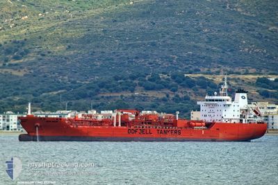
BOW NEON
Tanker
Current Trip
TW TPE
| Time Travelled | 10 h, 25 mins |
|---|---|
| Remaining Time | --- |
| Distance Travelled | 115.01 nm |
| Remaining Distance | --- |
| AVG Speed | 13.4 Noeuds |
| MAX Speed | 13.8 Noeuds |
| AVG Wind | 11 knots |
| MAX Wind | 12.2 knots |
| MIN Temp | 27.9°C / 82.22°F |
| MAX Temp | 28.5°C / 83.3°F |
| Tirant d eau | 8.7 m |
| Position reçue | 2 d depuis |
Current Position
| Longitude | --- |
|---|---|
| Latitude | --- |
| Etat | Under way using engine |
| Vitesse | 0.4 Noeuds |
| Parcours | 286° |
| Zone | Gulf of Thailand |
| Station | T-AIS |
| Position reçue | 2 d depuis |
Information
The current position of BOW NEON is in Gulf of Thailand with coordinates 12.58924° / 101.15853° as reported on 2025-03-25 13:56 by AIS to our vessel tracker app. The vessel's current speed is 0.4 Noeuds
The vessel BOW NEON (IMO: 9777369, MMSI: 257244000) is a Tanker It's sailing under the flag of [NO] Norway.
In this page you can find informations about the vessels current position, last detected port calls, and current voyage information. If the vessels is not in coverage by AIS you will find the latest position.
The current position of BOW NEON is detected by our AIS receivers and we are not responsible for the reliability of the data. The last position was recorded while the vessel was in Coverage by the Ais receivers of our vessel tracking app.
The current draught of BOW NEON as reported by AIS is 8.7 meters
Weather
| Temperature | 28°C / 82.4°F |
|---|---|
| Wind Speed | 7 knots |
| Direction | 176° S |
| Pressure | 1005.3 hPa |
| Humidity | 73.7 % |
| Cloud Coverage | 48 % |
Featured Company
Last Port Calls
| Port | Arrival | Departure | Time In Port |
|---|---|---|---|
| 2025-03-25 15:26 | 2025-03-27 08:30 | 1 d | |
| 2025-03-18 00:54 | 2025-03-20 06:21 | 2 d | |
| 2025-03-14 03:28 | 2025-03-15 00:28 | 21 h | |
| 2025-03-10 04:06 | 2025-03-11 08:45 | 1 d | |
| 2025-02-19 12:39 | 2025-03-07 03:14 | 15 d | |
| 2025-02-15 05:21 | 2025-02-16 18:02 | 1 d | |
| 2025-01-24 19:36 | 2025-01-26 04:22 | 1 d | |
| 2025-01-16 10:19 | 2025-01-18 03:40 | 1 d | |
| 2025-01-16 09:00 | 2025-01-16 10:10 | 1 h | |
| 2025-01-16 07:46 | 2025-01-16 08:28 | 41 m |
Most Visited Ports (Last year)
| Port | Arrivals | |
|---|---|---|
| 6 | ||
| 3 | ||
| 3 | ||
| 3 | ||
| 2 | ||
| 2 |
Last Trips
| Origin | Departure | Destination | Arrival | Distance | |
|---|---|---|---|---|---|
| 2025-03-20 14:21 | 2025-03-25 22:26 | 1767.20 nm | |||
| 2025-03-15 09:28 | 2025-03-18 08:54 | 982.08 nm | |||
| 2025-03-11 16:45 | 2025-03-14 12:28 | 873.38 nm | |||
| 2025-03-07 11:14 | 2025-03-10 12:06 | 810.35 nm | |||
| 2025-02-17 02:02 | 2025-02-19 20:39 | 539.46 nm | |||
| 2025-01-26 07:22 | 2025-02-15 13:21 | 5741.29 nm | |||
| 2025-01-18 08:40 | 2025-01-24 22:36 | 1168.58 nm | |||
| 2025-01-16 15:10 | 2025-01-16 15:19 | 0.20 nm | |||
| 2025-01-16 13:28 | 2025-01-16 14:00 | 14.45 nm | |||
| 2025-01-15 06:37 | 2025-01-16 12:46 | 359.93 nm |
Events
| Heure | Evenement | Détails | Position/ Destination | Info |
|---|---|---|---|---|
| 2025-03-27 08:30 | PORT DE DEPART |
|
12.62406 / 101.15622
TW TPE
|
Vitesse: 8.9 kn Parcours: 166° |
| 2025-03-27 08:18 | Démarrage |
12.65144 / 101.14883
[TH] MAP TA PHUT
|
Vitesse: 4.8 kn Parcours: 161° |
|
| 2025-03-26 16:50 | Arret |
12.65520 / 101.14438
[TH] MAP TA PHUT
|
Vitesse: Parcours: 135° |
|
| 2025-03-26 16:26 | Démarrage |
12.66463 / 101.14326
[TH] MAP TA PHUT
|
Vitesse: 3.9 kn Parcours: 130° |
|
| 2025-03-25 15:30 | Arret |
12.66737 / 101.13958
[TH] MAP TA PHUT
|
Vitesse: 0.2 kn Parcours: 179° |
|
| 2025-03-25 15:26 | Port d'arrivée |
|
12.66718 / 101.14006
[TH] MAP TA PHUT
|
Vitesse: 1 kn Parcours: 180° |
| 2025-03-25 14:42 | Démarrage | 3.25 nm, South of MAP TA PHUT |
12.59915 / 101.15978
TW TPE
|
Vitesse: 6.6 kn Parcours: 353° |
| 2025-03-25 14:14 | Arret | 3.79 nm, South of MAP TA PHUT |
12.59004 / 101.16012
TW TPE
|
Vitesse: 0.3 kn Parcours: 309° |
| 2025-03-25 14:02 | Etat Changé | Default Under way using engine |
12.58909 / 101.15937
TW TPE
|
Vitesse: 0.4 kn Parcours: 286° |
| 2025-03-25 13:56 | Hors de la zone couverte |
12.58924 / 101.15853
Gulf of Thailand
|
Vitesse: 0.4 kn Parcours: 3.9° |