

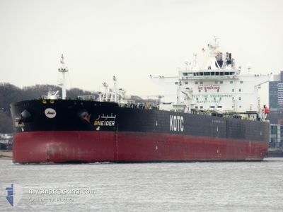
BNEIDER
Crude Oil Tanker

Current Trip
| Time Travelled | 9 days |
|---|---|
| Remaining Time | --- |
| Distance Travelled | 2959.80 nm |
| Remaining Distance | --- |
| AVG Speed | 12.9 Noeuds |
| MAX Speed | 17.3 Noeuds |
| AVG Wind | 20.6 knots |
| MAX Wind | 36.8 knots |
| MIN Temp | 8.2°C / 46.76°F |
| MAX Temp | 17.4°C / 63.32°F |
| Tirant d eau | 8.8 m |
| Position reçue | 2 d depuis |
Current Position
| Longitude | --- |
|---|---|
| Latitude | --- |
| Etat | Under way using engine |
| Vitesse | 13.6 Noeuds |
| Parcours | 111.6° |
| Zone | Mediterranean Sea - Eastern Basin |
| Station | T-AIS |
| Position reçue | 2 d depuis |
Information
The current position of BNEIDER is in Mediterranean Sea - Eastern Basin with coordinates 36.06210° / 14.98246° as reported on 2025-03-26 08:02 by AIS to our vessel tracker app. The vessel's current speed is 13.6 Noeuds and is heading at the port of MINA AL AHMADI. The estimated time of arrival as calculated by MyShipTracking vessel tracking app is 2025-04-09 12:00 LT
The vessel BNEIDER (IMO: 9595010, MMSI: 447089000) is a Crude Oil Tanker that was built in 2012 ( 13 Age ). It's sailing under the flag of [KW] Kuwait.
In this page you can find informations about the vessels current position, last detected port calls, and current voyage information. If the vessels is not in coverage by AIS you will find the latest position.
The current position of BNEIDER is detected by our AIS receivers and we are not responsible for the reliability of the data. The last position was recorded while the vessel was in Coverage by the Ais receivers of our vessel tracking app.
The current draught of BNEIDER as reported by AIS is 8.8 meters
Weather
| Temperature | 17.4°C / 63.32°F |
|---|---|
| Wind Speed | 23 knots |
| Direction | 295° WNW |
| Pressure | 1009.8 hPa |
| Humidity | 72.9 % |
| Cloud Coverage | 10 % |


Featured Company
Last Port Calls
| Port | Arrival | Departure | Time In Port |
|---|---|---|---|
| 2025-03-15 10:02 | 2025-03-19 00:14 | 3 d | |
| 2025-02-25 10:47 | 2025-02-25 20:01 | 9 h | |
| 2025-02-08 00:59 | 2025-02-09 12:38 | 1 d | |
| 2025-01-27 07:17 | 2025-01-27 16:17 | 8 h | |
| 2025-01-12 13:16 | 2025-01-15 11:32 | 2 d | |
| 2025-01-09 11:32 | 2025-01-11 03:45 | 1 d |
Most Visited Ports (Last year)
| Port | Arrivals | |
|---|---|---|
| 4 | ||
| 3 | ||
| 3 | ||
| 1 | ||
| 1 | ||
| 1 |
Last Trips
| Origin | Departure | Destination | Arrival | Distance | |
|---|---|---|---|---|---|
| 2025-02-09 12:38 | 2025-03-15 10:02 | 6949.79 nm | |||
| 2025-02-09 12:38 | 2025-02-25 10:47 | 3331.41 nm | |||
| 2025-01-15 11:32 | 2025-02-08 00:59 | 7067.43 nm | |||
| 2025-01-15 11:32 | 2025-01-27 07:17 | 3642.37 nm | |||
| 2025-01-11 03:45 | 2025-01-12 13:16 | 374.37 nm | |||
| 2024-11-25 12:42 | 2025-01-09 11:32 | 10694.01 nm |
Events
| Heure | Evenement | Détails | Position/ Destination | Info |
|---|---|---|---|---|
| 2025-03-26 08:09 | Etat Changé | Default Under way using engine |
36.05083 / 15.01724
FRLEH>KWMEA
|
Vitesse: 13.6 kn Parcours: 111.6° |
| 2025-03-26 08:02 | Hors de la zone couverte |
36.06210 / 14.98246
Mediterranean Sea - Eastern Basin
FRLEH>KWMEA
|
Vitesse: 13.6 kn Parcours: 111.6° |
|
| 2025-03-26 07:11 | Etat Changé | Under way using engine Default |
36.13750 / 14.76185
FRLEH>KWMEA
|
Vitesse: 13.4 kn Parcours: 113° |
| 2025-03-26 07:06 | Etat Changé | Default Under way using engine |
36.14520 / 14.73996
FRLEH>KWMEA
|
Vitesse: 13.1 kn Parcours: 113.7° |
| 2025-03-26 06:51 | Etat Changé | Under way using engine Default |
36.16656 / 14.67953
FRLEH>KWMEA
|
Vitesse: 13.3 kn Parcours: 114° |
| 2025-03-26 06:50 | Etat Changé | Default Under way using engine |
36.16877 / 14.67334
FRLEH>KWMEA
|
Vitesse: 13.3 kn Parcours: 114.5° |
| 2025-03-26 04:04 | Etat Changé | Under way using engine Default |
36.40292 / 13.96657
FRLEH>KWMEA
|
Vitesse: 13.6 kn Parcours: 108° |
| 2025-03-26 03:55 | Etat Changé | Default Under way using engine |
36.41304 / 13.92942
FRLEH>KWMEA
|
Vitesse: 13.6 kn Parcours: 108.9° |
| 2025-03-26 03:43 | Detecté en mer | Maltese part of the Mediterranean Sea - Eastern Basin |
36.42782 / 13.87600
Mediterranean Sea - Eastern Basin
FRLEH>KWMEA
|
Vitesse: 13.6 kn Parcours: 108.5° |
| 2025-03-26 03:43 | Etat Changé | Under way using engine Default |
36.42782 / 13.87600
FRLEH>KWMEA
|
Vitesse: 13.6 kn Parcours: 107° |