

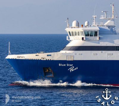
BLUE STAR PAROS
Ro-Ro/Passenger Ship

Current Trip
| Time Travelled | 57 mins |
|---|---|
| Remaining Time | 43 mins |
| Distance Travelled | 17.36 nm |
| Remaining Distance | 19.51 nm |
| AVG Speed | 20.9 Noeuds |
| MAX Speed | 21.6 Noeuds |
| AVG Wind | 23.8 knots |
| MAX Wind | 28.5 knots |
| MIN Temp | 9.1°C / 48.38°F |
| MAX Temp | 9.5°C / 49.1°F |
| Tirant d eau | 5 m |
| Position reçue | 1 m depuis |
Current Position
| Longitude | --- |
|---|---|
| Latitude | --- |
| Etat | Under way using engine |
| Vitesse | 21.3 Noeuds |
| Parcours | 163° |
| Zone | Aegean Sea |
| Station | T-AIS |
| Position reçue | 1 m depuis |
Information
The current position of BLUE STAR PAROS is in Aegean Sea with coordinates 36.79245° / 26.15082° as reported on 2025-02-20 01:58 by AIS to our vessel tracker app. The vessel's current speed is 21.3 Noeuds and is heading at the port of ASTYPALEA. The estimated time of arrival as calculated by MyShipTracking vessel tracking app is 2025-02-20 04:43 LT
The vessel BLUE STAR PAROS (IMO: 9241774, MMSI: 239924000) is a Ro-Ro/Passenger Ship that was built in 2002 ( 23 Age ). It's sailing under the flag of [GR] Greece.
In this page you can find informations about the vessels current position, last detected port calls, and current voyage information. If the vessels is not in coverage by AIS you will find the latest position.
The current position of BLUE STAR PAROS is detected by our AIS receivers and we are not responsible for the reliability of the data. The last position was recorded while the vessel was in Coverage by the Ais receivers of our vessel tracking app.
The current draught of BLUE STAR PAROS as reported by AIS is 5 meters
Weather
| Temperature | 9.5°C / 49.1°F |
|---|---|
| Wind Speed | 27 knots |
| Direction | 358° N |
| Pressure | 1023.1 hPa |
| Humidity | 58.3 % |
| Cloud Coverage | 7 % |


Featured Company
Last Port Calls
| Port | Arrival | Departure | Time In Port |
|---|---|---|---|
| 2025-02-20 02:42 | 2025-02-20 03:03 | 21 m | |
| 2025-02-20 01:54 | 2025-02-20 02:00 | 6 m | |
| 2025-02-20 00:04 | 2025-02-20 00:36 | 31 m | |
| 2025-02-19 22:38 | 2025-02-19 23:14 | 35 m | |
| 2025-02-19 15:13 | 2025-02-19 17:58 | 2 h | |
| 2025-02-19 10:20 | 2025-02-19 10:57 | 36 m | |
| 2025-02-19 09:03 | 2025-02-19 09:34 | 31 m | |
| 2025-02-19 07:48 | 2025-02-19 08:04 | 15 m | |
| 2025-02-19 07:30 | 2025-02-19 07:40 | 10 m | |
| 2025-02-19 06:40 | 2025-02-19 06:53 | 13 m |
Last Trips
| Origin | Departure | Destination | Arrival | Distance | |
|---|---|---|---|---|---|
| 2025-02-20 02:00 | 2025-02-20 02:42 | 14.89 nm | |||
| 2025-02-20 00:36 | 2025-02-20 01:54 | 25.18 nm | |||
| 2025-02-19 23:14 | 2025-02-20 00:04 | 17.28 nm | |||
| 2025-02-19 17:58 | 2025-02-19 22:38 | 96.03 nm | |||
| 2025-02-19 10:57 | 2025-02-19 15:13 | 92.37 nm | |||
| 2025-02-19 09:34 | 2025-02-19 10:20 | 16.51 nm | |||
| 2025-02-19 08:04 | 2025-02-19 09:03 | 20.25 nm | |||
| 2025-02-19 07:40 | 2025-02-19 07:48 | 2.07 nm | |||
| 2025-02-19 06:53 | 2025-02-19 07:30 | 11.99 nm | |||
| 2025-02-19 06:00 | 2025-02-19 06:40 | 13.21 nm |
Events
| Heure | Evenement | Détails | Position/ Destination | Info |
|---|---|---|---|---|
| 2025-02-20 01:03 | PORT DE DEPART |
|
36.90452 / 25.95695
PI PA NA DON AIG AST
|
Vitesse: 20.1 kn Parcours: 272° |
| 2025-02-20 01:00 | Démarrage |
36.90380 / 25.97258
[GR] AIGIALI
|
Vitesse: 7.6 kn Parcours: 269° |
|
| 2025-02-20 00:48 | Arret |
36.90330 / 25.97480
[GR] AIGIALI
|
Vitesse: 0.1 kn Parcours: 338° |
|
| 2025-02-20 00:42 | Port d'arrivée |
|
36.90507 / 25.96385
[GR] AIGIALI
|
Vitesse: 20.2 kn Parcours: 98° |
| 2025-02-20 00:00 | Démarrage | 0.18 nm, South West of DONOUSA |
37.09625 / 25.79182
PI PA NA DON AIG AST
|
Vitesse: 9.3 kn Parcours: 224° |
| 2025-02-20 00:00 | PORT DE DEPART |
|
37.09625 / 25.79182
PI PA NA DON AIG AST
|
Vitesse: 6.9 kn Parcours: 233° |
| 2025-02-19 23:58 | Arret |
37.09830 / 25.79432
[GR] DONOUSA
|
Vitesse: 0.2 kn Parcours: 168° |
|
| 2025-02-19 23:54 | Port d'arrivée |
|
37.09838 / 25.79310
[GR] DONOUSA
|
Vitesse: 13.1 kn Parcours: 65° |
| 2025-02-19 23:25 | Etat Changé | Under way using engine Default |
37.17138 / 25.62627
PI PA NA DON AIG AST
|
Vitesse: 20.4 kn Parcours: 68° |
| 2025-02-19 23:08 | Etat Changé | Default Under way using engine |
37.20903 / 25.51773
PI PA NA DON AIG AST
|
Vitesse: 20.1 kn Parcours: 67° |