

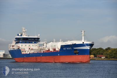
BIT WAVE
Tanker

Current Trip
| Time Travelled | 1 day |
|---|---|
| Remaining Time | 2 h, 47 mins |
| Distance Travelled | 460.30 nm |
| Remaining Distance | 26.44 nm |
| AVG Speed | 12.4 Noeuds |
| MAX Speed | 13.5 Noeuds |
| AVG Wind | 11.6 knots |
| MAX Wind | 19 knots |
| MIN Temp | 5°C / 41°F |
| MAX Temp | 8°C / 46.4°F |
| Tirant d eau | 7.3 m |
| Position reçue | Maintenant |
Current Position
| Longitude | --- |
|---|---|
| Latitude | --- |
| Etat | Under way using engine |
| Vitesse | 8.3 Noeuds |
| Parcours | 154.8° |
| Zone | North Sea |
| Station | T-AIS |
| Position reçue | Maintenant |
Information
The current position of BIT WAVE is in North Sea with coordinates 52.52425° / 4.11979° as reported on 2025-03-27 20:33 by AIS to our vessel tracker app. The vessel's current speed is 8.3 Noeuds and is heading at the port of AMSTERDAM. The estimated time of arrival as calculated by MyShipTracking vessel tracking app is 2025-03-28 00:21 LT
The vessel BIT WAVE (IMO: 9904041, MMSI: 246478000) is a Tanker It's sailing under the flag of [NL] Netherlands.
In this page you can find informations about the vessels current position, last detected port calls, and current voyage information. If the vessels is not in coverage by AIS you will find the latest position.
The current position of BIT WAVE is detected by our AIS receivers and we are not responsible for the reliability of the data. The last position was recorded while the vessel was in Coverage by the Ais receivers of our vessel tracking app.
The current draught of BIT WAVE as reported by AIS is 7.3 meters
Weather
| Temperature | 8°C / 46.4°F |
|---|---|
| Wind Speed | 11 knots |
| Direction | 206° SSW |
| Pressure | 1017.1 hPa |
| Humidity | 87.9 % |
| Cloud Coverage | 3 % |


Featured Company
Last Port Calls
| Port | Arrival | Departure | Time In Port |
|---|---|---|---|
| 2025-03-25 12:42 | 2025-03-26 08:46 | 20 h | |
| 2025-03-22 07:54 | 2025-03-23 05:14 | 21 h | |
| 2025-03-18 22:31 | 2025-03-19 12:54 | 14 h | |
| 2025-03-16 20:34 | 2025-03-17 19:42 | 23 h | |
| 2025-03-14 17:14 | 2025-03-15 07:10 | 13 h | |
| 2025-03-12 22:29 | 2025-03-13 16:19 | 17 h | |
| 2025-03-09 20:30 | 2025-03-10 16:45 | 20 h | |
| 2025-03-06 23:18 | 2025-03-08 00:52 | 1 d | |
| 2025-03-03 12:57 | 2025-03-05 11:59 | 1 d | |
| 2025-02-24 07:15 | 2025-02-25 04:20 | 21 h |
Most Visited Ports (Last year)
| Port | Arrivals | |
|---|---|---|
| 41 | ||
| 37 | ||
| 17 | ||
| 10 | ||
| 9 | ||
| 4 |
Last Trips
| Origin | Departure | Destination | Arrival | Distance | |
|---|---|---|---|---|---|
| 2025-03-23 05:14 | 2025-03-25 12:42 | 671.02 nm | |||
| 2025-03-19 12:54 | 2025-03-22 07:54 | 848.91 nm | |||
| 2025-03-17 19:42 | 2025-03-18 22:31 | 321.37 nm | |||
| 2025-03-15 07:10 | 2025-03-16 20:34 | 449.61 nm | |||
| 2025-03-13 16:19 | 2025-03-14 17:14 | 320.48 nm | |||
| 2025-03-10 16:45 | 2025-03-12 22:29 | 408.03 nm | |||
| 2025-03-08 00:52 | 2025-03-09 20:30 | 2.53 nm | |||
| 2025-03-05 11:59 | 2025-03-06 23:18 | 491.85 nm | |||
| 2025-02-25 04:20 | 2025-03-03 12:57 | 797.90 nm | |||
| 2025-02-22 00:18 | 2025-02-24 07:15 | 681.16 nm |
Events
| Heure | Evenement | Détails | Position/ Destination | Info |
|---|---|---|---|---|
| 2025-03-27 18:17 | Etat Changé | Under way using engine Default |
52.80736 / 3.95692
SEGOT > NLAMS
|
Vitesse: 10.4 kn Parcours: 191° |
| 2025-03-27 18:08 | Etat Changé | Default Under way using engine |
52.82694 / 3.95858
SEGOT > NLAMS
|
Vitesse: 11.7 kn Parcours: 190.8° |
| 2025-03-27 18:07 | Etat Changé | Under way using engine Default |
52.83041 / 3.95969
SEGOT > NLAMS
|
Vitesse: 13.1 kn Parcours: 192° |
| 2025-03-27 18:07 | Dans la zone couverte |
52.83041 / 3.95969
North Sea
SEGOT > NLAMS
|
Vitesse: 11.7 kn Parcours: 190.8° |
|
| 2025-03-27 11:01 | Etat Changé | Default Under way using engine |
54.16235 / 5.03993
SEGOT > NLAMS
|
Vitesse: 13 kn Parcours: 206° |
| 2025-03-27 11:00 | Hors de la zone couverte |
54.16726 / 5.04394
North Sea
SEGOT > NLAMS
|
Vitesse: 13 kn Parcours: 206° |
|
| 2025-03-27 10:45 | Detecté en mer | Dutch part of the North Sea |
54.21548 / 5.08291
North Sea
SEGOT > NLAMS
|
Vitesse: 13.2 kn Parcours: 205.7° |
| 2025-03-27 10:45 | Etat Changé | Under way using engine Default |
54.21548 / 5.08291
SEGOT > NLAMS
|
Vitesse: 13.2 kn Parcours: 205° |
| 2025-03-27 10:45 | Dans la zone couverte |
54.21548 / 5.08291
North Sea
SEGOT > NLAMS
|
Vitesse: 13.2 kn Parcours: 205.7° |
|
| 2025-03-27 09:46 | Etat Changé | Default Under way using engine |
54.40847 / 5.23972
SEGOT > NLAMS
|
Vitesse: 13.3 kn Parcours: 204.9° |