

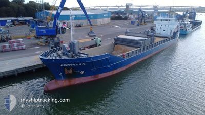
BERTHOLD K.
General Cargo

Current Trip
ES RIB
| Time Travelled | 3 days |
|---|---|
| Remaining Time | --- |
| Distance Travelled | 753.53 nm |
| Remaining Distance | --- |
| AVG Speed | 11.8 Noeuds |
| MAX Speed | 15.4 Noeuds |
| AVG Wind | 9 knots |
| MAX Wind | 22 knots |
| MIN Temp | --- |
| MAX Temp | 11.2°C / 52.16°F |
| Tirant d eau | 5.5 m |
| Position reçue | 10 h, 43 m depuis |
Current Position
| Longitude | --- |
|---|---|
| Latitude | --- |
| Etat | Under way using engine |
| Vitesse | 9.7 Noeuds |
| Parcours | 189.8° |
| Zone | Celtic Sea |
| Station | T-AIS |
| Position reçue | 10 h, 43 m depuis |
Information
The current position of BERTHOLD K. is in Celtic Sea with coordinates 48.51199° / -5.95527° as reported on 2025-02-04 01:35 by AIS to our vessel tracker app. The vessel's current speed is 9.7 Noeuds
The vessel BERTHOLD K. (IMO: 9374715, MMSI: 246613000) is a General Cargo that was built in 2008 ( 17 Age ). It's sailing under the flag of [NL] Netherlands.
In this page you can find informations about the vessels current position, last detected port calls, and current voyage information. If the vessels is not in coverage by AIS you will find the latest position.
The current position of BERTHOLD K. is detected by our AIS receivers and we are not responsible for the reliability of the data. The last position was recorded while the vessel was in Coverage by the Ais receivers of our vessel tracking app.
The current draught of BERTHOLD K. as reported by AIS is 5.5 meters
Weather
| Temperature | 11.7°C / 53.06°F |
|---|---|
| Wind Speed | 21 knots |
| Direction | 206° SSW |
| Pressure | 1022.5 hPa |
| Humidity | 85.6 % |
| Cloud Coverage | 100 % |


Featured Company
Last Port Calls
| Port | Arrival | Departure | Time In Port |
|---|---|---|---|
| 2025-01-30 22:02 | 2025-02-01 06:26 | 1 d | |
| 2025-01-28 21:11 | 2025-01-29 16:18 | 19 h | |
| 2025-01-27 15:28 | 2025-01-28 20:34 | 1 d | |
| 2025-01-22 15:07 | 2025-01-23 19:59 | 1 d | |
| 2025-01-21 08:07 | 2025-01-21 22:05 | 13 h | |
| 2025-01-15 20:43 | 2025-01-17 07:54 | 1 d | |
| 2025-01-10 00:45 | 2025-01-14 07:49 | 4 d | |
| 2025-01-06 07:59 | 2025-01-09 08:33 | 3 d | |
| 2024-12-27 07:59 | 2025-01-02 11:15 | 6 d | |
| 2024-12-13 05:13 | 2024-12-13 20:24 | 15 h |
Last Trips
| Origin | Departure | Destination | Arrival | Distance | |
|---|---|---|---|---|---|
| 2025-01-29 17:18 | 2025-01-30 23:02 | 285.55 nm | |||
| 2025-01-28 21:34 | 2025-01-28 22:11 | 2.74 nm | |||
| 2025-01-23 20:59 | 2025-01-27 16:28 | 937.39 nm | |||
| 2025-01-21 23:05 | 2025-01-22 16:07 | 175.13 nm | |||
| 2025-01-17 08:54 | 2025-01-21 09:07 | 1054.14 nm | |||
| 2025-01-14 07:49 | 2025-01-15 21:43 | 375.48 nm | |||
| 2025-01-09 09:33 | 2025-01-10 00:45 | 118.74 nm | |||
| 2025-01-02 11:15 | 2025-01-06 08:59 | 746.35 nm | |||
| 2024-12-13 20:24 | 2024-12-27 07:59 | 1397.45 nm | |||
| 2024-12-10 13:54 | 2024-12-13 05:13 | 673.95 nm |
Events
| Heure | Evenement | Détails | Position/ Destination | Info |
|---|---|---|---|---|
| 2025-02-04 01:37 | Etat Changé | Default Under way using engine |
48.50664 / -5.95636
ES RIB
|
Vitesse: 9.7 kn Parcours: 189.8° |
| 2025-02-04 01:35 | Hors de la zone couverte |
48.51199 / -5.95527
Celtic Sea
ES RIB
|
Vitesse: 9.7 kn Parcours: 189.8° |
|
| 2025-02-04 01:30 | Etat Changé | Under way using engine Default |
48.52625 / -5.95192
ES RIB
|
Vitesse: 10.4 kn Parcours: 189° |
| 2025-02-04 01:03 | Etat Changé | Default Under way using engine |
48.60636 / -5.94180
ES RIB
|
Vitesse: 10.3 kn Parcours: 183.7° |
| 2025-02-04 01:02 | Etat Changé | Under way using engine Default |
48.60919 / -5.94123
ES RIB
|
Vitesse: 10.6 kn Parcours: 182° |
| 2025-02-04 00:36 | Etat Changé | Default Under way using engine |
48.68234 / -5.91862
ES RIB
|
Vitesse: 10.6 kn Parcours: 207.4° |
| 2025-02-03 23:36 | Etat Changé | Under way using engine Default |
48.83652 / -5.78946
ES RIB
|
Vitesse: 9.9 kn Parcours: 238° |
| 2025-02-03 23:17 | Dans la zone couverte |
48.83652 / -5.78946
Celtic Sea
ES RIB
|
Vitesse: 10.7 kn Parcours: 211.8° |
|
| 2025-02-03 20:39 | Etat Changé | Default Under way using engine |
49.10280 / -5.16054
ES RIB
|
Vitesse: 9.1 kn Parcours: 240.1° |
| 2025-02-03 20:31 | Hors de la zone couverte |
49.11283 / -5.13372
Celtic Sea
ES RIB
|
Vitesse: 9.1 kn Parcours: 240.1° |