
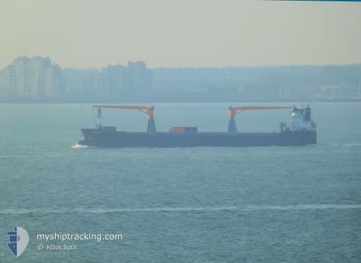
BEAUTRANGA
General Cargo
Current Trip
| Time Travelled | 12 days |
|---|---|
| Remaining Time | --- |
| Distance Travelled | 2710.66 nm |
| Remaining Distance | --- |
| AVG Speed | 12 Noeuds |
| MAX Speed | 14.2 Noeuds |
| AVG Wind | 7.9 knots |
| MAX Wind | 16 knots |
| MIN Temp | 19.1°C / 66.38°F |
| MAX Temp | 29.1°C / 84.38°F |
| Tirant d eau | 7.1 m |
| Position reçue | 7 d depuis |
Current Position
| Longitude | -61.66458° |
|---|---|
| Latitude | 16.53427° |
| Etat | Under way using engine |
| Vitesse | 11.7 Noeuds |
| Parcours | 54.1° |
| Zone | Caribbean Sea |
| Station | T-AIS |
| Position reçue | 7 d depuis |
Info
Information
The current position of BEAUTRANGA is in Caribbean Sea with coordinates 16.53427° / -61.66458° as reported on 2024-05-13 15:34 by AIS to our vessel tracker app. The vessel's current speed is 11.7 Noeuds and is heading at the port of ROTTERDAM. The estimated time of arrival as calculated by MyShipTracking vessel tracking app is 2024-05-27 12:00 LT
The vessel BEAUTRANGA (IMO: 9532812, MMSI: 246795000) is a General Cargo that was built in 2011 ( 13 Age ). It's sailing under the flag of [NL] Netherlands.
In this page you can find informations about the vessels current position, last detected port calls, and current voyage information. If the vessels is not in coverage by AIS you will find the latest position.
The current position of BEAUTRANGA is detected by our AIS receivers and we are not responsible for the reliability of the data. The last position was recorded while the vessel was in Coverage by the Ais receivers of our vessel tracking app.
The current draught of BEAUTRANGA as reported by AIS is 7.1 meters
Weather
| Temperature | 19.9°C / 67.82°F |
|---|---|
| Wind Speed | 7 knots |
| Direction | 257° WSW |
| Pressure | 1022.3 hPa |
| Humidity | 72.8 % |
| Cloud Coverage | 100 % |
Featured Company
Last Port Calls
| Port | Arrival | Departure | Time In Port |
|---|---|---|---|
| 2024-05-07 04:49 | 2024-05-08 04:42 | 23 h | |
| 2024-05-04 02:09 | 2024-05-04 02:13 | 4 m | |
| 2024-04-30 20:33 | 2024-05-01 15:22 | 18 h | |
| 2024-04-26 07:22 | 2024-04-29 07:14 | 2 d | |
| 2024-04-10 06:12 | 2024-04-12 12:02 | 2 d | |
| 2024-04-05 04:56 | 2024-04-09 00:13 | 3 d | |
| 2024-04-02 08:18 | 2024-04-04 16:54 | 2 d | |
| 2024-03-02 09:14 | 2024-03-07 07:54 | 4 d | |
| 2024-03-01 21:47 | 2024-03-02 08:56 | 11 h |
Most Visited Ports (Last year)
| Port | Arrivals | |
|---|---|---|
| 17 | ||
| 6 | ||
| 6 | ||
| 4 | ||
| 4 | ||
| 3 |
Last Trips
| Origin | Departure | Destination | Arrival | Distance | |
|---|---|---|---|---|---|
| 2024-05-04 02:13 | 2024-05-07 04:49 | 110.97 nm | |||
| 2024-05-01 15:22 | 2024-05-04 02:09 | 399.37 nm | |||
| 2024-04-29 07:14 | 2024-04-30 20:33 | 398.28 nm | |||
| 2024-04-12 12:02 | 2024-04-26 07:22 | 4213.39 nm | |||
| 2024-04-09 00:13 | 2024-04-10 06:12 | 273.40 nm | |||
| 2024-04-04 16:54 | 2024-04-05 04:56 | 112.96 nm | |||
| 2024-03-07 07:54 | 2024-04-02 08:18 | 4352.94 nm | |||
| 2024-03-02 08:56 | 2024-03-02 09:14 | 0.35 nm | |||
| 2024-02-13 07:45 | 2024-03-01 21:47 | 4596.66 nm |
Events
| Heure | Evenement | Détails | Position/ Destination | Info |
|---|---|---|---|---|
| 2024-05-13 15:45 | Etat Changé | Default Under way using engine |
16.55508 / -61.63364
NLRTM
|
Vitesse: 11.7 kn Parcours: 54.1° |
| 2024-05-13 15:34 | Hors de la zone couverte |
16.53427 / -61.66458
Caribbean Sea
NLRTM
|
Vitesse: 11.7 kn Parcours: 54.1° |
|
| 2024-05-13 15:25 | Etat Changé | Under way using engine Default |
16.51740 / -61.68994
NLRTM
|
Vitesse: 11.8 kn Parcours: 56° |
| 2024-05-13 15:02 | Etat Changé | Default Under way using engine |
16.47402 / -61.75452
NLRTM
|
Vitesse: 11.6 kn Parcours: 58.5° |
| 2024-05-13 14:54 | Etat Changé | Under way using engine Default |
16.45878 / -61.77767
NLRTM
|
Vitesse: 11.9 kn Parcours: 49° |
| 2024-05-13 14:21 | Etat Changé | Default Under way using engine |
16.38513 / -61.85775
NLRTM
|
Vitesse: 11.6 kn Parcours: 5.7° |
| 2024-05-13 13:55 | Etat Changé | Under way using engine Default |
16.30096 / -61.86733
NLRTM
|
Vitesse: 11.7 kn Parcours: 6° |
| 2024-05-13 13:48 | Etat Changé | Default Under way using engine |
16.27587 / -61.87014
NLRTM
|
Vitesse: 11 kn Parcours: 7° |
| 2024-05-13 10:19 | Changement de zone | Guadeloupe and Martinique part of the Caribbean Sea Dominican part of the Caribbean Sea |
15.59247 / -61.77865
Caribbean Sea
NLRTM
|
Vitesse: 11.6 kn Parcours: 350.4° |
| 2024-05-13 09:40 | Etat Changé | Under way using engine Default |
15.46980 / -61.75800
NLRTM
|
Vitesse: 11.4 kn Parcours: 351° |