

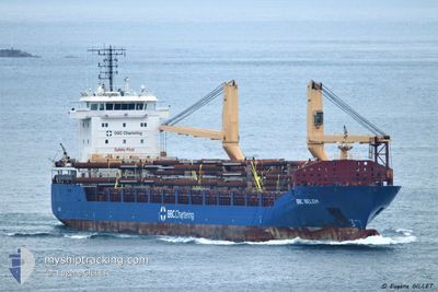
BBC BELEM
General Cargo

Current Trip
| Time Travelled | 12 days |
|---|---|
| Remaining Time | --- |
| Distance Travelled | 2456.76 nm |
| Remaining Distance | --- |
| AVG Speed | 8.9 Noeuds |
| MAX Speed | 11.2 Noeuds |
| AVG Wind | 9.3 knots |
| MAX Wind | 27 knots |
| MIN Temp | 1°C / 33.8°F |
| MAX Temp | 16.1°C / 60.98°F |
| Tirant d eau | 5.2 m |
| Position reçue | 2 d depuis |
Current Position
| Longitude | --- |
|---|---|
| Latitude | --- |
| Etat | Under way using engine |
| Vitesse | 7.7 Noeuds |
| Parcours | 0.2° |
| Zone | North Atlantic Ocean |
| Station | T-AIS |
| Position reçue | 2 d depuis |
Information
The current position of BBC BELEM is in North Atlantic Ocean with coordinates 39.63506° / -9.84250° as reported on 2025-03-01 20:34 by AIS to our vessel tracker app. The vessel's current speed is 7.7 Noeuds and is heading at the port of STORD. The estimated time of arrival as calculated by MyShipTracking vessel tracking app is 2025-03-06 12:00 LT
The vessel BBC BELEM (IMO: 9501655, MMSI: 305729000) is a General Cargo that was built in 2012 ( 13 Age ). It's sailing under the flag of [AG] Antigua Barbuda.
In this page you can find informations about the vessels current position, last detected port calls, and current voyage information. If the vessels is not in coverage by AIS you will find the latest position.
The current position of BBC BELEM is detected by our AIS receivers and we are not responsible for the reliability of the data. The last position was recorded while the vessel was in Coverage by the Ais receivers of our vessel tracking app.
The current draught of BBC BELEM as reported by AIS is 5.2 meters
Weather
| Temperature | 10.4°C / 50.72°F |
|---|---|
| Wind Speed | 13 knots |
| Direction | 60° ENE |
| Pressure | 1022.9 hPa |
| Humidity | 68.8 % |
| Cloud Coverage | --- |


Featured Company
Last Port Calls
| Port | Arrival | Departure | Time In Port |
|---|---|---|---|
| 2025-02-19 10:08 | 2025-02-20 04:12 | 18 h | |
| 2025-02-12 07:22 | 2025-02-13 23:00 | 1 d | |
| 2025-01-31 17:38 | 2025-02-03 18:50 | 3 d | |
| 2025-01-25 23:51 | 2025-01-26 23:10 | 23 h | |
| 2025-01-10 10:16 | 2025-01-12 00:56 | 1 d |
Last Trips
| Origin | Departure | Destination | Arrival | Distance | |
|---|---|---|---|---|---|
| 2025-02-14 00:00 | 2025-02-19 11:08 | 1174.78 nm | |||
| 2025-02-03 19:50 | 2025-02-12 08:22 | 265.59 nm | |||
| 2025-01-27 00:10 | 2025-01-31 18:38 | 1114.74 nm | |||
| 2025-01-12 01:56 | 2025-01-26 00:51 | 316.22 nm | |||
| 2024-12-25 10:38 | 2025-01-10 11:16 | 1663.20 nm |
Events
| Heure | Evenement | Détails | Position/ Destination | Info |
|---|---|---|---|---|
| 2025-03-01 20:40 | Etat Changé | Default Under way using engine |
39.64719 / -9.84228
STORD
|
Vitesse: 7.7 kn Parcours: 0.2° |
| 2025-03-01 20:34 | Etat Changé | Under way using engine Default |
39.63506 / -9.84250
STORD
|
Vitesse: 7.7 kn Parcours: 1° |
| 2025-03-01 20:34 | Hors de la zone couverte |
39.63506 / -9.84250
North Atlantic Ocean
STORD
|
Vitesse: 7.7 kn Parcours: 0.2° |
|
| 2025-03-01 20:23 | Etat Changé | Default Under way using engine |
39.61291 / -9.84319
STORD
|
Vitesse: 8 kn Parcours: 0.8° |
| 2025-03-01 06:25 | Etat Changé | Under way using engine Default |
37.72323 / -9.56395
STORD
|
Vitesse: 8.5 kn Parcours: 346° |
| 2025-03-01 06:23 | Etat Changé | Default Under way using engine |
37.72060 / -9.56311
STORD
|
Vitesse: 8.3 kn Parcours: 347.2° |
| 2025-03-01 06:13 | Detecté en mer | Portuguese part of the North Atlantic Ocean |
37.69734 / -9.55631
North Atlantic Ocean
STORD
|
Vitesse: 8.5 kn Parcours: 347.1° |
| 2025-03-01 06:13 | Etat Changé | Under way using engine Default |
37.69734 / -9.55631
STORD
|
Vitesse: 8.5 kn Parcours: 348° |
| 2025-03-01 06:12 | Dans la zone couverte |
37.69734 / -9.55631
North Atlantic Ocean
STORD
|
Vitesse: 8.5 kn Parcours: 347.1° |
|
| 2025-02-28 02:51 | Hors de la zone couverte |
35.95831 / -5.69939
Strait of Gibraltar
STORD
|
Vitesse: 6.6 kn Parcours: 263.2° |