
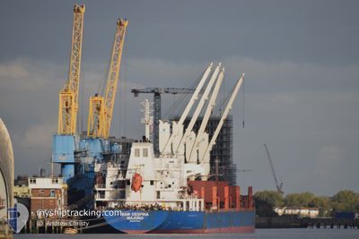
BAM DESPINA
Bulk Carrier
Current Trip
| Time Travelled | 18 days |
|---|---|
| Remaining Time | 3 h, 39 mins |
| Distance Travelled | 4644.62 nm |
| Remaining Distance | 429.17 nm |
| AVG Speed | 10.9 Noeuds |
| MAX Speed | 13.2 Noeuds |
| AVG Wind | 11.4 knots |
| MAX Wind | 24 knots |
| MIN Temp | 11.4°C / 52.52°F |
| MAX Temp | 28.1°C / 82.58°F |
| Tirant d eau | 10 m |
| Position reçue | 2 d depuis |
Current Position
| Longitude | --- |
|---|---|
| Latitude | --- |
| Etat | Under way using engine |
| Vitesse | 11.4 Noeuds |
| Parcours | 20.9° |
| Zone | North Atlantic Ocean |
| Station | T-AIS |
| Position reçue | 2 d depuis |
Info
Information
The current position of BAM DESPINA is in North Atlantic Ocean with coordinates 17.66667° / -20.78669° as reported on 2026-01-01 14:46 by AIS to our vessel tracker app. The vessel's current speed is 11.4 Noeuds and is heading at the port of LAS PALMAS. The estimated time of arrival as calculated by MyShipTracking vessel tracking app is 2026-01-04 03:07 LT
The vessel BAM DESPINA (IMO: 9517549, MMSI: 538011187) is a Bulk Carrier that was built in 2009 ( 17 Age ). It's sailing under the flag of [MH] Marshall Is.
In this page you can find informations about the vessels current position, last detected port calls, and current voyage information. If the vessels is not in coverage by AIS you will find the latest position.
The current position of BAM DESPINA is detected by our AIS receivers and we are not responsible for the reliability of the data. The last position was recorded while the vessel was in Coverage by the Ais receivers of our vessel tracking app.
The current draught of BAM DESPINA as reported by AIS is 10 meters
Weather
| Temperature | 19.7°C / 67.46°F |
|---|---|
| Wind Speed | 20 knots |
| Direction | 279° W |
| Pressure | 1011.3 hPa |
| Humidity | 77 % |
| Cloud Coverage | --- |
Featured Company
Last Port Calls
| Port | Arrival | Departure | Time In Port |
|---|---|---|---|
| 2025-12-11 04:41 | 2025-12-16 16:26 | 5 d | |
| 2025-12-10 01:42 | 2025-12-11 02:22 | 1 d | |
| 2025-11-27 21:58 | 2025-11-27 22:54 | 56 m |
Most Visited Ports (Last year)
| Port | Arrivals | |
|---|---|---|
| 2 | ||
| 2 | ||
| 1 | ||
| 1 | ||
| 1 | ||
| 1 |
Last Trips
| Origin | Departure | Destination | Arrival | Distance | |
|---|---|---|---|---|---|
| 2025-12-11 02:22 | 2025-12-11 04:41 | 17.18 nm | |||
| 2025-11-27 22:54 | 2025-12-10 01:42 | 1223.07 nm | |||
| 2025-10-20 21:29 | 2025-11-27 21:58 | 8034.96 nm |
Events
| Heure | Evenement | Détails | Position/ Destination | Info |
|---|---|---|---|---|
| 2026-01-01 14:48 | Etat Changé | Default Under way using engine |
17.67428 / -20.78280
ES LPA
|
Vitesse: 11.4 kn Parcours: 20.9° |
| 2026-01-01 14:46 | Etat Changé | Under way using engine Default |
17.66667 / -20.78669
ES LPA
|
Vitesse: 11.3 kn Parcours: 23° |
| 2026-01-01 14:46 | Dans la zone couverte |
17.66667 / -20.78669
North Atlantic Ocean
ES LPA
|
Vitesse: 11.4 kn Parcours: 20.9° |
|
| 2026-01-01 14:46 | Hors de la zone couverte |
17.66667 / -20.78669
North Atlantic Ocean
ES LPA
|
Vitesse: 11.4 kn Parcours: 20.9° |
|
| 2026-01-01 12:44 | Etat Changé | Default Under way using engine |
17.32578 / -20.96338
ES LPA
|
Vitesse: 11.4 kn Parcours: 26.1° |
| 2026-01-01 12:36 | Etat Changé | Under way using engine Default |
17.30357 / -20.97496
ES LPA
|
Vitesse: 11.2 kn Parcours: 26° |
| 2026-01-01 12:36 | Hors de la zone couverte |
17.30357 / -20.97496
North Atlantic Ocean
ES LPA
|
Vitesse: 11.4 kn Parcours: 26.1° |
|
| 2026-01-01 12:14 | Etat Changé | Default Under way using engine |
17.24149 / -21.00602
ES LPA
|
Vitesse: 11.5 kn Parcours: 24° |
| 2026-01-01 12:08 | Etat Changé | Under way using engine Default |
17.22396 / -21.01435
ES LPA
|
Vitesse: 11.6 kn Parcours: 26° |
| 2026-01-01 11:01 | Hors de la zone couverte |
17.02835 / -21.11240
North Atlantic Ocean
ES LPA
|
Vitesse: 11.6 kn Parcours: 26.2° |