
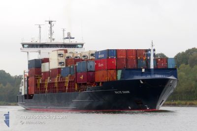
BALTIC SHARK
Container Ship
Current Trip
| Time Travelled | 3 days |
|---|---|
| Remaining Time | 1 day |
| Distance Travelled | 920.40 nm |
| Remaining Distance | 385.77 nm |
| AVG Speed | 13.1 Noeuds |
| MAX Speed | 16.6 Noeuds |
| AVG Wind | 8.2 knots |
| MAX Wind | 29 knots |
| MIN Temp | -1.4°C / 29.48°F |
| MAX Temp | 6.5°C / 43.7°F |
| Tirant d eau | 7.2 m |
| Position reçue | 4 h, 33 m depuis |
Current Position
| Longitude | --- |
|---|---|
| Latitude | --- |
| Etat | Under way using engine |
| Vitesse | 13.4 Noeuds |
| Parcours | 37.6° |
| Zone | Baltic Sea |
| Station | T-AIS |
| Position reçue | 4 h, 33 m depuis |
Info
Information
The current position of BALTIC SHARK is in Baltic Sea with coordinates 57.50110° / 19.57733° as reported on 2025-01-13 22:46 by AIS to our vessel tracker app. The vessel's current speed is 13.4 Noeuds and is heading at the port of ST PETERSBURG. The estimated time of arrival as calculated by MyShipTracking vessel tracking app is 2025-01-15 03:58 LT
The vessel BALTIC SHARK (IMO: 9315032, MMSI: 304932000) is a Container Ship that was built in 2004 ( 21 Age ). It's sailing under the flag of [AG] Antigua Barbuda.
In this page you can find informations about the vessels current position, last detected port calls, and current voyage information. If the vessels is not in coverage by AIS you will find the latest position.
The current position of BALTIC SHARK is detected by our AIS receivers and we are not responsible for the reliability of the data. The last position was recorded while the vessel was in Coverage by the Ais receivers of our vessel tracking app.
The current draught of BALTIC SHARK as reported by AIS is 7.2 meters
Weather
| Temperature | 3.8°C / 38.84°F |
|---|---|
| Wind Speed | 28 knots |
| Direction | 243° WSW |
| Pressure | 1020.9 hPa |
| Humidity | 88.8 % |
| Cloud Coverage | 100 % |
Featured Company
Last Port Calls
| Port | Arrival | Departure | Time In Port |
|---|---|---|---|
| 2025-01-09 04:02 | 2025-01-11 02:27 | 1 d | |
| 2025-01-07 19:46 | 2025-01-07 21:25 | 1 h | |
| 2025-01-02 16:17 | 2025-01-04 09:43 | 1 d | |
| 2024-12-30 05:43 | 2024-12-30 05:46 | 2 m | |
| 2024-12-27 06:15 | 2024-12-28 20:20 | 1 d | |
| 2024-12-20 16:49 | 2024-12-22 12:41 | 1 d | |
| 2024-12-14 19:27 | 2024-12-16 10:49 | 1 d | |
| 2024-12-09 10:38 | |||
| 2024-12-09 10:16 | |||
| 2024-12-07 15:25 | 2024-12-09 08:52 | 1 d |
Most Visited Ports (Last year)
| Port | Arrivals | |
|---|---|---|
| 25 | ||
| 25 | ||
| 12 | ||
| 2 | ||
| 2 | ||
| 1 |
Last Trips
| Origin | Departure | Destination | Arrival | Distance | |
|---|---|---|---|---|---|
| 2025-01-07 22:25 | 2025-01-09 05:02 | 289.83 nm | |||
| 2025-01-04 12:43 | 2025-01-07 20:46 | 839.61 nm | |||
| 2024-12-30 06:46 | 2025-01-02 19:17 | 785.66 nm | |||
| 2024-12-28 21:20 | 2024-12-30 06:43 | 331.85 nm | |||
| 2024-12-22 15:41 | 2024-12-27 07:15 | 1447.12 nm | |||
| 2024-12-16 11:49 | 2024-12-20 19:49 | 1114.94 nm | |||
| 2024-12-09 13:16 | 2024-12-14 20:27 | 1435.40 nm | |||
| 2024-12-09 11:52 | 2024-12-09 13:38 | 13.53 nm | |||
| 2024-12-03 23:18 | 2024-12-07 18:25 | 1114.36 nm | |||
| 2024-11-28 12:26 | 2024-12-02 11:57 | 1316.92 nm |
Events
| Heure | Evenement | Détails | Position/ Destination | Info |
|---|---|---|---|---|
| 2025-01-13 23:00 | Etat Changé | Default Under way using engine |
57.54175 / 19.63641
RULED
|
Vitesse: 13.4 kn Parcours: 37.6° |
| 2025-01-13 22:46 | Hors de la zone couverte |
57.50110 / 19.57733
Baltic Sea
RULED
|
Vitesse: 13.4 kn Parcours: 37.6° |
|
| 2025-01-13 22:37 | Etat Changé | Under way using engine Default |
57.47630 / 19.54081
RULED
|
Vitesse: 13.2 kn Parcours: 38° |
| 2025-01-13 22:29 | Etat Changé | Default Under way using engine |
57.45346 / 19.50634
RULED
|
Vitesse: 13.2 kn Parcours: 35.9° |
| 2025-01-13 21:26 | Etat Changé | Under way using engine Default |
57.27758 / 19.22257
RULED
|
Vitesse: 13.6 kn Parcours: 40° |
| 2025-01-13 21:26 | Dans la zone couverte |
57.28438 / 19.23410
Baltic Sea
RULED
|
Vitesse: 13.4 kn Parcours: 39.4° |
|
| 2025-01-13 12:27 | Etat Changé | Default Under way using engine |
55.97394 / 16.56027
RULED
|
Vitesse: 13.3 kn Parcours: 59.7° |
| 2025-01-13 12:26 | Etat Changé | Under way using engine Default |
55.97143 / 16.55284
RULED
|
Vitesse: 13.2 kn Parcours: 61° |
| 2025-01-13 12:26 | Hors de la zone couverte |
55.97143 / 16.55284
Baltic Sea
RULED
|
Vitesse: 13.3 kn Parcours: 59.7° |
|
| 2025-01-13 11:57 | Etat Changé | Default Under way using engine |
55.91693 / 16.39259
RULED
|
Vitesse: 13.1 kn Parcours: 57.6° |