
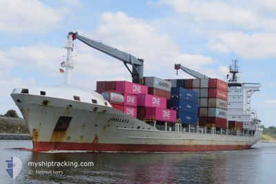
BALLATA
General Cargo
Current Trip
| Trip Time | 1 day |
|---|---|
| Trip Distance | 84.72 nm |
| AVG Speed | 9.1 Noeuds |
| MAX Speed | 15.3 Noeuds |
| Tirant d eau | 6.1 m |
| AVG Wind | 9.2 knots |
| MAX Wind | 20 knots |
| MIN Temp | 7.7°C / 45.86°F |
| MAX Temp | 14.2°C / 57.56°F |
| Position reçue | 22 h, 43 m depuis |
Current Position
| Longitude | --- |
|---|---|
| Latitude | --- |
| Etat | Under way using engine |
| Vitesse | 11.6 Noeuds |
| Parcours | 31.6° |
| Zone | North Atlantic Ocean |
| Station | T-AIS |
| Position reçue | 22 h, 43 m depuis |
Info
Information
The current position of BALLATA is in North Atlantic Ocean with coordinates 38.38390° / -9.02997° as reported on 2026-01-07 09:10 by AIS to our vessel tracker app. The vessel's current speed is 11.6 Noeuds and is currently inside the port of SETUBAL.
The vessel BALLATA (IMO: 9327578, MMSI: 277586000) is a General Cargo that was built in 2006 ( 20 Age ). It's sailing under the flag of [LT] Lithuania.
In this page you can find informations about the vessels current position, last detected port calls, and current voyage information. If the vessels is not in coverage by AIS you will find the latest position.
The current position of BALLATA is detected by our AIS receivers and we are not responsible for the reliability of the data. The last position was recorded while the vessel was in Coverage by the Ais receivers of our vessel tracking app.
The current draught of BALLATA as reported by AIS is 6.1 meters
Weather
| Temperature | 7.7°C / 45.86°F |
|---|---|
| Wind Speed | 2 knots |
| Direction | 83° E |
| Pressure | 1032.2 hPa |
| Humidity | 84.6 % |
| Cloud Coverage | 6 % |
Featured Company
Last Port Calls
| Port | Arrival | Departure | Time In Port |
|---|---|---|---|
| 2026-01-08 05:57 | |||
| 2026-01-06 10:38 | 2026-01-06 22:24 | 11 h | |
| 2026-01-04 10:41 | 2026-01-05 11:35 | 1 d | |
| 2025-12-29 20:53 | 2025-12-31 00:28 | 1 d | |
| 2025-12-29 03:32 | 2025-12-29 13:20 | 9 h | |
| 2025-12-20 22:21 | 2025-12-21 15:47 | 17 h | |
| 2025-12-19 19:02 | 2025-12-20 12:56 | 17 h | |
| 2025-12-18 06:15 | 2025-12-18 16:50 | 10 h | |
| 2025-12-16 04:30 | 2025-12-17 21:30 | 1 d | |
| 2025-12-11 14:21 | 2025-12-12 03:32 | 13 h |
Most Visited Ports (Last year)
| Port | Arrivals | |
|---|---|---|
| 22 | ||
| 8 | ||
| 7 | ||
| 7 | ||
| 7 | ||
| 6 |
Last Trips
| Origin | Departure | Destination | Arrival | Distance | |
|---|---|---|---|---|---|
| 2026-01-06 22:24 | 2026-01-08 05:57 | 84.72 nm | |||
| 2026-01-05 11:35 | 2026-01-06 10:38 | 241.16 nm | |||
| 2025-12-31 00:28 | 2026-01-04 10:41 | 974.39 nm | |||
| 2025-12-29 13:20 | 2025-12-29 20:53 | 95.27 nm | |||
| 2025-12-21 15:47 | 2025-12-29 03:32 | 700.09 nm | |||
| 2025-12-20 12:56 | 2025-12-20 22:21 | 109.77 nm | |||
| 2025-12-18 16:50 | 2025-12-19 19:02 | 93.23 nm | |||
| 2025-12-17 21:30 | 2025-12-18 06:15 | 114.66 nm | |||
| 2025-12-12 03:32 | 2025-12-16 04:30 | 494.36 nm | |||
| 2025-12-10 21:46 | 2025-12-11 14:21 | 124.02 nm |
Events
| Heure | Evenement | Détails | Position/ Destination | Info |
|---|---|---|---|---|
| 2026-01-08 06:16 | Arret |
38.47245 / -8.78658
[PT] SETUBAL
|
Vitesse: 0.1 kn Parcours: 175° |
|
| 2026-01-08 05:57 | Port d'arrivée |
|
38.47245 / -8.78658
[PT] SETUBAL
|
Vitesse: 4.6 kn Parcours: 79° |
| 2026-01-08 05:23 | Démarrage | 2.25 nm, South of SETUBAL |
38.46950 / -8.84454
PTSET
|
Vitesse: 7.2 kn Parcours: 85° |
| 2026-01-07 11:31 | Arret | 2.21 nm, South of SETUBAL |
38.46944 / -8.84847
PTSET
|
Vitesse: 0.3 kn Parcours: 138° |
| 2026-01-07 09:15 | Etat Changé | Default Under way using engine |
38.39352 / -9.02194
PTSET
|
Vitesse: 11.6 kn Parcours: 31.6° |
| 2026-01-07 09:10 | Hors de la zone couverte |
38.38390 / -9.02997
North Atlantic Ocean
|
Vitesse: 11.6 kn Parcours: 31.6° |
|
| 2026-01-07 08:53 | Etat Changé | Under way using engine Default |
38.33694 / -9.06617
PTSET
|
Vitesse: 11.7 kn Parcours: 31° |
| 2026-01-07 08:39 | Dans la zone couverte |
38.33694 / -9.06617
North Atlantic Ocean
|
Vitesse: 11.8 kn Parcours: 36.7° |
|
| 2026-01-07 00:51 | Etat Changé | Default Under way using engine |
38.32599 / -9.25614
PTSET
|
Vitesse: 13.3 kn Parcours: 125.7° |
| 2026-01-07 00:45 | Hors de la zone couverte |
38.33715 / -9.27590
North Atlantic Ocean
|
Vitesse: 13.3 kn Parcours: 125.7° |