
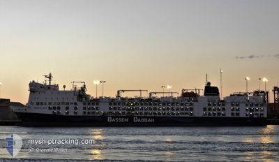
BAHIJAH
Livestock Carrier
Current Trip
| Time Travelled | 6 days |
|---|---|
| Remaining Time | 4 h, 31 mins |
| Distance Travelled | 2215.85 nm |
| Remaining Distance | 81.25 nm |
| AVG Speed | 14.7 Noeuds |
| MAX Speed | 18.1 Noeuds |
| AVG Wind | 20.5 knots |
| MAX Wind | 36.3 knots |
| MIN Temp | 12.1°C / 53.78°F |
| MAX Temp | 19.4°C / 66.92°F |
| Tirant d eau | 7.5 m |
| Position reçue | 48 m depuis |
Current Position
| Longitude | --- |
|---|---|
| Latitude | --- |
| Etat | Under way using engine |
| Vitesse | 17.1 Noeuds |
| Parcours | 288° |
| Zone | North Atlantic Ocean |
| Station | T-AIS |
| Position reçue | 48 m depuis |
Info
Information
The current position of BAHIJAH is in North Atlantic Ocean with coordinates 36.64440° / -8.80165° as reported on 2024-12-27 11:09 by AIS to our vessel tracker app. The vessel's current speed is 17.1 Noeuds and is heading at the port of SINES. The estimated time of arrival as calculated by MyShipTracking vessel tracking app is 2024-12-27 16:28 LT
The vessel BAHIJAH (IMO: 9360788, MMSI: 538007603) is a Livestock Carrier that was built in 2010 ( 14 Age ). It's sailing under the flag of [MH] Marshall Is.
In this page you can find informations about the vessels current position, last detected port calls, and current voyage information. If the vessels is not in coverage by AIS you will find the latest position.
The current position of BAHIJAH is detected by our AIS receivers and we are not responsible for the reliability of the data. The last position was recorded while the vessel was in Coverage by the Ais receivers of our vessel tracking app.
The current draught of BAHIJAH as reported by AIS is 7.5 meters
Weather
| Temperature | 16°C / 60.8°F |
|---|---|
| Wind Speed | 20 knots |
| Direction | 89° E |
| Pressure | 1025.9 hPa |
| Humidity | 74.2 % |
| Cloud Coverage | 100 % |
Featured Company
Last Port Calls
| Port | Arrival | Departure | Time In Port |
|---|---|---|---|
| 2024-12-20 06:39 | 2024-12-21 00:11 | 17 h | |
| 2024-12-05 19:36 | 2024-12-14 02:45 | 8 d | |
| 2024-11-22 07:54 | 2024-11-23 21:01 | 1 d | |
| 2024-10-18 18:03 | 2024-10-18 18:09 | 5 m | |
| 2024-10-18 16:30 | 2024-10-18 16:47 | 16 m | |
| 2024-10-18 12:33 | 2024-10-18 14:51 | 2 h | |
| 2024-10-18 09:01 | 2024-10-18 10:39 | 1 h | |
| 2024-10-14 10:59 | 2024-10-15 17:31 | 1 d | |
| 2024-10-06 14:05 | 2024-10-06 14:29 | 24 m | |
| 2024-10-05 16:31 | 2024-10-06 13:56 | 21 h |
Most Visited Ports (Last year)
| Port | Arrivals | |
|---|---|---|
| 7 | ||
| 7 | ||
| 5 | ||
| 4 | ||
| 1 | ||
| 1 |
Last Trips
| Origin | Departure | Destination | Arrival | Distance | |
|---|---|---|---|---|---|
| 2024-12-14 02:45 | 2024-12-20 08:39 | 2317.30 nm | |||
| 2024-11-23 22:01 | 2024-12-05 19:36 | 2276.32 nm | |||
| 2024-10-18 19:09 | 2024-11-22 08:54 | 9213.07 nm | |||
| 2024-10-18 17:47 | 2024-10-18 19:03 | 0.39 nm | |||
| 2024-10-18 15:51 | 2024-10-18 17:30 | 0.73 nm | |||
| 2024-10-18 11:39 | 2024-10-18 13:33 | 0.78 nm | |||
| 2024-10-15 19:31 | 2024-10-18 10:01 | 957.68 nm | |||
| 2024-10-06 17:29 | 2024-10-14 12:59 | 2121.10 nm | |||
| 2024-10-06 16:56 | 2024-10-06 17:05 | 2.83 nm | |||
| 2024-09-27 23:20 | 2024-10-05 19:31 | 2470.45 nm |
Events
| Heure | Evenement | Détails | Position/ Destination | Info |
|---|---|---|---|---|
| 2024-12-27 11:15 | Etat Changé | Default Under way using engine |
36.65383 / -8.83632
PTSIE
|
Vitesse: 17.1 kn Parcours: 288° |
| 2024-12-27 11:09 | Etat Changé | Under way using engine Default |
36.64440 / -8.80165
PTSIE
|
Vitesse: 17.2 kn Parcours: 288° |
| 2024-12-27 11:03 | Etat Changé | Default Under way using engine |
36.63398 / -8.76968
PTSIE
|
Vitesse: 17.2 kn Parcours: 286° |
| 2024-12-27 10:52 | Etat Changé | Under way using engine Default |
36.61858 / -8.70905
PTSIE
|
Vitesse: 17.3 kn Parcours: 287° |
| 2024-12-27 10:35 | Etat Changé | Default Under way using engine |
36.59350 / -8.60908
PTSIE
|
Vitesse: 17.1 kn Parcours: 288° |
| 2024-12-27 10:15 | Etat Changé | Under way using engine Default |
36.56392 / -8.49897
PTSIE
|
Vitesse: 17.1 kn Parcours: 287° |
| 2024-12-27 10:15 | Dans la zone couverte |
36.56392 / -8.49897
North Atlantic Ocean
PTSIE
|
Vitesse: 17.1 kn Parcours: 286° |
|
| 2024-12-27 09:14 | Etat Changé | Default Under way using engine |
36.47590 / -8.15565
PTSIE
|
Vitesse: 16.7 kn Parcours: 286° |
| 2024-12-27 09:09 | Detecté en mer | Portuguese part of the North Atlantic Ocean |
36.46830 / -8.12500
North Atlantic Ocean
PTSIE
|
Vitesse: 16.7 kn Parcours: 286° |
| 2024-12-27 09:09 | Hors de la zone couverte |
36.46830 / -8.12500
North Atlantic Ocean
PTSIE
|
Vitesse: 16.7 kn Parcours: 286° |