
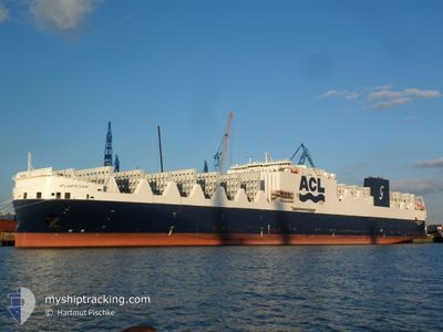
ATLANTIC STAR
Cargo B
Current Trip
| Time Travelled | 2 days |
|---|---|
| Remaining Time | 1 h, 34 mins |
| Distance Travelled | 758.82 nm |
| Remaining Distance | 27.50 nm |
| AVG Speed | 14.7 Noeuds |
| MAX Speed | 16 Noeuds |
| AVG Wind | 11.4 knots |
| MAX Wind | 18 knots |
| MIN Temp | 3.1°C / 37.58°F |
| MAX Temp | 11.4°C / 52.52°F |
| Tirant d eau | 8.9 m |
| Position reçue | 1 d depuis |
Current Position
| Longitude | -75.09503° |
|---|---|
| Latitude | 37.16716° |
| Etat | Under way using engine |
| Vitesse | 15.9 Noeuds |
| Parcours | 35.2° |
| Zone | North Atlantic Ocean |
| Station | T-AIS |
| Position reçue | 1 d depuis |
Info
Information
The current position of ATLANTIC STAR is in North Atlantic Ocean with coordinates 37.16716° / -75.09503° as reported on 2024-04-26 09:31 by AIS to our vessel tracker app. The vessel's current speed is 15.9 Noeuds and is heading at the port of HALIFAX. The estimated time of arrival as calculated by MyShipTracking vessel tracking app is 2024-04-28 07:26 LT
The vessel ATLANTIC STAR (IMO: 9670573, MMSI: 215797000) is a Cargo B It's sailing under the flag of [MT] Malta.
In this page you can find informations about the vessels current position, last detected port calls, and current voyage information. If the vessels is not in coverage by AIS you will find the latest position.
The current position of ATLANTIC STAR is detected by our AIS receivers and we are not responsible for the reliability of the data. The last position was recorded while the vessel was in Coverage by the Ais receivers of our vessel tracking app.
The current draught of ATLANTIC STAR as reported by AIS is 8.9 meters
Weather
| Temperature | 3.3°C / 37.94°F |
|---|---|
| Wind Speed | 11 knots |
| Direction | 30° NNE |
| Pressure | 1026.7 hPa |
| Humidity | 64.1 % |
| Cloud Coverage | --- |
Featured Company
Last Port Calls
| Port | Arrival | Departure | Time In Port |
|---|---|---|---|
| 2024-04-25 06:57 | 2024-04-26 03:52 | 20 h | |
| 2024-04-20 09:50 | 2024-04-23 04:34 | 2 d | |
| 2024-04-18 08:33 | 2024-04-18 20:25 | 11 h | |
| 2024-04-09 22:28 | 2024-04-11 12:27 | 1 d | |
| 2024-04-05 13:36 | 2024-04-07 02:59 | 1 d | |
| 2024-04-03 07:48 | 2024-04-04 07:49 | 1 d | |
| 2024-03-24 18:34 | 2024-03-25 12:53 | 18 h | |
| 2024-03-21 15:12 | 2024-03-22 01:03 | 9 h | |
| 2024-03-20 05:35 | 2024-03-21 03:58 | 22 h | |
| 2024-03-19 14:44 | 2024-03-20 05:22 | 14 h |
Last Trips
| Origin | Departure | Destination | Arrival | Distance | |
|---|---|---|---|---|---|
| 2024-04-23 00:34 | 2024-04-25 02:57 | 344.31 nm | |||
| 2024-04-18 17:25 | 2024-04-20 05:50 | 592.64 nm | |||
| 2024-04-11 13:27 | 2024-04-18 05:33 | 2519.95 nm | |||
| 2024-04-07 04:59 | 2024-04-09 23:28 | 816.36 nm | |||
| 2024-04-04 09:49 | 2024-04-05 15:36 | 406.01 nm | |||
| 2024-03-25 09:53 | 2024-04-03 09:48 | 3152.32 nm | |||
| 2024-03-21 21:03 | 2024-03-24 15:34 | 868.57 nm | |||
| 2024-03-20 23:58 | 2024-03-21 11:12 | 165.36 nm | |||
| 2024-03-20 01:22 | 2024-03-20 01:35 | 0.43 nm | |||
| 2024-03-18 03:56 | 2024-03-19 10:44 | 416.13 nm |
Events
| Heure | Evenement | Détails | Position/ Destination | Info |
|---|---|---|---|---|
| 2024-04-26 09:38 | Etat Changé | Default Under way using engine |
37.18892 / -75.06464
US ORF>CA HAL
|
Vitesse: 15.9 kn Parcours: 35.2° |
| 2024-04-26 09:31 | Hors de la zone couverte |
37.16716 / -75.09503
North Atlantic Ocean
US ORF>CA HAL
|
Vitesse: 15.9 kn Parcours: 35.2° |
|
| 2024-04-26 08:59 | Etat Changé | Under way using engine Default |
37.03070 / -75.14112
US ORF>CA HAL
|
Vitesse: 15.3 kn Parcours: 22° |
| 2024-04-26 08:46 | Dans la zone couverte |
37.03590 / -75.13967
North Atlantic Ocean
US ORF>CA HAL
|
Vitesse: 15.9 kn Parcours: 11.7° |
|
| 2024-04-26 05:06 | Etat Changé | Default Under way using engine |
36.93379 / -75.98102
US ORF>CA HAL
|
Vitesse: 7.8 kn Parcours: 127.6° |
| 2024-04-26 05:00 | Hors de la zone couverte |
36.94006 / -75.99606
North Atlantic Ocean
US ORF>CA HAL
|
Vitesse: 7.8 kn Parcours: 127.6° |
|
| 2024-04-26 04:57 | Etat Changé | Under way using engine Default |
36.94524 / -76.00210
US ORF>CA HAL
|
Vitesse: 8.8 kn Parcours: 112° |
| 2024-04-26 04:54 | Etat Changé | Default Under way using engine |
36.94792 / -76.00993
US ORF>CA HAL
|
Vitesse: 10 kn Parcours: 106.5° |
| 2024-04-26 03:52 | PORT DE DEPART |
|
37.00552 / -76.26673
US ORF>CA HAL
|
Vitesse: 13.9 kn Parcours: 73° |
| 2024-04-26 03:02 | Démarrage |
36.90788 / -76.32783
[US] NORFOLK
|
Vitesse: 3.4 kn Parcours: 341° |