

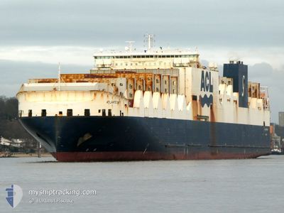
ATLANTIC SKY
Cargo

Current Trip
| Time Travelled | 4 days |
|---|---|
| Remaining Time | --- |
| Distance Travelled | 1700.84 nm |
| Remaining Distance | 873.86 nm |
| AVG Speed | 17.4 Noeuds |
| MAX Speed | 21.2 Noeuds |
| AVG Wind | 20.2 knots |
| MAX Wind | 31.8 knots |
| MIN Temp | -1.6°C / 29.12°F |
| MAX Temp | 13.6°C / 56.48°F |
| Tirant d eau | 9.9 m |
| Position reçue | 3 d depuis |
Current Position
| Longitude | --- |
|---|---|
| Latitude | --- |
| Etat | Under way using engine |
| Vitesse | 17 Noeuds |
| Parcours | 81.7° |
| Zone | North Atlantic Ocean |
| Station | T-AIS |
| Position reçue | 3 d depuis |
Information
The current position of ATLANTIC SKY is in North Atlantic Ocean with coordinates 44.41450° / -63.05641° as reported on 2025-03-24 01:58 by AIS to our vessel tracker app. The vessel's current speed is 17 Noeuds and is heading at the port of LIVERPOOL. The estimated time of arrival as calculated by MyShipTracking vessel tracking app is 2025-03-30 10:30 LT
The vessel ATLANTIC SKY (IMO: 9670602, MMSI: 215804000) is a Cargo It's sailing under the flag of [MT] Malta.
In this page you can find informations about the vessels current position, last detected port calls, and current voyage information. If the vessels is not in coverage by AIS you will find the latest position.
The current position of ATLANTIC SKY is detected by our AIS receivers and we are not responsible for the reliability of the data. The last position was recorded while the vessel was in Coverage by the Ais receivers of our vessel tracking app.
The current draught of ATLANTIC SKY as reported by AIS is 9.9 meters
Weather
| Temperature | 9.8°C / 49.64°F |
|---|---|
| Wind Speed | 11 knots |
| Direction | 310° NW |
| Pressure | 1025.4 hPa |
| Humidity | 62.3 % |
| Cloud Coverage | 89 % |


Featured Company
Last Port Calls
| Port | Arrival | Departure | Time In Port |
|---|---|---|---|
| 2025-03-22 17:47 | 2025-03-23 21:05 | 1 d | |
| 2025-03-20 05:18 | 2025-03-20 16:10 | 10 h | |
| 2025-03-18 18:05 | 2025-03-19 06:47 | 12 h | |
| 2025-03-17 23:09 | 2025-03-18 18:04 | 18 h | |
| 2025-03-14 04:55 | 2025-03-16 12:25 | 2 d | |
| 2025-03-12 05:31 | 2025-03-12 17:29 | 11 h | |
| 2025-03-03 10:58 | 2025-03-05 01:27 | 1 d | |
| 2025-02-27 20:36 | 2025-03-01 09:57 | 1 d | |
| 2025-02-26 00:17 | 2025-02-26 17:12 | 16 h | |
| 2025-02-22 03:43 | 2025-02-23 07:08 | 1 d |
Last Trips
| Origin | Departure | Destination | Arrival | Distance | |
|---|---|---|---|---|---|
| 2025-03-20 16:10 | 2025-03-22 17:47 | 796.15 nm | |||
| 2025-03-19 06:47 | 2025-03-20 05:18 | 216.10 nm | |||
| 2025-03-18 18:04 | 2025-03-18 18:05 | 0.06 nm | |||
| 2025-03-16 12:25 | 2025-03-17 23:09 | 430.72 nm | |||
| 2025-03-12 17:29 | 2025-03-14 04:55 | 590.04 nm | |||
| 2025-03-05 01:27 | 2025-03-12 05:31 | 2517.89 nm | |||
| 2025-03-01 09:57 | 2025-03-03 10:58 | 707.34 nm | |||
| 2025-02-26 17:12 | 2025-02-27 20:36 | 402.02 nm | |||
| 2025-02-23 07:08 | 2025-02-26 00:17 | 998.72 nm | |||
| 2025-02-14 09:58 | 2025-02-22 03:43 | 2504.93 nm |
Events
| Heure | Evenement | Détails | Position/ Destination | Info |
|---|---|---|---|---|
| 2025-03-24 02:02 | Etat Changé | Default Under way using engine |
44.41701 / -63.03105
CAHAL>GBLIV
|
Vitesse: 17 kn Parcours: 81.7° |
| 2025-03-24 01:58 | Hors de la zone couverte |
44.41450 / -63.05641
North Atlantic Ocean
CAHAL>GBLIV
|
Vitesse: 17 kn Parcours: 81.7° |
|
| 2025-03-24 01:53 | Etat Changé | Under way using engine Default |
44.41137 / -63.09058
CAHAL>GBLIV
|
Vitesse: 17 kn Parcours: 83° |
| 2025-03-24 01:50 | Etat Changé | Default Under way using engine |
44.40940 / -63.11295
CAHAL>GBLIV
|
Vitesse: 17.1 kn Parcours: 85.8° |
| 2025-03-24 00:05 | PORT DE DEPART |
|
44.60375 / -63.54112
CAHAL>GBLIV
|
Vitesse: 13.3 kn Parcours: 159° |
| 2025-03-23 23:36 | Changement d'ETA | 2025/03/30 09:30 2025/03/30 08:30 |
44.66523 / -63.58862
[CA] HALIFAX
|
Vitesse: 7.6 kn Parcours: 137° |
| 2025-03-23 23:07 | Démarrage |
44.67178 / -63.62824
[CA] HALIFAX
|
Vitesse: 3.1 kn Parcours: 332° |
|
| 2025-03-23 22:48 | Etat Changé | Under way using engine Moored |
44.67042 / -63.62623
[CA] HALIFAX
|
Vitesse: Parcours: 22° |
| 2025-03-23 20:50 | Changement d'ETA | 2025/03/30 08:30 2025/03/30 17:00 |
44.67039 / -63.62603
[CA] HALIFAX
|
Vitesse: Parcours: 22° |
| 2025-03-23 20:43 | Changement d'ETA | 2025/03/30 17:00 2025/03/29 17:00 |
44.67041 / -63.62609
[CA] HALIFAX
|
Vitesse: Parcours: 22° |