
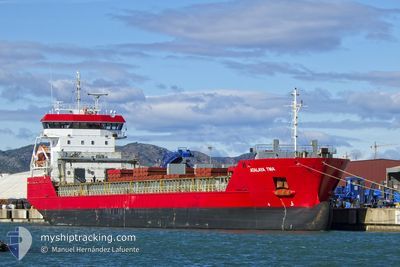
KATUXA NM
Cargo
Current Trip
| Time Travelled | 6 days |
|---|---|
| Remaining Time | --- |
| Distance Travelled | 1432.09 nm |
| Remaining Distance | --- |
| AVG Speed | 9.4 Noeuds |
| MAX Speed | 11.3 Noeuds |
| AVG Wind | 15.1 knots |
| MAX Wind | 26 knots |
| MIN Temp | 10.7°C / 51.26°F |
| MAX Temp | 16.8°C / 62.24°F |
| Tirant d eau | 7.1 m |
| Position reçue | 1 d depuis |
Current Position
| Longitude | 15.24490° |
|---|---|
| Latitude | 36.54260° |
| Etat | Under way using engine |
| Vitesse | 10.4 Noeuds |
| Parcours | 94.8° |
| Zone | Mediterranean Sea - Eastern Basin |
| Station | T-AIS |
| Position reçue | 1 d depuis |
Info
Information
The current position of KATUXA NM is in Mediterranean Sea - Eastern Basin with coordinates 36.54260° / 15.24490° as reported on 2024-04-25 08:58 by AIS to our vessel tracker app. The vessel's current speed is 10.4 Noeuds and is heading at the port of GEMLIK. The estimated time of arrival as calculated by MyShipTracking vessel tracking app is 2024-04-28 23:59 LT
The vessel KATUXA NM (IMO: 9956513, MMSI: 224584000) is a Cargo It's sailing under the flag of [ES] Spain.
In this page you can find informations about the vessels current position, last detected port calls, and current voyage information. If the vessels is not in coverage by AIS you will find the latest position.
The current position of KATUXA NM is detected by our AIS receivers and we are not responsible for the reliability of the data. The last position was recorded while the vessel was in Coverage by the Ais receivers of our vessel tracking app.
The current draught of KATUXA NM as reported by AIS is 7.1 meters
Weather
| Temperature | 16.5°C / 61.7°F |
|---|---|
| Wind Speed | 14 knots |
| Direction | 305° NW |
| Pressure | 1014.8 hPa |
| Humidity | 65.3 % |
| Cloud Coverage | 8 % |
Featured Company
Last Port Calls
| Port | Arrival | Departure | Time In Port |
|---|---|---|---|
| 2024-04-19 13:38 | 2024-04-20 11:45 | 22 h | |
| 2024-04-19 04:24 | 2024-04-19 11:39 | 7 h | |
| 2024-04-13 02:51 | 2024-04-13 04:09 | 1 h | |
| 2024-04-09 21:59 | 2024-04-11 00:08 | 1 d | |
| 2024-04-06 04:12 | 2024-04-07 21:10 | 1 d | |
| 2024-03-30 19:33 | 2024-03-31 09:42 | 14 h | |
| 2024-03-25 10:49 | 2024-03-26 19:27 | 1 d | |
| 2024-03-21 10:30 | 2024-03-23 18:48 | 2 d | |
| 2024-03-12 19:21 | 2024-03-14 16:36 | 1 d | |
| 2024-03-10 21:13 | 2024-03-11 20:57 | 23 h |
Last Trips
| Origin | Departure | Destination | Arrival | Distance | |
|---|---|---|---|---|---|
| 2024-04-19 12:39 | 2024-04-19 15:38 | 18.91 nm | |||
| 2024-04-13 06:09 | 2024-04-19 05:24 | 1434.81 nm | |||
| 2024-04-11 02:08 | 2024-04-13 04:51 | 88.76 nm | |||
| 2024-04-07 22:10 | 2024-04-09 23:59 | 531.74 nm | |||
| 2024-03-31 11:42 | 2024-04-06 05:12 | 1209.74 nm | |||
| 2024-03-26 20:27 | 2024-03-30 20:33 | 891.46 nm | |||
| 2024-03-23 19:48 | 2024-03-25 11:49 | 163.68 nm | |||
| 2024-03-14 17:36 | 2024-03-21 11:30 | 1825.66 nm | |||
| 2024-03-11 21:57 | 2024-03-12 20:21 | 252.21 nm | |||
| 2024-03-09 04:05 | 2024-03-10 22:13 | 383.92 nm |
Events
| Heure | Evenement | Détails | Position/ Destination | Info |
|---|---|---|---|---|
| 2024-04-25 09:08 | Etat Changé | Default Under way using engine |
36.54089 / 15.27980
TRGEM
|
Vitesse: 10.4 kn Parcours: 94.8° |
| 2024-04-25 08:58 | Hors de la zone couverte |
36.54260 / 15.24490
Mediterranean Sea - Eastern Basin
TRGEM
|
Vitesse: 10.4 kn Parcours: 94.8° |
|
| 2024-04-25 08:29 | Etat Changé | Under way using engine Default |
36.54771 / 15.13970
TRGEM
|
Vitesse: 10.3 kn Parcours: 93° |
| 2024-04-25 07:36 | Etat Changé | Default Under way using engine |
36.57632 / 14.95922
TRGEM
|
Vitesse: 10.1 kn Parcours: 107.1° |
| 2024-04-25 01:52 | Etat Changé | Under way using engine Default |
36.88282 / 13.76102
TRGEM
|
Vitesse: 10.2 kn Parcours: 114° |
| 2024-04-25 01:35 | Etat Changé | Default Under way using engine |
36.90356 / 13.70620
TRGEM
|
Vitesse: 10.5 kn Parcours: 150.4° |
| 2024-04-25 01:09 | Etat Changé | Under way using engine Default |
36.96795 / 13.65747
TRGEM
|
Vitesse: 10.3 kn Parcours: 150° |
| 2024-04-25 01:08 | Etat Changé | Default Under way using engine |
36.97041 / 13.65554
TRGEM
|
Vitesse: 10.1 kn Parcours: 134.3° |
| 2024-04-25 00:57 | Etat Changé | Under way using engine Default |
36.99398 / 13.62986
TRGEM
|
Vitesse: 10.2 kn Parcours: 136° |
| 2024-04-25 00:56 | Etat Changé | Default Under way using engine |
36.99668 / 13.62654
TRGEM
|
Vitesse: 10.1 kn Parcours: 137.8° |