
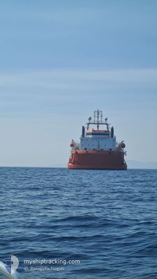
ATALANTI
Cable Layer
Current Trip
| Trip Time | 2 days |
|---|---|
| Trip Distance | 316.53 nm |
| AVG Speed | 7.1 Noeuds |
| MAX Speed | 10.5 Noeuds |
| Tirant d eau | 3.7 m |
| AVG Wind | 9.4 knots |
| MAX Wind | 26 knots |
| MIN Temp | 17.9°C / 64.22°F |
| MAX Temp | 25.3°C / 77.54°F |
| Position reçue | 1 m depuis |
Current Position
| Longitude | -8.78665° |
|---|---|
| Latitude | 38.47711° |
| Etat | At anchor |
| Vitesse | |
| Parcours | 179° |
| Zone | North Atlantic Ocean |
| Station | T-AIS |
| Position reçue | 1 m depuis |
Info
Information
The current position of ATALANTI is in North Atlantic Ocean with coordinates 38.47711° / -8.78665° as reported on 2024-06-08 08:28 by AIS to our vessel tracker app. The vessel's current speed is 0 Noeuds and is currently inside the port of SETUBAL.
The vessel ATALANTI (IMO: 8661616, MMSI: 241806000) is a Cable Layer that was built in 2008 ( 16 Age ). It's sailing under the flag of [GR] Greece.
In this page you can find informations about the vessels current position, last detected port calls, and current voyage information. If the vessels is not in coverage by AIS you will find the latest position.
The current position of ATALANTI is detected by our AIS receivers and we are not responsible for the reliability of the data. The last position was recorded while the vessel was in Coverage by the Ais receivers of our vessel tracking app.
The current draught of ATALANTI as reported by AIS is 3.7 meters
Weather
| Temperature | 18.4°C / 65.12°F |
|---|---|
| Wind Speed | 7 knots |
| Direction | 213° SSW |
| Pressure | 1012.7 hPa |
| Humidity | 78.4 % |
| Cloud Coverage | 100 % |
Featured Company
Events
| Heure | Evenement | Détails | Position/ Destination | Info |
|---|---|---|---|---|
| 2024-06-05 10:18 | Dans la zone couverte |
38.47713 / -8.78664
North Atlantic Ocean
[PT] SETUBAL
|
Vitesse: Parcours: 149.1° |
|
| 2024-06-04 12:26 | Hors de la zone couverte |
38.47713 / -8.78664
North Atlantic Ocean
[PT] SETUBAL
|
Vitesse: Parcours: 263.9° |
|
| 2024-06-03 11:41 | Arret |
38.46944 / -8.78661
[PT] SETUBAL
|
Vitesse: 0.3 kn Parcours: 64° |
|
| 2024-06-03 11:35 | Port d'arrivée |
|
38.46800 / -8.79084
[PT] SETUBAL
|
Vitesse: 4.9 kn Parcours: 56° |
| 2024-06-03 10:59 | Démarrage | 2.12 nm, South of SETUBAL |
38.47051 / -8.85221
PTSET
|
Vitesse: 3.1 kn Parcours: 87° |
| 2024-06-02 17:07 | Etat Changé | At anchor Restricted manoeuverability |
38.47033 / -8.85404
PTSET
|
Vitesse: Parcours: 159° |
| 2024-06-02 16:45 | Arret | 1.95 nm, South of SETUBAL |
38.47299 / -8.85640
PTSET
|
Vitesse: 0.1 kn Parcours: 109° |
| 2024-06-02 14:34 | Démarrage | 9 nm, South West of SETUBAL |
38.41762 / -9.01280
PTSET
|
Vitesse: 3.5 kn Parcours: 56° |
| 2024-06-02 11:18 | Arret | 9.12 nm, South West of SETUBAL |
38.41656 / -9.01501
PTSET
|
Vitesse: 0.2 kn Parcours: 53° |
| 2024-06-01 15:52 | Tirant d'eau modifié | 3.7 2.9 |
36.41354 / -7.85733
PTSET
|
Vitesse: 9.2 kn Parcours: 283.4° |