
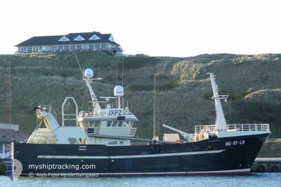
ASTRID
Fishing Vessel
Current Trip
CH 16 FOR INFO
| Time Travelled | 6 h, 51 mins |
|---|---|
| Remaining Time | --- |
| Distance Travelled | 54.78 nm |
| Remaining Distance | --- |
| AVG Speed | 8.3 Noeuds |
| MAX Speed | 9.1 Noeuds |
| AVG Wind | 12.4 knots |
| MAX Wind | 15.8 knots |
| MIN Temp | 3.5°C / 38.3°F |
| MAX Temp | 5°C / 41°F |
| Tirant d eau | 0 m |
| Position reçue | Maintenant |
Current Position
| Longitude | --- |
|---|---|
| Latitude | --- |
| Etat | Engaged in Fishing |
| Vitesse | 8.4 Noeuds |
| Parcours | 272.5° |
| Zone | Norwegian Sea |
| Station | T-AIS |
| Position reçue | Maintenant |
Info
Information
The current position of ASTRID is in Norwegian Sea with coordinates 67.31620° / 12.00614° as reported on 2025-03-06 22:45 by AIS to our vessel tracker app. The vessel's current speed is 8.4 Noeuds
The vessel ASTRID (IMO: 9232943, MMSI: 258040000) is a Fishing Vessel that was built in 2000 ( 25 Age ). It's sailing under the flag of [NO] Norway.
In this page you can find informations about the vessels current position, last detected port calls, and current voyage information. If the vessels is not in coverage by AIS you will find the latest position.
The current position of ASTRID is detected by our AIS receivers and we are not responsible for the reliability of the data. The last position was recorded while the vessel was in Coverage by the Ais receivers of our vessel tracking app.
Weather
| Temperature | 5°C / 41°F |
|---|---|
| Wind Speed | 7 knots |
| Direction | 283° WNW |
| Pressure | 1002.9 hPa |
| Humidity | 61.8 % |
| Cloud Coverage | 38 % |
Featured Company
Last Port Calls
| Port | Arrival | Departure | Time In Port |
|---|---|---|---|
| 2025-03-02 21:12 | 2025-03-06 15:55 | 3 d | |
| 2025-03-01 17:01 | 2025-03-02 10:55 | 17 h | |
| 2025-02-26 19:38 | 2025-02-26 22:26 | 2 h | |
| 2025-02-25 16:33 | 2025-02-25 19:21 | 2 h | |
| 2025-02-24 21:14 | 2025-02-25 15:54 | 18 h | |
| 2025-02-23 23:46 | 2025-02-24 20:35 | 20 h | |
| 2025-02-20 16:43 | 2025-02-21 04:37 | 11 h | |
| 2025-02-16 21:20 | 2025-02-17 15:05 | 17 h | |
| 2025-02-16 14:05 | 2025-02-16 20:29 | 6 h | |
| 2025-02-13 12:48 | 2025-02-14 00:11 | 11 h |
Last Trips
| Origin | Departure | Destination | Arrival | Distance | |
|---|---|---|---|---|---|
| 2025-03-02 11:55 | 2025-03-02 22:12 | 63.06 nm | |||
| 2025-02-26 23:26 | 2025-03-01 18:01 | 484.09 nm | |||
| 2025-02-25 20:21 | 2025-02-26 20:38 | 148.89 nm | |||
| 2025-02-25 16:54 | 2025-02-25 17:33 | 5.83 nm | |||
| 2025-02-24 21:35 | 2025-02-24 22:14 | 5.85 nm | |||
| 2025-02-21 05:37 | 2025-02-24 00:46 | 444.44 nm | |||
| 2025-02-17 16:05 | 2025-02-20 17:43 | 312.64 nm | |||
| 2025-02-16 21:29 | 2025-02-16 22:20 | 6.66 nm | |||
| 2025-02-14 01:11 | 2025-02-16 15:05 | 221.06 nm | |||
| 2025-02-11 19:17 | 2025-02-13 13:48 | 179.65 nm |
Events
| Heure | Evenement | Détails | Position/ Destination | Info |
|---|---|---|---|---|
| 2025-03-06 15:55 | PORT DE DEPART |
|
67.28496 / 14.36034
CH 16 FOR INFO
|
Vitesse: 7.4 kn Parcours: 251° |
| 2025-03-06 15:52 | Démarrage |
67.28535 / 14.37178
[NO] BODOE
|
Vitesse: 3.6 kn Parcours: 284° |
|
| 2025-03-02 21:19 | Arret |
67.28463 / 14.37618
[NO] BODOE
|
Vitesse: Parcours: 224° |
|
| 2025-03-02 21:12 | Port d'arrivée |
|
67.28531 / 14.36480
[NO] BODOE
|
Vitesse: 5 kn Parcours: 90.9° |
| 2025-03-02 17:29 | Démarrage | 17.1 nm, North of MISTEN |
67.73549 / 14.77363
CH 16 FOR INFO
|
Vitesse: 8.2 kn Parcours: 23.7° |
| 2025-03-02 14:18 | Arret | 16.89 nm, North of MISTEN |
67.73195 / 14.77050
CH 16 FOR INFO
|
Vitesse: 0.1 kn Parcours: 206° |
| 2025-03-02 10:55 | PORT DE DEPART |
|
67.28624 / 14.36158
CH 16 FOR INFO
|
Vitesse: 8.7 kn Parcours: 337° |
| 2025-03-02 10:52 | Démarrage |
67.28508 / 14.37110
[NO] BODOE
|
Vitesse: 3.7 kn Parcours: 279° |
|
| 2025-03-01 17:07 | Arret |
67.28468 / 14.37600
[NO] BODOE
|
Vitesse: 0.3 kn Parcours: 235° |
|
| 2025-03-01 17:01 | Port d'arrivée |
|
67.28574 / 14.36537
[NO] BODOE
|
Vitesse: 5.2 kn Parcours: 71.7° |