
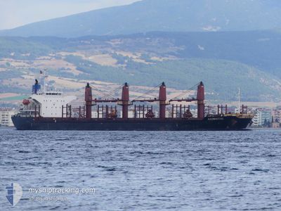
ASOMATOS
Bulk Carrier
Current Trip
| Time Travelled | 4 days |
|---|---|
| Remaining Time | 9 h, 12 mins |
| Distance Travelled | 319.83 nm |
| Remaining Distance | 182.09 nm |
| AVG Speed | 10.8 Noeuds |
| MAX Speed | 11.4 Noeuds |
| AVG Wind | 10 knots |
| MAX Wind | 21 knots |
| MIN Temp | 13.7°C / 56.66°F |
| MAX Temp | 14.9°C / 58.82°F |
| Tirant d eau | 9.9 m |
| Position reçue | 1 d depuis |
Current Position
| Longitude | 37.37866° |
|---|---|
| Latitude | 44.45193° |
| Etat | Under way using engine |
| Vitesse | 10.8 Noeuds |
| Parcours | 245.4° |
| Zone | Black Sea |
| Station | T-AIS |
| Position reçue | 1 d depuis |
Info
Information
The current position of ASOMATOS is in Black Sea with coordinates 44.45193° / 37.37866° as reported on 2024-05-16 17:32 by AIS to our vessel tracker app. The vessel's current speed is 10.8 Noeuds and is heading at the port of ISTANBUL. The estimated time of arrival as calculated by MyShipTracking vessel tracking app is 2024-05-18 07:46 LT
The vessel ASOMATOS (IMO: 9289855, MMSI: 351654000) is a Bulk Carrier that was built in 2003 ( 21 Age ). It's sailing under the flag of [PA] Panama.
In this page you can find informations about the vessels current position, last detected port calls, and current voyage information. If the vessels is not in coverage by AIS you will find the latest position.
The current position of ASOMATOS is detected by our AIS receivers and we are not responsible for the reliability of the data. The last position was recorded while the vessel was in Coverage by the Ais receivers of our vessel tracking app.
The current draught of ASOMATOS as reported by AIS is 9.9 meters
Weather
| Temperature | 14.8°C / 58.64°F |
|---|---|
| Wind Speed | 19 knots |
| Direction | 71° ENE |
| Pressure | 1018 hPa |
| Humidity | 81.6 % |
| Cloud Coverage | 33 % |
Featured Company
Last Port Calls
| Port | Arrival | Departure | Time In Port |
|---|---|---|---|
| 2024-05-13 02:42 | |||
| 2024-04-22 03:12 | 2024-04-27 20:54 | 5 d | |
| 2024-04-09 12:37 | 2024-04-11 13:34 | 2 d | |
| 2024-03-29 20:39 | |||
| 2024-03-19 10:43 |
Most Visited Ports (Last year)
| Port | Arrivals | |
|---|---|---|
| 4 | ||
| 4 | ||
| 3 | ||
| 2 | ||
| 2 | ||
| 2 |
Last Trips
| Origin | Departure | Destination | Arrival | Distance | |
|---|---|---|---|---|---|
| 2024-04-11 16:34 | 2024-04-22 06:12 | 1402.85 nm | |||
| 2024-03-29 23:39 | 2024-04-09 15:37 | 2581.39 nm |
Events
| Heure | Evenement | Détails | Position/ Destination | Info |
|---|---|---|---|---|
| 2024-05-16 17:41 | Etat Changé | Default Under way using engine |
44.44183 / 37.34811
TR IST
|
Vitesse: 10.8 kn Parcours: 245.4° |
| 2024-05-16 17:32 | Hors de la zone couverte |
44.45193 / 37.37866
Black Sea
TR IST
|
Vitesse: 10.8 kn Parcours: 245.4° |
|
| 2024-05-16 16:55 | Dans la zone couverte |
44.49825 / 37.51832
Black Sea
TR IST
|
Vitesse: 10.6 kn Parcours: 248.6° |
|
| 2024-05-16 13:19 | Changement d'ETA | 2024/05/18 10:00 2024/05/15 14:00 |
44.68039 / 37.82974
TR IST
|
Vitesse: 8 kn Parcours: 155.7° |
| 2024-05-13 09:41 | Tirant d'eau modifié | 9.9 5.1 |
44.68039 / 37.82974
TR IST
|
Vitesse: 8 kn Parcours: 155.7° |
| 2024-05-13 09:41 | Changement de destination | TR IST RU NVS |
44.68039 / 37.82974
TR IST
|
Vitesse: 8 kn Parcours: 155.7° |
| 2024-05-13 09:41 | Changement d'ETA | 2024/05/15 14:00 2024/05/03 14:00 |
44.68039 / 37.82974
TR IST
|
Vitesse: 8 kn Parcours: 155.7° |
| 2024-05-13 02:49 | Hors de la zone couverte |
44.68039 / 37.82974
Black Sea
|
Vitesse: 8 kn Parcours: 155.7° |
|
| 2024-05-13 02:42 | PORT DE DEPART |
|
44.69481 / 37.81898
RU NVS
|
Vitesse: 9.2 kn Parcours: 151° |
| 2024-05-13 02:30 | Etat Changé | Under way using engine Moored |
44.72061 / 37.80034
[RU] NOVOROSSIYSK
|
Vitesse: 7 kn Parcours: 150° |