
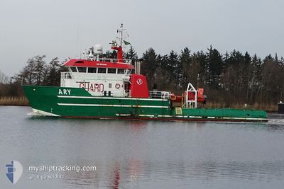
ARY
Offshore Supply Ship
Current Trip
GT1
| Time Travelled | 1 day |
|---|---|
| Remaining Time | --- |
| Distance Travelled | 19.38 nm |
| Remaining Distance | --- |
| AVG Speed | 5.9 Noeuds |
| MAX Speed | 7.8 Noeuds |
| AVG Wind | 20.5 knots |
| MAX Wind | 21.3 knots |
| MIN Temp | 7.5°C / 45.5°F |
| MAX Temp | 7.8°C / 46.04°F |
| Tirant d eau | 3.1 m |
| Position reçue | 1 d depuis |
Current Position
| Longitude | 6.21825° |
|---|---|
| Latitude | 53.60230° |
| Etat | Under way using engine |
| Vitesse | 6 Noeuds |
| Parcours | 40.4° |
| Zone | North Sea |
| Station | T-AIS |
| Position reçue | 1 d depuis |
Info
Information
The current position of ARY is in North Sea with coordinates 53.60230° / 6.21825° as reported on 2024-04-24 23:42 by AIS to our vessel tracker app. The vessel's current speed is 6 Noeuds
The vessel ARY (IMO: 8928480, MMSI: 577031000) is a Offshore Supply Ship that was built in 1980 ( 44 Age ). It's sailing under the flag of [VU] Vanuatu.
In this page you can find informations about the vessels current position, last detected port calls, and current voyage information. If the vessels is not in coverage by AIS you will find the latest position.
The current position of ARY is detected by our AIS receivers and we are not responsible for the reliability of the data. The last position was recorded while the vessel was in Coverage by the Ais receivers of our vessel tracking app.
The current draught of ARY as reported by AIS is 3.1 meters
Weather
| Temperature | 7.6°C / 45.68°F |
|---|---|
| Wind Speed | 19 knots |
| Direction | 339° NNW |
| Pressure | 1006.2 hPa |
| Humidity | 70.5 % |
| Cloud Coverage | 100 % |
Featured Company
Last Port Calls
| Port | Arrival | Departure | Time In Port |
|---|---|---|---|
| 2024-03-03 12:51 | 2024-04-24 20:15 | ||
| 2024-03-02 15:29 | 2024-03-02 19:09 | 3 h | |
| 2024-02-11 09:13 |
Last Trips
| Origin | Departure | Destination | Arrival | Distance | |
|---|---|---|---|---|---|
| 2024-03-02 20:09 | 2024-03-03 13:51 | 137.43 nm | |||
| 2024-02-11 10:13 | 2024-03-02 16:29 | 929.35 nm |
Events
| Heure | Evenement | Détails | Position/ Destination | Info |
|---|---|---|---|---|
| 2024-04-24 23:42 | Hors de la zone couverte |
53.60230 / 6.21825
North Sea
GT1
|
Vitesse: 6 kn Parcours: 40.4° |
|
| 2024-04-24 21:07 | Changement d'ETA | 2024/04/25 11:00 2025/03/03 18:00 |
53.44145 / 6.08153
GT1
|
Vitesse: 6 kn Parcours: 310° |
| 2024-04-24 21:04 | Changement de destination | GT1 LAUWERSOOG |
53.43892 / 6.08723
GT1
|
Vitesse: 6.2 kn Parcours: 303.8° |
| 2024-04-24 21:03 | Etat Changé | Under way using engine Moored |
53.43747 / 6.09038
LAUWERSOOG
|
Vitesse: 6 kn Parcours: 309.2° |
| 2024-04-24 20:15 | PORT DE DEPART |
|
53.41328 / 6.20072
LAUWERSOOG
|
Vitesse: 4.5 kn Parcours: 337° |
| 2024-04-24 20:08 | Démarrage |
53.40857 / 6.20457
[NL] LAUWERSOOG
|
Vitesse: 3.2 kn Parcours: 258° |
|
| 2024-04-24 17:42 | Etat Changé | Moored Under way using engine |
53.40897 / 6.20762
[NL] LAUWERSOOG
|
Vitesse: Parcours: 0° |
| 2024-04-24 17:39 | Etat Changé | Under way using engine Moored |
53.40895 / 6.20762
[NL] LAUWERSOOG
|
Vitesse: Parcours: 252° |
| 2024-04-24 14:54 | Dans la zone couverte |
53.40887 / 6.20755
North Sea
[NL] LAUWERSOOG
|
Vitesse: Parcours: 90° |
|
| 2024-04-24 13:30 | Hors de la zone couverte |
53.40890 / 6.20760
North Sea
[NL] LAUWERSOOG
|
Vitesse: Parcours: 90° |