
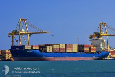
ARIANA A
Container Ship
Current Trip
| Time Travelled | 2 days |
|---|---|
| Remaining Time | 20 h, 53 mins |
| Distance Travelled | 806.89 nm |
| Remaining Distance | 375.77 nm |
| AVG Speed | 16.4 Noeuds |
| MAX Speed | 17.6 Noeuds |
| AVG Wind | 13.3 knots |
| MAX Wind | 24 knots |
| MIN Temp | 15°C / 59°F |
| MAX Temp | 17.6°C / 63.68°F |
| Tirant d eau | 10.7 m |
| Position reçue | 8 h, 59 m depuis |
Current Position
| Longitude | 14.63426° |
|---|---|
| Latitude | 36.40735° |
| Etat | Under way using engine |
| Vitesse | 16.8 Noeuds |
| Parcours | 98.1° |
| Zone | Mediterranean Sea - Eastern Basin |
| Station | T-AIS |
| Position reçue | 8 h, 59 m depuis |
Info
Information
The current position of ARIANA A is in Mediterranean Sea - Eastern Basin with coordinates 36.40735° / 14.63426° as reported on 2024-04-29 23:01 by AIS to our vessel tracker app. The vessel's current speed is 16.8 Noeuds and is heading at the port of PIRAEUS. The estimated time of arrival as calculated by MyShipTracking vessel tracking app is 2024-05-01 04:53 LT
The vessel ARIANA A (IMO: 9320142, MMSI: 538009388) is a Container Ship that was built in 2005 ( 19 Age ). It's sailing under the flag of [MH] Marshall Is.
In this page you can find informations about the vessels current position, last detected port calls, and current voyage information. If the vessels is not in coverage by AIS you will find the latest position.
The current position of ARIANA A is detected by our AIS receivers and we are not responsible for the reliability of the data. The last position was recorded while the vessel was in Coverage by the Ais receivers of our vessel tracking app.
The current draught of ARIANA A as reported by AIS is 10.7 meters
Weather
| Temperature | 17.7°C / 63.86°F |
|---|---|
| Wind Speed | 10 knots |
| Direction | 122° ESE |
| Pressure | 1018.2 hPa |
| Humidity | 84.7 % |
| Cloud Coverage | 58 % |
Featured Company
Last Port Calls
| Port | Arrival | Departure | Time In Port |
|---|---|---|---|
| 2024-04-27 10:08 | 2024-04-28 07:10 | 21 h | |
| 2024-04-26 05:12 | 2024-04-27 01:04 | 19 h | |
| 2024-04-25 03:09 | 2024-04-26 01:30 | 22 h | |
| 2024-04-22 01:12 | 2024-04-24 01:00 | 1 d | |
| 2024-04-17 16:42 | 2024-04-18 06:57 | 14 h | |
| 2024-04-16 10:14 | 2024-04-16 19:15 | 9 h | |
| 2024-04-15 11:52 | 2024-04-16 03:29 | 15 h | |
| 2024-04-14 12:18 | 2024-04-15 05:51 | 17 h | |
| 2024-04-12 00:11 | 2024-04-13 03:50 | 1 d | |
| 2024-04-07 10:14 | 2024-04-08 02:04 | 15 h |
Last Trips
| Origin | Departure | Destination | Arrival | Distance | |
|---|---|---|---|---|---|
| 2024-04-27 03:04 | 2024-04-27 12:08 | 134.57 nm | |||
| 2024-04-26 03:30 | 2024-04-26 07:12 | 47.54 nm | |||
| 2024-04-24 03:00 | 2024-04-25 05:09 | 349.92 nm | |||
| 2024-04-18 09:57 | 2024-04-22 03:12 | 1311.72 nm | |||
| 2024-04-16 22:15 | 2024-04-17 19:42 | 293.98 nm | |||
| 2024-04-16 06:29 | 2024-04-16 13:14 | 75.63 nm | |||
| 2024-04-15 08:51 | 2024-04-15 14:52 | 60.89 nm | |||
| 2024-04-13 06:50 | 2024-04-14 15:18 | 358.07 nm | |||
| 2024-04-08 04:04 | 2024-04-12 03:11 | 1196.06 nm | |||
| 2024-04-06 07:42 | 2024-04-07 12:14 | 159.42 nm |
Events
| Heure | Evenement | Détails | Position/ Destination | Info |
|---|---|---|---|---|
| 2024-04-29 23:03 | Etat Changé | Default Under way using engine |
36.40526 / 14.64615
PIRAEUS
|
Vitesse: 16.8 kn Parcours: 98.1° |
| 2024-04-29 23:01 | Hors de la zone couverte |
36.40735 / 14.63426
Mediterranean Sea - Eastern Basin
PIRAEUS
|
Vitesse: 16.8 kn Parcours: 98.1° |
|
| 2024-04-29 22:29 | Detecté en mer | Italian part of the Mediterranean Sea - Eastern Basin |
36.41424 / 14.45157
Mediterranean Sea - Eastern Basin
PIRAEUS
|
Vitesse: 16.7 kn Parcours: 82.6° |
| 2024-04-29 22:07 | Changement d'ETA | 2024/05/01 06:00 2024/05/01 10:00 |
36.40109 / 14.32010
PIRAEUS
|
Vitesse: 16.4 kn Parcours: 84.6° |
| 2024-04-29 21:19 | Changement de zone | Maltese part of the Mediterranean Sea - Eastern Basin Spanish part of the Balearic Sea |
36.41769 / 14.05580
Mediterranean Sea - Eastern Basin
PIRAEUS
|
Vitesse: 16.3 kn Parcours: 95.5° |
| 2024-04-29 21:19 | Etat Changé | Under way using engine Default |
36.41769 / 14.05580
PIRAEUS
|
Vitesse: 16.1 kn Parcours: 97° |
| 2024-04-29 21:19 | Dans la zone couverte |
36.41769 / 14.05580
Mediterranean Sea - Eastern Basin
PIRAEUS
|
Vitesse: 16.3 kn Parcours: 95.5° |
|
| 2024-04-28 09:11 | Etat Changé | Default Under way using engine |
40.99942 / 2.72826
PIRAEUS
|
Vitesse: 17 kn Parcours: 124.3° |
| 2024-04-28 09:00 | Hors de la zone couverte |
41.02608 / 2.67431
Balearic Sea
PIRAEUS
|
Vitesse: 17 kn Parcours: 124.3° |
|
| 2024-04-28 07:10 | PORT DE DEPART |
|
41.31028 / 2.17090
PIRAEUS
|
Vitesse: 8.6 kn Parcours: 167° |