
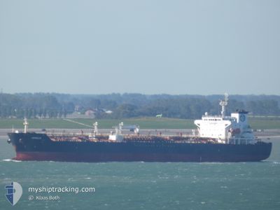
ARGOLIS
Oil/Chemical Tanker
Current Trip
| Time Travelled | 5 days |
|---|---|
| Remaining Time | 1 day |
| Distance Travelled | 1259.43 nm |
| Remaining Distance | 430.96 nm |
| AVG Speed | 12.1 Noeuds |
| MAX Speed | 14.5 Noeuds |
| AVG Wind | 11.4 knots |
| MAX Wind | 29 knots |
| MIN Temp | 11.9°C / 53.42°F |
| MAX Temp | 20.7°C / 69.26°F |
| Tirant d eau | 7.5 m |
| Position reçue | 4 h, 9 m depuis |
Current Position
| Longitude | 29.35731° |
|---|---|
| Latitude | 41.34817° |
| Etat | Under way using engine |
| Vitesse | 14.1 Noeuds |
| Parcours | 58.7° |
| Zone | Black Sea |
| Station | T-AIS |
| Position reçue | 4 h, 9 m depuis |
Info
Information
The current position of ARGOLIS is in Black Sea with coordinates 41.34817° / 29.35731° as reported on 2024-05-02 15:52 by AIS to our vessel tracker app. The vessel's current speed is 14.1 Noeuds and is heading at the port of NOVOROSSIYSK. The estimated time of arrival as calculated by MyShipTracking vessel tracking app is 2024-05-04 00:21 LT
The vessel ARGOLIS (IMO: 9326524, MMSI: 215504000) is a Oil/Chemical Tanker that was built in 2007 ( 17 Age ). It's sailing under the flag of [MT] Malta.
In this page you can find informations about the vessels current position, last detected port calls, and current voyage information. If the vessels is not in coverage by AIS you will find the latest position.
The current position of ARGOLIS is detected by our AIS receivers and we are not responsible for the reliability of the data. The last position was recorded while the vessel was in Coverage by the Ais receivers of our vessel tracking app.
The current draught of ARGOLIS as reported by AIS is 7.5 meters
Weather
| Temperature | 13.6°C / 56.48°F |
|---|---|
| Wind Speed | 6 knots |
| Direction | 266° W |
| Pressure | 1010.3 hPa |
| Humidity | 92.4 % |
| Cloud Coverage | 100 % |
Featured Company
Last Port Calls
| Port | Arrival | Departure | Time In Port |
|---|---|---|---|
| 2024-04-25 10:32 | 2024-04-27 07:17 | 1 d | |
| 2024-04-18 17:28 | 2024-04-20 00:54 | 1 d | |
| 2024-04-12 09:26 | 2024-04-13 17:02 | 1 d | |
| 2024-04-09 04:28 | 2024-04-11 14:30 | 2 d | |
| 2024-03-26 05:19 | 2024-03-27 08:01 | 1 d | |
| 2024-03-18 04:49 | |||
| 2024-03-03 18:04 | 2024-03-05 09:46 | 1 d |
Last Trips
| Origin | Departure | Destination | Arrival | Distance | |
|---|---|---|---|---|---|
| 2024-04-20 03:54 | 2024-04-25 12:32 | 1040.49 nm | |||
| 2024-04-13 20:02 | 2024-04-18 20:28 | 697.95 nm | |||
| 2024-04-11 17:30 | 2024-04-12 12:26 | 115.96 nm | |||
| 2024-03-27 11:01 | 2024-04-09 07:28 | 1357.20 nm | |||
| 2024-03-18 07:49 | 2024-03-26 08:19 | 1360.98 nm | |||
| 2024-02-27 17:01 | 2024-03-03 20:04 | 1025.59 nm |
Events
| Heure | Evenement | Détails | Position/ Destination | Info |
|---|---|---|---|---|
| 2024-05-02 16:02 | Etat Changé | Default Under way using engine |
41.36819 / 29.39990
SIKOP>RUNVS
|
Vitesse: 14.1 kn Parcours: 58.7° |
| 2024-05-02 15:52 | Hors de la zone couverte |
41.34817 / 29.35731
Black Sea
SIKOP>RUNVS
|
Vitesse: 14.1 kn Parcours: 58.7° |
|
| 2024-05-02 15:01 | Changement de zone | Turkish part of the Black Sea Turkish part of the Sea of Marmara |
41.23085 / 29.14216
Black Sea
SIKOP>RUNVS
|
Vitesse: 13.1 kn Parcours: 45.7° |
| 2024-05-02 14:45 | Etat Changé | Under way using engine Default |
41.19566 / 29.10372
SIKOP>RUNVS
|
Vitesse: 11.2 kn Parcours: 47° |
| 2024-05-02 14:36 | Etat Changé | Default Under way using engine |
41.17837 / 29.07938
SIKOP>RUNVS
|
Vitesse: 11.6 kn Parcours: 28.4° |
| 2024-05-02 14:28 | Etat Changé | Under way using engine Default |
41.15714 / 29.05974
SIKOP>RUNVS
|
Vitesse: 12.1 kn Parcours: 329° |
| 2024-05-02 14:24 | Etat Changé | Default Under way using engine |
41.14399 / 29.06127
SIKOP>RUNVS
|
Vitesse: 10.6 kn Parcours: 350.4° |
| 2024-05-02 11:32 | Changement d'ETA | 2024/05/04 03:00 2024/05/03 21:01 |
40.77679 / 28.89051
SIKOP>RUNVS
|
Vitesse: 9.4 kn Parcours: 337.8° |
| 2024-05-02 11:20 | Démarrage | 12.48 nm, South of YESILKOY |
40.75568 / 28.90306
SIKOP>RUNVS
|
Vitesse: 3.1 kn Parcours: 328° |
| 2024-05-02 06:28 | Arret | 9.12 nm, South of YESILKOY |
40.81048 / 28.88666
SIKOP>RUNVS
|
Vitesse: 0.3 kn Parcours: 327° |