
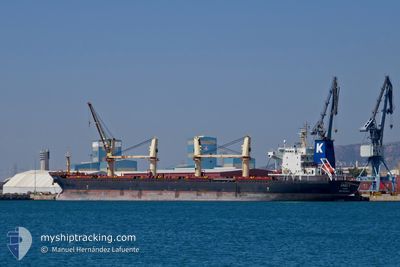
ARGO I
Bulk Carrier
Current Trip
HYDAR PASA
| Time Travelled | 20 days |
|---|---|
| Remaining Time | --- |
| Distance Travelled | 1756.39 nm |
| Remaining Distance | --- |
| AVG Speed | 10.6 Noeuds |
| MAX Speed | 10.6 Noeuds |
| AVG Wind | 12.2 knots |
| MAX Wind | 33.6 knots |
| MIN Temp | 8.6°C / 47.48°F |
| MAX Temp | 23.7°C / 74.66°F |
| Tirant d eau | 5.9 m |
| Position reçue | 6 d depuis |
Current Position
| Longitude | 29.64512° |
|---|---|
| Latitude | 41.38785° |
| Etat | Under way using engine |
| Vitesse | 12 Noeuds |
| Parcours | 64.8° |
| Zone | Black Sea |
| Station | T-AIS |
| Position reçue | 6 d depuis |
Info
Information
The current position of ARGO I is in Black Sea with coordinates 41.38785° / 29.64512° as reported on 2024-04-28 20:47 by AIS to our vessel tracker app. The vessel's current speed is 12 Noeuds
The vessel ARGO I (IMO: 9583897, MMSI: 370543000) is a Bulk Carrier that was built in 2010 ( 14 Age ). It's sailing under the flag of [PA] Panama.
In this page you can find informations about the vessels current position, last detected port calls, and current voyage information. If the vessels is not in coverage by AIS you will find the latest position.
The current position of ARGO I is detected by our AIS receivers and we are not responsible for the reliability of the data. The last position was recorded while the vessel was in Coverage by the Ais receivers of our vessel tracking app.
The current draught of ARGO I as reported by AIS is 5.9 meters
Weather
| Temperature | 12.5°C / 54.5°F |
|---|---|
| Wind Speed | 4 knots |
| Direction | 83° E |
| Pressure | 1006.9 hPa |
| Humidity | 70.1 % |
| Cloud Coverage | 43 % |
Featured Company
Last Port Calls
| Port | Arrival | Departure | Time In Port |
|---|---|---|---|
| 2024-04-04 12:19 | 2024-04-15 05:10 | 10 d | |
| 2024-03-24 05:34 | 2024-03-24 14:34 | 8 h | |
| 2024-03-04 21:43 | 2024-03-08 21:04 | 3 d | |
| 2024-03-01 09:01 | 2024-03-04 04:49 | 2 d |
Events
| Heure | Evenement | Détails | Position/ Destination | Info |
|---|---|---|---|---|
| 2024-05-03 20:14 | Démarrage |
45.03747 / 33.98301
HYDAR PASA
|
Vitesse: 49.6 kn Parcours: 17° |
|
| 2024-05-03 19:26 | Arret |
45.03312 / 33.96121
HYDAR PASA
|
Vitesse: 0.3 kn Parcours: 352° |
|
| 2024-05-03 14:22 | Arret |
45.03323 / 33.96637
HYDAR PASA
|
Vitesse: 0.2 kn Parcours: 14° |
|
| 2024-05-01 10:50 | Démarrage |
45.03550 / 33.96715
HYDAR PASA
|
Vitesse: 52 kn Parcours: 73° |
|
| 2024-04-28 20:52 | Etat Changé | Default Under way using engine |
41.39535 / 29.66624
HYDAR PASA
|
Vitesse: 12 kn Parcours: 64.8° |
| 2024-04-28 20:47 | Etat Changé | Under way using engine Default |
41.38785 / 29.64512
HYDAR PASA
|
Vitesse: 12 kn Parcours: 65° |
| 2024-04-28 20:47 | Hors de la zone couverte |
41.38785 / 29.64512
Black Sea
HYDAR PASA
|
Vitesse: 12 kn Parcours: 64.8° |
|
| 2024-04-28 20:27 | Etat Changé | Default Under way using engine |
41.35877 / 29.56383
HYDAR PASA
|
Vitesse: 11.9 kn Parcours: 64.2° |
| 2024-04-28 20:20 | Etat Changé | Under way using engine Default |
41.34957 / 29.53763
HYDAR PASA
|
Vitesse: 12.2 kn Parcours: 68° |
| 2024-04-28 19:53 | Etat Changé | Default Under way using engine |
41.31382 / 29.42493
HYDAR PASA
|
Vitesse: 11.9 kn Parcours: 73.9° |