

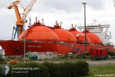
ARCTIC LADY
Lng Tanker

Current Trip
| Time Travelled | 8 days |
|---|---|
| Remaining Time | --- |
| Distance Travelled | 1955.15 nm |
| Remaining Distance | --- |
| AVG Speed | 9.5 Noeuds |
| MAX Speed | 15.6 Noeuds |
| AVG Wind | 13.5 knots |
| MAX Wind | 35 knots |
| MIN Temp | -1.2°C / 29.84°F |
| MAX Temp | 9.8°C / 49.64°F |
| Tirant d eau | 9.7 m |
| Position reçue | 2 m depuis |
Current Position
| Longitude | --- |
|---|---|
| Latitude | --- |
| Etat | At anchor |
| Vitesse | 0.1 Noeuds |
| Parcours | 274° |
| Zone | Norwegian Sea |
| Station | T-AIS |
| Position reçue | 2 m depuis |
Information
The current position of ARCTIC LADY is in Norwegian Sea with coordinates 70.64393° / 23.55598° as reported on 2025-03-28 00:06 by AIS to our vessel tracker app. The vessel's current speed is 0.1 Noeuds
The vessel ARCTIC LADY (IMO: 9284192, MMSI: 257742000) is a Lng Tanker that was built in 2006 ( 19 Age ). It's sailing under the flag of [NO] Norway.
In this page you can find informations about the vessels current position, last detected port calls, and current voyage information. If the vessels is not in coverage by AIS you will find the latest position.
The current position of ARCTIC LADY is detected by our AIS receivers and we are not responsible for the reliability of the data. The last position was recorded while the vessel was in Coverage by the Ais receivers of our vessel tracking app.
The current draught of ARCTIC LADY as reported by AIS is 9.7 meters
Weather
| Temperature | -0.5°C / 31.1°F |
|---|---|
| Wind Speed | 4 knots |
| Direction | 262° W |
| Pressure | 987.5 hPa |
| Humidity | 95.1 % |
| Cloud Coverage | 100 % |


Featured Company
Last Port Calls
Most Visited Ports (Last year)
| Port | Arrivals | |
|---|---|---|
| 12 | ||
| 7 | ||
| 3 | ||
| 2 | ||
| 1 | ||
| 1 |
Last Trips
| Origin | Departure | Destination | Arrival | Distance | |
|---|---|---|---|---|---|
| 2025-03-11 08:07 | 2025-03-18 00:41 | 1478.26 nm | |||
| 2025-02-26 22:30 | 2025-03-09 15:47 | 1556.81 nm | |||
| 2025-02-08 08:40 | 2025-02-26 00:43 | 1841.27 nm | |||
| 2025-01-08 13:34 | 2025-02-05 20:40 | 1649.34 nm | |||
| 2024-12-29 17:25 | 2025-01-07 15:16 | 1487.64 nm |
Events
| Heure | Evenement | Détails | Position/ Destination | Info |
|---|---|---|---|---|
| 2025-03-27 21:18 | Etat Changé | At anchor Default |
70.64360 / 23.55553
NO HFT
|
Vitesse: 0.1 kn Parcours: 297° |
| 2025-03-27 21:15 | Etat Changé | Default At anchor |
70.64349 / 23.55540
NO HFT
|
Vitesse: 0.1 kn Parcours: 304° |
| 2025-03-27 14:21 | Etat Changé | At anchor Under way using engine |
70.64296 / 23.55456
NO HFT
|
Vitesse: 0.2 kn Parcours: 279° |
| 2025-03-27 14:19 | Arret | 1.86 nm, West of RYPEFJORD |
70.64286 / 23.55391
NO HFT
|
Vitesse: 0.2 kn Parcours: 279° |
| 2025-03-27 07:21 | Changement d'ETA | 2025/03/27 12:00 2025/03/27 14:00 |
71.12947 / 22.56607
NO HFT
|
Vitesse: 8.6 kn Parcours: 257.9° |
| 2025-03-26 07:57 | Changement d'ETA | 2025/03/27 14:00 2025/03/26 11:00 |
71.69744 / 24.24105
NO HFT
|
Vitesse: 11.2 kn Parcours: 187.8° |
| 2025-03-26 07:07 | Changement de zone | Norwegian part of the Norwegian Sea Norwegian part of the Barentsz Sea |
71.84968 / 24.31063
Norwegian Sea
NO HFT
|
Vitesse: 11 kn Parcours: 187.5° |
| 2025-03-26 03:43 | Changement d'ETA | 2025/03/26 11:00 2025/03/26 04:00 |
72.29323 / 24.98616
NO HFT
|
Vitesse: 7.3 kn Parcours: 225.9° |
| 2025-03-26 03:05 | Etat Changé | Under way using engine Default |
72.34236 / 25.17791
NO HFT
|
Vitesse: 7.3 kn Parcours: 228° |
| 2025-03-26 02:58 | Etat Changé | Default Under way using engine |
72.35093 / 25.21076
NO HFT
|
Vitesse: 7.2 kn Parcours: 228.2° |