
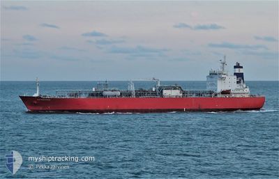
ANTWERPEN
Lpg Tanker
Current Trip
| Time Travelled | 11 h, 5 mins |
|---|---|
| Remaining Time | 21 h, 14 mins |
| Distance Travelled | 105.78 nm |
| Remaining Distance | 354.45 nm |
| AVG Speed | 12.6 Noeuds |
| MAX Speed | 14.5 Noeuds |
| AVG Wind | 10.7 knots |
| MAX Wind | 16.7 knots |
| MIN Temp | 2.9°C / 37.22°F |
| MAX Temp | 6.9°C / 44.42°F |
| Tirant d eau | 9.9 m |
| Position reçue | 3 h, 41 m depuis |
Current Position
| Longitude | --- |
|---|---|
| Latitude | --- |
| Etat | Under way using engine |
| Vitesse | 13.2 Noeuds |
| Parcours | 136.5° |
| Zone | North Sea |
| Station | T-AIS |
| Position reçue | 3 h, 41 m depuis |
Info
Information
The current position of ANTWERPEN is in North Sea with coordinates 55.50296° / -0.86547° as reported on 2024-12-03 18:34 by AIS to our vessel tracker app. The vessel's current speed is 13.2 Noeuds and is heading at the port of ANTWERP. The estimated time of arrival as calculated by MyShipTracking vessel tracking app is 2024-12-04 19:30 LT
The vessel ANTWERPEN (IMO: 9318321, MMSI: 477076700) is a Lpg Tanker that was built in 2005 ( 19 Age ). It's sailing under the flag of [HK] Hong Kong.
In this page you can find informations about the vessels current position, last detected port calls, and current voyage information. If the vessels is not in coverage by AIS you will find the latest position.
The current position of ANTWERPEN is detected by our AIS receivers and we are not responsible for the reliability of the data. The last position was recorded while the vessel was in Coverage by the Ais receivers of our vessel tracking app.
The current draught of ANTWERPEN as reported by AIS is 9.9 meters
Weather
| Temperature | 6.7°C / 44.06°F |
|---|---|
| Wind Speed | 14 knots |
| Direction | 207° SSW |
| Pressure | 1021.3 hPa |
| Humidity | 66.3 % |
| Cloud Coverage | 81 % |
Featured Company
Last Port Calls
| Port | Arrival | Departure | Time In Port |
|---|---|---|---|
| 2024-11-30 20:46 | 2024-12-03 11:11 | 2 d | |
| 2024-11-25 02:49 | 2024-11-27 00:30 | 1 d | |
| 2024-11-20 02:12 | 2024-11-21 02:19 | 1 d | |
| 2024-11-15 09:17 | 2024-11-16 16:02 | 1 d | |
| 2024-11-10 19:10 | 2024-11-12 07:22 | 1 d | |
| 2024-11-02 01:38 | 2024-11-06 00:27 | 3 d | |
| 2024-10-28 18:24 | 2024-10-29 23:26 | 1 d | |
| 2024-10-11 06:12 | 2024-10-12 14:53 | 1 d | |
| 2024-10-07 12:51 | 2024-10-08 12:26 | 23 h |
Last Trips
| Origin | Departure | Destination | Arrival | Distance | |
|---|---|---|---|---|---|
| 2024-11-27 01:30 | 2024-11-30 20:46 | 466.66 nm | |||
| 2024-11-21 03:19 | 2024-11-25 03:49 | 582.98 nm | |||
| 2024-11-16 17:02 | 2024-11-20 03:12 | 558.07 nm | |||
| 2024-11-12 07:22 | 2024-11-15 10:17 | 922.45 nm | |||
| 2024-11-06 01:27 | 2024-11-10 19:10 | 595.39 nm | |||
| 2024-10-29 23:26 | 2024-11-02 02:38 | 486.06 nm | |||
| 2024-10-12 16:53 | 2024-10-28 18:24 | 854.26 nm | |||
| 2024-10-08 14:26 | 2024-10-11 08:12 | 694.21 nm | |||
| 2024-09-29 20:32 | 2024-10-07 14:51 | 866.68 nm |
Events
| Heure | Evenement | Détails | Position/ Destination | Info |
|---|---|---|---|---|
| 2024-12-03 18:42 | Etat Changé | Default Under way using engine |
55.48097 / -.82843
BEANR
|
Vitesse: 13.2 kn Parcours: 136.5° |
| 2024-12-03 18:34 | Hors de la zone couverte |
55.50296 / -.86547
North Sea
BEANR
|
Vitesse: 13.2 kn Parcours: 136.5° |
|
| 2024-12-03 18:32 | Etat Changé | Under way using engine Default |
55.51007 / -.87742
BEANR
|
Vitesse: 13.5 kn Parcours: 137° |
| 2024-12-03 18:19 | Etat Changé | Default Under way using engine |
55.54551 / -.93626
BEANR
|
Vitesse: 13.2 kn Parcours: 138.5° |
| 2024-12-03 14:21 | Etat Changé | Under way using engine Default |
56.06542 / -2.26700
BEANR
|
Vitesse: 13.2 kn Parcours: 110° |
| 2024-12-03 14:00 | Etat Changé | Default Under way using engine |
56.08960 / -2.39609
BEANR
|
Vitesse: 13.2 kn Parcours: 110.2° |
| 2024-12-03 11:11 | PORT DE DEPART |
|
56.03698 / -3.30452
BEANR
|
Vitesse: 4.1 kn Parcours: 63° |
| 2024-12-03 11:09 | Démarrage |
56.03555 / -3.30894
[GB] BRAEFOOT
|
Vitesse: 3.1 kn Parcours: 60° |
|
| 2024-12-03 11:07 | Tirant d'eau modifié | 9.9 6.8 |
56.03475 / -3.31119
[GB] BRAEFOOT
|
Vitesse: 1.9 kn Parcours: 54° |
| 2024-12-03 11:07 | Changement de destination | BEANR GBBFB |
56.03475 / -3.31119
[GB] BRAEFOOT
|
Vitesse: 1.9 kn Parcours: 54° |