
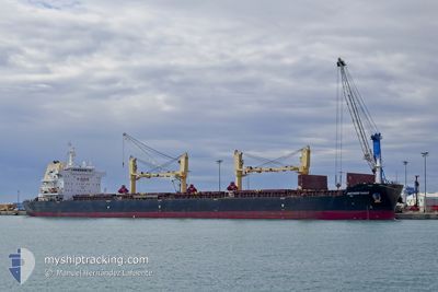
ANTWERP EAGLE
Cargo
Current Trip
| Time Travelled | 13 days |
|---|---|
| Remaining Time | --- |
| Distance Travelled | 3362.31 nm |
| Remaining Distance | --- |
| AVG Speed | 10 Noeuds |
| MAX Speed | 14.3 Noeuds |
| AVG Wind | 15.8 knots |
| MAX Wind | 27 knots |
| MIN Temp | 25.7°C / 78.26°F |
| MAX Temp | 29.1°C / 84.38°F |
| Tirant d eau | 8.5 m |
| Position reçue | 10 d depuis |
Current Position
| Longitude | --- |
|---|---|
| Latitude | --- |
| Etat | Under way using engine |
| Vitesse | 10.1 Noeuds |
| Parcours | 95.1° |
| Zone | Caribbean Sea |
| Station | T-AIS |
| Position reçue | 10 d depuis |
Info
Information
The current position of ANTWERP EAGLE is in Caribbean Sea with coordinates 11.73634° / -61.69632° as reported on 2025-01-19 01:53 by AIS to our vessel tracker app. The vessel's current speed is 10.1 Noeuds
The vessel ANTWERP EAGLE (IMO: 9699036, MMSI: 538009603) is a Cargo It's sailing under the flag of [MH] Marshall Is.
In this page you can find informations about the vessels current position, last detected port calls, and current voyage information. If the vessels is not in coverage by AIS you will find the latest position.
The current position of ANTWERP EAGLE is detected by our AIS receivers and we are not responsible for the reliability of the data. The last position was recorded while the vessel was in Coverage by the Ais receivers of our vessel tracking app.
The current draught of ANTWERP EAGLE as reported by AIS is 8.5 meters
Weather
| Temperature | 26.3°C / 79.34°F |
|---|---|
| Wind Speed | 10 knots |
| Direction | 65° ENE |
| Pressure | 1012 hPa |
| Humidity | 79.9 % |
| Cloud Coverage | 18 % |
Featured Company
Last Port Calls
| Port | Arrival | Departure | Time In Port |
|---|---|---|---|
| 2025-01-10 23:09 | 2025-01-15 15:10 | 4 d | |
| 2024-12-21 23:43 | 2024-12-25 02:55 | 3 d | |
| 2024-12-12 04:34 | 2024-12-13 15:42 | 1 d | |
| 2024-12-02 08:22 | 2024-12-05 14:19 | 3 d | |
| 2024-11-27 19:23 | 2024-12-01 03:32 | 3 d | |
| 2024-11-21 08:04 | 2024-11-23 10:03 | 2 d | |
| 2024-11-15 18:32 | 2024-11-19 19:25 | 4 d | |
| 2024-11-07 14:43 | 2024-11-12 15:36 | 5 d |
Most Visited Ports (Last year)
| Port | Arrivals | |
|---|---|---|
| 2 | ||
| 1 | ||
| 1 | ||
| 1 | ||
| 1 | ||
| 1 |
Last Trips
| Origin | Departure | Destination | Arrival | Distance | |
|---|---|---|---|---|---|
| 2024-12-25 02:55 | 2025-01-10 18:09 | 3634.91 nm | |||
| 2024-12-13 16:42 | 2024-12-21 23:43 | 1691.90 nm | |||
| 2024-12-05 16:19 | 2024-12-12 05:34 | 1597.39 nm | |||
| 2024-12-01 05:32 | 2024-12-02 10:22 | 55.62 nm | |||
| 2024-11-23 11:03 | 2024-11-27 21:23 | 1108.66 nm | |||
| 2024-11-19 20:25 | 2024-11-21 09:04 | 117.46 nm | |||
| 2024-11-12 16:36 | 2024-11-15 19:32 | 84.16 nm | |||
| 2024-08-29 07:35 | 2024-11-07 15:43 | 7180.44 nm |
Events
| Heure | Evenement | Détails | Position/ Destination | Info |
|---|---|---|---|---|
| 2025-01-29 03:16 | Arret | 8.15 nm, South West of SALVADOR |
-13.07894 / -38.59485
BR SSA
|
Vitesse: 0.3 kn Parcours: 325° |