

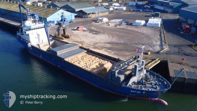
ANTJE K
General Cargo

Current Trip
| Time Travelled | 6 days |
|---|---|
| Remaining Time | 1 day |
| Distance Travelled | 1481.98 nm |
| Remaining Distance | 399.11 nm |
| AVG Speed | 8.4 Noeuds |
| MAX Speed | 11.8 Noeuds |
| AVG Wind | 17.8 knots |
| MAX Wind | 33 knots |
| MIN Temp | 10.5°C / 50.9°F |
| MAX Temp | 18.1°C / 64.58°F |
| Tirant d eau | 5.6 m |
| Position reçue | 40 m depuis |
Current Position
| Longitude | --- |
|---|---|
| Latitude | --- |
| Etat | Under way using engine |
| Vitesse | 8.4 Noeuds |
| Parcours | 61.5° |
| Zone | English Channel |
| Station | T-AIS |
| Position reçue | 40 m depuis |
Information
The current position of ANTJE K is in English Channel with coordinates 49.70712° / -3.16392° as reported on 2025-03-27 12:00 by AIS to our vessel tracker app. The vessel's current speed is 8.4 Noeuds and is heading at the port of IMMINGHAM. The estimated time of arrival as calculated by MyShipTracking vessel tracking app is 2025-03-29 09:19 LT
The vessel ANTJE K (IMO: 9198630, MMSI: 245472000) is a General Cargo that was built in 2002 ( 23 Age ). It's sailing under the flag of [NL] Netherlands.
In this page you can find informations about the vessels current position, last detected port calls, and current voyage information. If the vessels is not in coverage by AIS you will find the latest position.
The current position of ANTJE K is detected by our AIS receivers and we are not responsible for the reliability of the data. The last position was recorded while the vessel was in Coverage by the Ais receivers of our vessel tracking app.
The current draught of ANTJE K as reported by AIS is 5.6 meters
Weather
| Temperature | 10.6°C / 51.08°F |
|---|---|
| Wind Speed | 2 knots |
| Direction | 272° W |
| Pressure | 1022.1 hPa |
| Humidity | 85.7 % |
| Cloud Coverage | 5 % |


Featured Company
Last Port Calls
| Port | Arrival | Departure | Time In Port |
|---|---|---|---|
| 2025-03-13 22:01 | 2025-03-20 14:06 | 6 d | |
| 2025-03-11 01:47 | 2025-03-11 19:25 | 17 h | |
| 2025-03-03 22:03 | 2025-03-04 21:33 | 23 h | |
| 2025-02-25 09:55 | 2025-02-27 13:21 | 2 d | |
| 2025-02-15 11:58 | 2025-02-17 20:09 | 2 d | |
| 2025-02-08 14:11 | 2025-02-10 21:51 | 2 d | |
| 2025-01-29 07:41 | 2025-01-30 07:11 | 23 h | |
| 2025-01-26 16:20 | 2025-01-28 05:32 | 1 d | |
| 2025-01-13 20:51 | 2025-01-14 22:01 | 1 d | |
| 2025-01-05 05:04 | 2025-01-09 10:45 | 4 d |
Last Trips
| Origin | Departure | Destination | Arrival | Distance | |
|---|---|---|---|---|---|
| 2025-03-11 19:25 | 2025-03-13 22:01 | 531.38 nm | |||
| 2025-03-04 21:33 | 2025-03-11 01:47 | 1451.54 nm | |||
| 2025-02-27 13:21 | 2025-03-03 22:03 | 837.04 nm | |||
| 2025-02-17 20:09 | 2025-02-25 09:55 | 1742.41 nm | |||
| 2025-02-10 21:51 | 2025-02-15 11:58 | 189.07 nm | |||
| 2025-01-30 07:11 | 2025-02-08 14:11 | 1949.55 nm | |||
| 2025-01-28 05:32 | 2025-01-29 07:41 | 269.20 nm | |||
| 2025-01-14 22:01 | 2025-01-26 16:20 | 957.57 nm | |||
| 2025-01-09 10:45 | 2025-01-13 20:51 | 1043.20 nm | |||
| 2025-01-03 14:20 | 2025-01-05 05:04 | 379.50 nm |
Events
| Heure | Evenement | Détails | Position/ Destination | Info |
|---|---|---|---|---|
| 2025-03-27 12:04 | Etat Changé | Default Under way using engine |
49.71175 / -3.15105
GBIMM
|
Vitesse: 8.4 kn Parcours: 61.5° |
| 2025-03-27 11:58 | Etat Changé | Under way using engine Default |
49.70504 / -3.16976
GBIMM
|
Vitesse: 8.4 kn Parcours: 60° |
| 2025-03-27 11:44 | Dans la zone couverte |
49.70504 / -3.16976
English Channel
GBIMM
|
Vitesse: 8.5 kn Parcours: 61° |
|
| 2025-03-27 09:48 | Etat Changé | Default Under way using engine |
49.55103 / -3.59618
GBIMM
|
Vitesse: 8.9 kn Parcours: 60.6° |
| 2025-03-27 09:42 | Detecté en mer | Guernsey part of the English Channel |
49.54426 / -3.61436
English Channel
GBIMM
|
Vitesse: 8.9 kn Parcours: 60.6° |
| 2025-03-27 09:42 | Hors de la zone couverte |
49.54426 / -3.61436
English Channel
GBIMM
|
Vitesse: 8.9 kn Parcours: 60.6° |
|
| 2025-03-27 09:41 | Etat Changé | Under way using engine Default |
49.54303 / -3.61762
GBIMM
|
Vitesse: 8.8 kn Parcours: 60° |
| 2025-03-27 09:28 | Dans la zone couverte |
49.54426 / -3.61436
English Channel
GBIMM
|
Vitesse: 8.9 kn Parcours: 60.6° |
|
| 2025-03-27 06:52 | Etat Changé | Default Under way using engine |
49.31674 / -4.20671
GBIMM
|
Vitesse: 9.9 kn Parcours: 59.1° |
| 2025-03-27 06:44 | Hors de la zone couverte |
49.30574 / -4.23545
English Channel
GBIMM
|
Vitesse: 9.9 kn Parcours: 59.1° |