
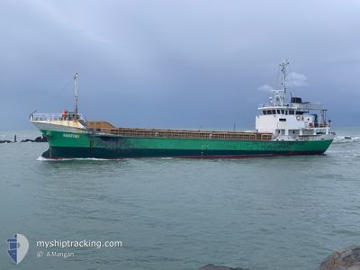
ANATOKI
Cargo
Current Trip
TIMARU
| Time Travelled | 10 days |
|---|---|
| Remaining Time | --- |
| Distance Travelled | 4.67 nm |
| Remaining Distance | --- |
| AVG Speed | --- |
| MAX Speed | --- |
| AVG Wind | 6.6 knots |
| MAX Wind | 18.4 knots |
| MIN Temp | 11.6°C / 52.88°F |
| MAX Temp | 21.5°C / 70.7°F |
| Tirant d eau | 4.4 m |
| Position reçue | 4 d depuis |
Current Position
| Longitude | --- |
|---|---|
| Latitude | --- |
| Etat | At anchor |
| Vitesse | 0.6 Noeuds |
| Parcours | 41° |
| Zone | South Pacific Ocean |
| Station | T-AIS |
| Position reçue | 4 d depuis |
Info
Information
The current position of ANATOKI is in South Pacific Ocean with coordinates -44.40611° / 171.30803° as reported on 2025-02-13 15:26 by AIS to our vessel tracker app. The vessel's current speed is 0.6 Noeuds
The vessel ANATOKI (MMSI: 512000390) is a Cargo It's sailing under the flag of [NZ] New Zealand.
In this page you can find informations about the vessels current position, last detected port calls, and current voyage information. If the vessels is not in coverage by AIS you will find the latest position.
The current position of ANATOKI is detected by our AIS receivers and we are not responsible for the reliability of the data. The last position was recorded while the vessel was in Coverage by the Ais receivers of our vessel tracking app.
The current draught of ANATOKI as reported by AIS is 4.4 meters
Weather
| Temperature | 17.5°C / 63.5°F |
|---|---|
| Wind Speed | 4 knots |
| Direction | 318° NW |
| Pressure | 992.1 hPa |
| Humidity | 88.2 % |
| Cloud Coverage | 98 % |
Featured Company
Last Port Calls
| Port | Arrival | Departure | Time In Port |
|---|---|---|---|
| 2025-02-07 06:59 | 2025-02-08 07:02 | 1 d | |
| 2025-02-04 18:24 | 2025-02-05 04:08 | 9 h | |
| 2025-02-01 20:03 | 2025-02-02 20:44 | 1 d | |
| 2025-01-30 07:12 | 2025-01-31 01:48 | 18 h | |
| 2025-01-25 03:07 | 2025-01-26 19:11 | 1 d | |
| 2025-01-22 19:48 | 2025-01-23 07:08 | 11 h | |
| 2025-01-18 20:40 | 2025-01-19 07:14 | 10 h | |
| 2025-01-16 05:00 | 2025-01-17 04:12 | 23 h | |
| 2025-01-12 22:27 | 2025-01-15 10:30 | 2 d | |
| 2025-01-09 07:11 | 2025-01-11 04:11 | 1 d |
Most Visited Ports (Last year)
| Port | Arrivals | |
|---|---|---|
| 20 | ||
| 18 | ||
| 10 | ||
| 5 | ||
| 4 | ||
| 1 |
Last Trips
| Origin | Departure | Destination | Arrival | Distance | |
|---|---|---|---|---|---|
| 2025-02-05 17:08 | 2025-02-07 19:59 | 412.80 nm | |||
| 2025-02-03 09:44 | 2025-02-05 07:24 | 373.71 nm | |||
| 2025-01-31 14:48 | 2025-02-02 09:03 | 327.04 nm | |||
| 2025-01-27 08:11 | 2025-01-30 20:12 | 327.14 nm | |||
| 2025-01-23 20:08 | 2025-01-25 16:07 | 319.59 nm | |||
| 2025-01-19 20:14 | 2025-01-23 08:48 | 329.75 nm | |||
| 2025-01-17 17:12 | 2025-01-19 09:40 | 327.85 nm | |||
| 2025-01-15 23:30 | 2025-01-16 18:00 | 121.96 nm | |||
| 2025-01-11 17:11 | 2025-01-13 11:27 | 346.85 nm | |||
| 2025-01-07 14:08 | 2025-01-09 20:11 | 409.67 nm |
Events
| Heure | Evenement | Détails | Position/ Destination | Info |
|---|---|---|---|---|
| 2025-02-13 15:41 | Etat Changé | Default At anchor |
-44.40615 / 171.30808
TIMARU
|
Vitesse: 0.6 kn Parcours: 41° |
| 2025-02-13 15:26 | Etat Changé | At anchor Default |
-44.40611 / 171.30803
TIMARU
|
Vitesse: 0.3 kn Parcours: 57° |
| 2025-02-13 15:26 | Hors de la zone couverte |
-44.40611 / 171.30803
South Pacific Ocean
|
Vitesse: 0.6 kn Parcours: 30° |
|
| 2025-02-13 15:23 | Etat Changé | Default At anchor |
-44.40609 / 171.30800
TIMARU
|
Vitesse: 0.2 kn Parcours: 54° |
| 2025-02-13 15:14 | Etat Changé | At anchor Default |
-44.40609 / 171.30800
TIMARU
|
Vitesse: 0.4 kn Parcours: 57° |
| 2025-02-13 14:59 | Etat Changé | Default At anchor |
-44.40612 / 171.30801
TIMARU
|
Vitesse: 0.3 kn Parcours: 67° |
| 2025-02-13 14:44 | Etat Changé | At anchor Default |
-44.40606 / 171.30792
TIMARU
|
Vitesse: 0.6 kn Parcours: 49° |
| 2025-02-13 13:59 | Etat Changé | Default At anchor |
-44.40602 / 171.30788
TIMARU
|
Vitesse: 0.4 kn Parcours: 69° |
| 2025-02-13 13:44 | Etat Changé | At anchor Default |
-44.40609 / 171.30790
TIMARU
|
Vitesse: 0.2 kn Parcours: 79° |
| 2025-02-13 13:29 | Dans la zone couverte |
-44.40609 / 171.30790
South Pacific Ocean
|
Vitesse: 0.3 kn Parcours: 48.9° |