
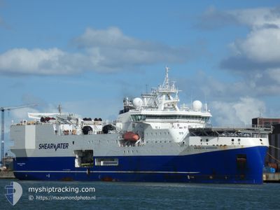
AMAZON WARRIOR
Research/Survey Vessel
Current Trip
TOWING CABLES
| Time Travelled | 3 days |
|---|---|
| Remaining Time | --- |
| Distance Travelled | 423.62 nm |
| Remaining Distance | --- |
| AVG Speed | 6.6 Noeuds |
| MAX Speed | 13.1 Noeuds |
| AVG Wind | 10.5 knots |
| MAX Wind | 18 knots |
| MIN Temp | 6.8°C / 44.24°F |
| MAX Temp | 10.5°C / 50.9°F |
| Tirant d eau | 7.7 m |
| Position reçue | 2 m depuis |
Current Position
| Longitude | 0.88669° |
|---|---|
| Latitude | 62.48672° |
| Etat | Restricted manoeuverability |
| Vitesse | 4 Noeuds |
| Parcours | 88° |
| Zone | Norwegian Sea |
| Station | T-AIS |
| Position reçue | 2 m depuis |
Info
Information
The current position of AMAZON WARRIOR is in Norwegian Sea with coordinates 62.48672° / 0.88669° as reported on 2024-05-10 09:49 by AIS to our vessel tracker app. The vessel's current speed is 4 Noeuds
The vessel AMAZON WARRIOR (IMO: 9662394, MMSI: 311001278) is a Research/Survey Vessel that was built in 2014 ( 10 Age ). It's sailing under the flag of [BS] Bahamas.
In this page you can find informations about the vessels current position, last detected port calls, and current voyage information. If the vessels is not in coverage by AIS you will find the latest position.
The current position of AMAZON WARRIOR is detected by our AIS receivers and we are not responsible for the reliability of the data. The last position was recorded while the vessel was in Coverage by the Ais receivers of our vessel tracking app.
The current draught of AMAZON WARRIOR as reported by AIS is 7.7 meters
Weather
| Temperature | 7.2°C / 44.96°F |
|---|---|
| Wind Speed | 17 knots |
| Direction | 178° S |
| Pressure | 1021.5 hPa |
| Humidity | 76.3 % |
| Cloud Coverage | 100 % |
Featured Company
Last Port Calls
| Port | Arrival | Departure | Time In Port |
|---|---|---|---|
| 2024-03-07 15:38 | 2024-05-06 13:00 | ||
| 2024-03-05 10:36 | 2024-03-06 07:41 | 21 h |
Most Visited Ports (Last year)
| Port | Arrivals | |
|---|---|---|
| 3 | ||
| 2 | ||
| 1 | ||
| 1 | ||
| 1 |
Last Trips
| Origin | Departure | Destination | Arrival | Distance | |
|---|---|---|---|---|---|
| 2024-03-06 08:41 | 2024-03-07 16:38 | 403.66 nm | |||
| 2023-12-17 09:02 | 2024-03-05 11:36 | 1515.15 nm |
Events
| Heure | Evenement | Détails | Position/ Destination | Info |
|---|---|---|---|---|
| 2024-05-10 04:10 | Changement de destination | TOWING CABLES TOWING CABLES,CPA5 |
62.14169 / .78657
TOWING CABLES
|
Vitesse: 4.6 kn Parcours: 5° |
| 2024-05-10 02:50 | Changement de destination | TOWING CABLES,CPA5 TOWING CABLES,KEEP |
62.04755 / .72682
TOWING CABLES,CPA5
|
Vitesse: 4.2 kn Parcours: 5° |
| 2024-05-09 22:48 | Changement de destination | TOWING CABLES,KEEP OFFSHORE |
61.76028 / .68381
TOWING CABLES,KEEP
|
Vitesse: 5.1 kn Parcours: 25.4° |
| 2024-05-09 18:47 | Tirant d'eau modifié | 7.7 7.8 |
61.48345 / .25829
OFFSHORE
|
Vitesse: 5.1 kn Parcours: 44° |
| 2024-05-09 18:47 | Changement de destination | OFFSHORE LERWICK |
61.48345 / .25829
OFFSHORE
|
Vitesse: 5.1 kn Parcours: 44° |
| 2024-05-09 18:47 | Changement d'ETA | 2024/05/10 00:00 2024/05/08 07:00 |
61.48345 / .25829
OFFSHORE
|
Vitesse: 5.1 kn Parcours: 44° |
| 2024-05-09 17:31 | Etat Changé | Restricted manoeuverability Under way using engine |
61.40542 / .10838
LERWICK
|
Vitesse: 4.8 kn Parcours: 52° |
| 2024-05-09 16:20 | Démarrage |
61.33478 / -.02179
LERWICK
|
Vitesse: 4.1 kn Parcours: 28° |
|
| 2024-05-09 15:52 | Dans la zone couverte |
61.30978 / -.04425
Norwegian Sea
|
Vitesse: Parcours: 285.2° |
|
| 2024-05-09 14:33 | Hors de la zone couverte |
61.19066 / -.04345
Norwegian Sea
|
Vitesse: 13.2 kn Parcours: 359.8° |