

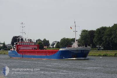
AMADEUS DIAMOND
General Cargo

Current Trip
| Time Travelled | 1 day |
|---|---|
| Remaining Time | --- |
| Distance Travelled | 345.16 nm |
| Remaining Distance | --- |
| AVG Speed | 10.1 Noeuds |
| MAX Speed | 10.8 Noeuds |
| AVG Wind | 9.3 knots |
| MAX Wind | 13.2 knots |
| MIN Temp | 4.4°C / 39.92°F |
| MAX Temp | 7.5°C / 45.5°F |
| Tirant d eau | 4.2 m |
| Position reçue | 1 m depuis |
Current Position
| Longitude | --- |
|---|---|
| Latitude | --- |
| Etat | Under way using engine |
| Vitesse | 10.5 Noeuds |
| Parcours | 204.6° |
| Zone | Baltic Sea |
| Station | T-AIS |
| Position reçue | 1 m depuis |
Information
The current position of AMADEUS DIAMOND is in Baltic Sea with coordinates 54.42447° / 10.21462° as reported on 2025-03-29 06:27 by AIS to our vessel tracker app. The vessel's current speed is 10.5 Noeuds and is heading at the port of GOOLE. The estimated time of arrival as calculated by MyShipTracking vessel tracking app is 2025-03-31 11:00 LT
The vessel AMADEUS DIAMOND (IMO: 9201968, MMSI: 245014000) is a General Cargo that was built in 2001 ( 24 Age ). It's sailing under the flag of [NL] Netherlands.
In this page you can find informations about the vessels current position, last detected port calls, and current voyage information. If the vessels is not in coverage by AIS you will find the latest position.
The current position of AMADEUS DIAMOND is detected by our AIS receivers and we are not responsible for the reliability of the data. The last position was recorded while the vessel was in Coverage by the Ais receivers of our vessel tracking app.
The current draught of AMADEUS DIAMOND as reported by AIS is 4.2 meters
Weather
| Temperature | 5.7°C / 42.26°F |
|---|---|
| Wind Speed | 9 knots |
| Direction | 323° NW |
| Pressure | 1013.2 hPa |
| Humidity | 88.6 % |
| Cloud Coverage | 100 % |


Featured Company
Last Port Calls
| Port | Arrival | Departure | Time In Port |
|---|---|---|---|
| 2025-03-25 20:39 | 2025-03-27 21:36 | 2 d | |
| 2025-03-24 17:16 | 2025-03-25 19:32 | 1 d | |
| 2025-03-20 05:10 | 2025-03-21 19:22 | 1 d | |
| 2025-03-16 16:25 | 2025-03-18 13:23 | 1 d | |
| 2025-03-12 10:12 | 2025-03-13 18:45 | 1 d | |
| 2025-03-09 12:47 | 2025-03-10 18:12 | 1 d | |
| 2025-03-07 05:38 | 2025-03-07 14:14 | 8 h | |
| 2025-03-04 16:24 | 2025-03-06 00:00 | 1 d | |
| 2025-02-26 13:14 | 2025-02-27 17:07 | 1 d | |
| 2025-02-24 17:19 | 2025-02-25 11:51 | 18 h |
Last Trips
| Origin | Departure | Destination | Arrival | Distance | |
|---|---|---|---|---|---|
| 2025-03-25 19:32 | 2025-03-25 20:39 | 12.39 nm | |||
| 2025-03-21 19:22 | 2025-03-24 17:16 | 481.62 nm | |||
| 2025-03-18 13:23 | 2025-03-20 05:10 | 350.52 nm | |||
| 2025-03-13 18:45 | 2025-03-16 16:25 | 648.48 nm | |||
| 2025-03-10 18:12 | 2025-03-12 10:12 | 417.75 nm | |||
| 2025-03-07 14:14 | 2025-03-09 12:47 | 484.95 nm | |||
| 2025-03-06 00:00 | 2025-03-07 05:38 | 329.78 nm | |||
| 2025-02-27 17:07 | 2025-03-04 16:24 | 984.00 nm | |||
| 2025-02-25 11:51 | 2025-02-26 13:14 | 214.22 nm | |||
| 2025-02-17 20:13 | 2025-02-24 17:19 | 1008.03 nm |
Events
| Heure | Evenement | Détails | Position/ Destination | Info |
|---|---|---|---|---|
| 2025-03-29 04:58 | Changement de zone | German part of the Baltic Sea Danish part of the Baltic Sea |
54.56602 / 10.56217
Baltic Sea
GOOLE
|
Vitesse: 10.5 kn Parcours: 247° |
| 2025-03-29 04:10 | Changement de zone | Danish part of the Baltic Sea German part of the Baltic Sea |
54.58374 / 10.79933
Baltic Sea
GOOLE
|
Vitesse: 10.6 kn Parcours: 266.2° |
| 2025-03-29 02:16 | Changement de zone | German part of the Baltic Sea Danish part of the Baltic Sea |
54.55902 / 11.33640
Baltic Sea
GOOLE
|
Vitesse: 10.1 kn Parcours: 290.6° |
| 2025-03-28 22:04 | Changement de zone | Danish part of the Baltic Sea German part of the Baltic Sea |
54.62169 / 12.35526
Baltic Sea
GOOLE
|
Vitesse: 10.3 kn Parcours: 250° |
| 2025-03-28 15:02 | Changement de zone | German part of the Baltic Sea Danish part of the Kattegat |
54.63333 / 14.44424
Baltic Sea
GOOLE
|
Vitesse: 10.8 kn Parcours: 261.7° |
| 2025-03-28 13:18 | Detecté en mer | Danish part of the Kattegat |
54.68310 / 14.97158
Kattegat
GOOLE
|
Vitesse: 10.6 kn Parcours: 262.2° |
| 2025-03-28 07:07 | Etat Changé | Under way using engine Default |
54.84308 / 16.77377
GOOLE
|
Vitesse: 9.9 kn Parcours: 253° |
| 2025-03-28 06:50 | Etat Changé | Default Under way using engine |
54.85046 / 16.85489
GOOLE
|
Vitesse: 10 kn Parcours: 253.8° |
| 2025-03-28 06:48 | Etat Changé | Under way using engine Default |
54.85264 / 16.86721
GOOLE
|
Vitesse: 9.9 kn Parcours: 254° |
| 2025-03-28 06:30 | Etat Changé | Default Under way using engine |
54.86697 / 16.94943
GOOLE
|
Vitesse: 10 kn Parcours: 254° |