
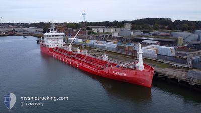
ALVANITH
Tanker B
Current Trip
| Time Travelled | 5 days |
|---|---|
| Remaining Time | --- |
| Distance Travelled | 1041.76 nm |
| Remaining Distance | --- |
| AVG Speed | 10 Noeuds |
| MAX Speed | 15.5 Noeuds |
| AVG Wind | 9.6 knots |
| MAX Wind | 23 knots |
| MIN Temp | 3.4°C / 38.12°F |
| MAX Temp | 14.6°C / 58.28°F |
| Tirant d eau | 5.1 m |
| Position reçue | 35 m depuis |
Current Position
| Longitude | --- |
|---|---|
| Latitude | --- |
| Etat | Moored |
| Vitesse | 9.6 Noeuds |
| Parcours | 174.4° |
| Zone | Bay of Biscay |
| Station | T-AIS |
| Position reçue | 35 m depuis |
Info
Information
The current position of ALVANITH is in Bay of Biscay with coordinates 46.49471° / -2.73218° as reported on 2025-03-11 09:26 by AIS to our vessel tracker app. The vessel's current speed is 9.6 Noeuds and is heading at the port of BAYONNE. The estimated time of arrival as calculated by MyShipTracking vessel tracking app is 2025-03-12 05:00 LT
The vessel ALVANITH (IMO: 9856799, MMSI: 210253000) is a Tanker B It's sailing under the flag of [CY] Cyprus.
In this page you can find informations about the vessels current position, last detected port calls, and current voyage information. If the vessels is not in coverage by AIS you will find the latest position.
The current position of ALVANITH is detected by our AIS receivers and we are not responsible for the reliability of the data. The last position was recorded while the vessel was in Coverage by the Ais receivers of our vessel tracking app.
The current draught of ALVANITH as reported by AIS is 5.1 meters
Weather
| Temperature | 10.5°C / 50.9°F |
|---|---|
| Wind Speed | 11 knots |
| Direction | 67° ENE |
| Pressure | 1002.7 hPa |
| Humidity | 80.4 % |
| Cloud Coverage | 8 % |
Featured Company
Last Port Calls
| Port | Arrival | Departure | Time In Port |
|---|---|---|---|
| 2025-03-05 04:17 | 2025-03-06 04:45 | 1 d | |
| 2025-03-01 13:58 | 2025-03-02 08:17 | 18 h | |
| 2025-02-26 10:46 | 2025-02-28 03:34 | 1 d | |
| 2025-02-22 02:11 | 2025-02-24 07:25 | 2 d | |
| 2025-02-18 13:26 | 2025-02-19 15:48 | 1 d | |
| 2025-02-15 13:10 | 2025-02-16 18:12 | 1 d | |
| 2025-02-10 06:37 | 2025-02-11 14:04 | 1 d | |
| 2025-02-07 12:28 | 2025-02-08 09:55 | 21 h | |
| 2025-02-01 08:33 | 2025-02-02 21:06 | 1 d | |
| 2025-01-27 07:11 | 2025-01-28 07:45 | 1 d |
Last Trips
| Origin | Departure | Destination | Arrival | Distance | |
|---|---|---|---|---|---|
| 2025-03-02 08:17 | 2025-03-05 05:17 | 420.34 nm | |||
| 2025-02-28 03:34 | 2025-03-01 13:58 | 223.49 nm | |||
| 2025-02-24 08:25 | 2025-02-26 10:46 | 439.13 nm | |||
| 2025-02-19 16:48 | 2025-02-22 03:11 | 295.17 nm | |||
| 2025-02-16 19:12 | 2025-02-18 14:26 | 110.38 nm | |||
| 2025-02-11 15:04 | 2025-02-15 14:10 | 990.36 nm | |||
| 2025-02-08 10:55 | 2025-02-10 07:37 | 489.88 nm | |||
| 2025-02-02 22:06 | 2025-02-07 13:28 | 1073.74 nm | |||
| 2025-01-28 08:45 | 2025-02-01 09:33 | 700.93 nm | |||
| 2025-01-25 00:42 | 2025-01-27 08:11 | 455.60 nm |
Events
| Heure | Evenement | Détails | Position/ Destination | Info |
|---|---|---|---|---|
| 2025-03-11 09:27 | Etat Changé | Default Moored |
46.49014 / -2.73159
FR BAY
|
Vitesse: 9.6 kn Parcours: 174.4° |
| 2025-03-11 09:07 | Etat Changé | Moored Default |
46.54462 / -2.74059
FR BAY
|
Vitesse: 9.4 kn Parcours: 171° |
| 2025-03-11 09:01 | Etat Changé | Default Moored |
46.56142 / -2.74435
FR BAY
|
Vitesse: 9.4 kn Parcours: 164.9° |
| 2025-03-11 01:50 | Changement de destination | FR BAY FR NTE |
47.20840 / -1.77390
FR BAY
|
Vitesse: 10.5 kn Parcours: 285.3° |
| 2025-03-11 01:50 | Changement d'ETA | 2025/03/12 05:00 2025/03/10 02:00 |
47.20840 / -1.77390
FR BAY
|
Vitesse: 10.5 kn Parcours: 285.3° |
| 2025-03-11 01:14 | Démarrage | 3.75 nm, West of NANTES |
47.19286 / -1.63545
FR NTE
|
Vitesse: 4.4 kn Parcours: 253° |
| 2025-03-11 01:08 | Etat Changé | Moored Default |
47.19329 / -1.63360
FR NTE
|
Vitesse: Parcours: 263° |
| 2025-03-11 00:48 | Tirant d'eau modifié | 5.1 6.3 |
47.19330 / -1.63361
FR NTE
|
Vitesse: Parcours: 262° |
| 2025-03-11 00:47 | Etat Changé | Default Moored |
47.19330 / -1.63361
FR NTE
|
Vitesse: Parcours: 262° |
| 2025-03-11 00:41 | Etat Changé | Moored Default |
47.19330 / -1.63359
FR NTE
|
Vitesse: Parcours: 262° |