
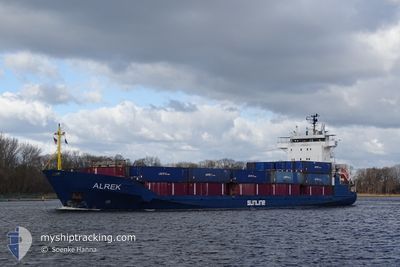
ALREK
General Cargo
Current Trip
| Time Travelled | 4 days |
|---|---|
| Remaining Time | 6 h, 0 mins |
| Distance Travelled | 819.76 nm |
| Remaining Distance | 74.18 nm |
| AVG Speed | 10 Noeuds |
| MAX Speed | 16.3 Noeuds |
| AVG Wind | 18.4 knots |
| MAX Wind | 33 knots |
| MIN Temp | -5.5°C / 22.1°F |
| MAX Temp | 14.8°C / 58.64°F |
| Tirant d eau | 5.5 m |
| Position reçue | 2 h, 20 m depuis |
Current Position
| Longitude | --- |
|---|---|
| Latitude | --- |
| Etat | Under way using engine |
| Vitesse | 12.3 Noeuds |
| Parcours | 291.5° |
| Zone | North Sea |
| Station | T-AIS |
| Position reçue | 2 h, 20 m depuis |
Info
Information
The current position of ALREK is in North Sea with coordinates 52.81757° / 1.88582° as reported on 2024-11-26 02:41 by AIS to our vessel tracker app. The vessel's current speed is 12.3 Noeuds and is heading at the port of HULL. The estimated time of arrival as calculated by MyShipTracking vessel tracking app is 2024-11-26 11:01 LT
The vessel ALREK (IMO: 9330953, MMSI: 304944000) is a General Cargo that was built in 2006 ( 18 Age ). It's sailing under the flag of [AG] Antigua Barbuda.
In this page you can find informations about the vessels current position, last detected port calls, and current voyage information. If the vessels is not in coverage by AIS you will find the latest position.
The current position of ALREK is detected by our AIS receivers and we are not responsible for the reliability of the data. The last position was recorded while the vessel was in Coverage by the Ais receivers of our vessel tracking app.
The current draught of ALREK as reported by AIS is 5.5 meters
Weather
| Temperature | 7°C / 44.6°F |
|---|---|
| Wind Speed | 18 knots |
| Direction | 226° SW |
| Pressure | 1009.6 hPa |
| Humidity | 83.5 % |
| Cloud Coverage | 9 % |
Featured Company
Last Port Calls
| Port | Arrival | Departure | Time In Port |
|---|---|---|---|
| 2024-11-21 21:21 | 2024-11-21 22:03 | 41 m | |
| 2024-11-20 14:20 | 2024-11-21 16:35 | 1 d | |
| 2024-11-20 09:25 | 2024-11-20 10:04 | 38 m | |
| 2024-11-17 06:05 | 2024-11-17 13:02 | 6 h | |
| 2024-11-15 13:14 | 2024-11-16 13:25 | 1 d | |
| 2024-11-13 13:36 | 2024-11-14 15:37 | 1 d | |
| 2024-11-11 23:57 | 2024-11-12 00:40 | 42 m | |
| 2024-11-08 07:45 | 2024-11-10 13:33 | 2 d | |
| 2024-11-04 02:32 | 2024-11-05 11:26 | 1 d | |
| 2024-10-31 19:33 | 2024-10-31 20:21 | 48 m |
Last Trips
| Origin | Departure | Destination | Arrival | Distance | |
|---|---|---|---|---|---|
| 2024-11-21 17:35 | 2024-11-21 22:21 | 49.54 nm | |||
| 2024-11-20 11:04 | 2024-11-20 15:20 | 49.17 nm | |||
| 2024-11-17 14:02 | 2024-11-20 10:25 | 750.01 nm | |||
| 2024-11-16 13:25 | 2024-11-17 07:05 | 208.67 nm | |||
| 2024-11-14 16:37 | 2024-11-15 13:14 | 242.43 nm | |||
| 2024-11-12 01:40 | 2024-11-13 14:36 | 396.18 nm | |||
| 2024-11-10 14:33 | 2024-11-12 00:57 | 430.35 nm | |||
| 2024-11-05 11:26 | 2024-11-08 08:45 | 842.41 nm | |||
| 2024-10-31 21:21 | 2024-11-04 02:32 | 860.05 nm | |||
| 2024-10-31 16:10 | 2024-10-31 20:33 | 49.13 nm |
Events
| Heure | Evenement | Détails | Position/ Destination | Info |
|---|---|---|---|---|
| 2024-11-26 02:49 | Etat Changé | Default Under way using engine |
52.82682 / 1.84517
GBHUL
|
Vitesse: 12.3 kn Parcours: 291.5° |
| 2024-11-26 02:41 | Hors de la zone couverte |
52.81757 / 1.88582
North Sea
GBHUL
|
Vitesse: 12.3 kn Parcours: 291.5° |
|
| 2024-11-26 02:29 | Etat Changé | Under way using engine Default |
52.80283 / 1.94850
GBHUL
|
Vitesse: 12.2 kn Parcours: 292° |
| 2024-11-26 02:24 | Etat Changé | Default Under way using engine |
52.79711 / 1.97200
GBHUL
|
Vitesse: 12.4 kn Parcours: 293.5° |
| 2024-11-26 01:59 | Changement de zone | United Kingdom part of the North Sea Dutch part of the North Sea |
52.76470 / 2.10190
North Sea
GBHUL
|
Vitesse: 12.1 kn Parcours: 293.8° |
| 2024-11-26 01:59 | Etat Changé | Under way using engine Default |
52.76470 / 2.10190
GBHUL
|
Vitesse: 12 kn Parcours: 292° |
| 2024-11-26 01:40 | Dans la zone couverte |
52.76470 / 2.10190
North Sea
GBHUL
|
Vitesse: 12.1 kn Parcours: 293.8° |
|
| 2024-11-25 17:09 | Etat Changé | Default Under way using engine |
53.23620 / 4.30965
GBHUL
|
Vitesse: 10.4 kn Parcours: 220.4° |
| 2024-11-25 17:05 | Hors de la zone couverte |
53.24473 / 4.32243
North Sea
GBHUL
|
Vitesse: 10.4 kn Parcours: 220.4° |
|
| 2024-11-25 16:38 | Etat Changé | Under way using engine Default |
53.30290 / 4.40403
GBHUL
|
Vitesse: 10.3 kn Parcours: 222° |