
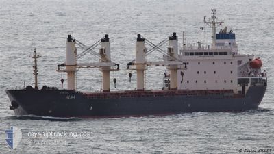
ALMA
Bulk Carrier
Current Trip
TR ISK.
| Time Travelled | 35 days |
|---|---|
| Remaining Time | --- |
| Distance Travelled | 2623.02 nm |
| Remaining Distance | --- |
| AVG Speed | 11.9 Noeuds |
| MAX Speed | 11.9 Noeuds |
| AVG Wind | 8.8 knots |
| MAX Wind | 28.3 knots |
| MIN Temp | 11°C / 51.8°F |
| MAX Temp | 30.9°C / 87.62°F |
| Tirant d eau | 9.5 m |
| Position reçue | 19 h, 39 m depuis |
Current Position
| Longitude | 35.33437° |
|---|---|
| Latitude | 36.10702° |
| Etat | Under way using engine |
| Vitesse | 2.3 Noeuds |
| Parcours | 309° |
| Zone | Mediterranean Sea - Eastern Basin |
| Station | T-AIS |
| Position reçue | 19 h, 39 m depuis |
Info
Information
The current position of ALMA is in Mediterranean Sea - Eastern Basin with coordinates 36.10702° / 35.33437° as reported on 2024-04-27 15:50 by AIS to our vessel tracker app. The vessel's current speed is 2.3 Noeuds
The vessel ALMA (IMO: 9231676, MMSI: 215223000) is a Bulk Carrier that was built in 2002 ( 22 Age ). It's sailing under the flag of [MT] Malta.
In this page you can find informations about the vessels current position, last detected port calls, and current voyage information. If the vessels is not in coverage by AIS you will find the latest position.
The current position of ALMA is detected by our AIS receivers and we are not responsible for the reliability of the data. The last position was recorded while the vessel was in Coverage by the Ais receivers of our vessel tracking app.
The current draught of ALMA as reported by AIS is 9.5 meters
Weather
| Temperature | 21.2°C / 70.16°F |
|---|---|
| Wind Speed | 12 knots |
| Direction | 192° SSW |
| Pressure | 1009.3 hPa |
| Humidity | 72.9 % |
| Cloud Coverage | 100 % |
Featured Company
Last Port Calls
| Port | Arrival | Departure | Time In Port |
|---|---|---|---|
| 2024-03-15 14:44 | 2024-03-23 15:01 | 8 d | |
| 2024-03-04 12:30 | 2024-03-07 16:02 | 3 d | |
| 2024-02-21 10:38 | 2024-02-22 01:14 | 14 h | |
| 2024-02-07 08:24 | 2024-02-08 19:36 | 1 d | |
| 2024-02-04 17:20 | 2024-02-04 17:55 | 34 m | |
| 2024-02-03 14:00 | 2024-02-03 14:37 | 36 m |
Last Trips
| Origin | Departure | Destination | Arrival | Distance | |
|---|---|---|---|---|---|
| 2024-03-07 17:02 | 2024-03-15 17:44 | 1390.57 nm | |||
| 2024-02-22 02:14 | 2024-03-04 13:30 | 2726.37 nm | |||
| 2024-02-08 20:36 | 2024-02-21 11:38 | 1394.50 nm | |||
| 2024-02-04 18:55 | 2024-02-07 09:24 | 720.18 nm | |||
| 2024-02-03 15:37 | 2024-02-04 18:20 | 2.20 nm | |||
| 2024-01-12 23:33 | 2024-02-03 15:00 | 6114.37 nm |
Events
| Heure | Evenement | Détails | Position/ Destination | Info |
|---|---|---|---|---|
| 2024-04-27 15:50 | Hors de la zone couverte |
36.10702 / 35.33437
Mediterranean Sea - Eastern Basin
|
Vitesse: 2.3 kn Parcours: 318° |
|
| 2024-04-27 15:32 | Démarrage |
36.10203 / 35.33972
TR ISK.
|
Vitesse: 10 kn Parcours: 125° |
|
| 2024-04-27 15:31 | Arret |
36.10273 / 35.33752
TR ISK.
|
Vitesse: 0.3 kn Parcours: 326° |
|
| 2024-04-27 15:27 | Etat Changé | Under way using engine Default |
36.10913 / 35.33398
TR ISK.
|
Vitesse: 0.4 kn Parcours: 311° |
| 2024-04-27 15:27 | Démarrage |
36.10913 / 35.33398
TR ISK.
|
Vitesse: 42.7 kn Parcours: 207° |
|
| 2024-04-27 15:27 | Dans la zone couverte |
36.10913 / 35.33398
Mediterranean Sea - Eastern Basin
|
Vitesse: 42.7 kn Parcours: 207° |
|
| 2024-04-27 02:05 | Hors de la zone couverte |
36.11240 / 35.49558
Mediterranean Sea - Eastern Basin
|
Vitesse: 1 kn Parcours: 70° |
|
| 2024-04-27 01:33 | Démarrage |
36.10835 / 35.48518
TR ISK.
|
Vitesse: 4.4 kn Parcours: 166° |
|
| 2024-04-27 01:31 | Etat Changé | Under way using engine Default |
36.10777 / 35.48477
TR ISK.
|
Vitesse: 1.1 kn Parcours: 180° |
| 2024-04-27 01:01 | Etat Changé | Default Under way using engine |
36.10380 / 35.47522
TR ISK.
|
Vitesse: 1 kn Parcours: 183° |