

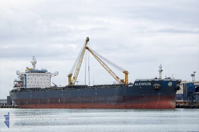
ALKIMOS
Bulk Carrier

Current Trip
| Time Travelled | 32 days |
|---|---|
| Remaining Time | 14 days |
| Distance Travelled | 7863.80 nm |
| Remaining Distance | 3970.28 nm |
| AVG Speed | 10.3 Noeuds |
| MAX Speed | 12.4 Noeuds |
| AVG Wind | 12.7 knots |
| MAX Wind | 25 knots |
| MIN Temp | 18.2°C / 64.76°F |
| MAX Temp | 27.7°C / 81.86°F |
| Tirant d eau | 14.9 m |
| Position reçue | 6 d depuis |
Current Position
| Longitude | --- |
|---|---|
| Latitude | --- |
| Etat | Under way using engine |
| Vitesse | 11.4 Noeuds |
| Parcours | 112° |
| Zone | South Atlantic Ocean |
| Station | T-AIS |
| Position reçue | 6 d depuis |
Information
The current position of ALKIMOS is in South Atlantic Ocean with coordinates -34.49099° / 18.39004° as reported on 2025-03-21 07:44 by AIS to our vessel tracker app. The vessel's current speed is 11.4 Noeuds and is heading at the port of SINGAPORE. The estimated time of arrival as calculated by MyShipTracking vessel tracking app is 2025-04-11 06:30 LT
The vessel ALKIMOS (IMO: 9603001, MMSI: 210725000) is a Bulk Carrier that was built in 2013 ( 12 Age ). It's sailing under the flag of [CY] Cyprus.
In this page you can find informations about the vessels current position, last detected port calls, and current voyage information. If the vessels is not in coverage by AIS you will find the latest position.
The current position of ALKIMOS is detected by our AIS receivers and we are not responsible for the reliability of the data. The last position was recorded while the vessel was in Coverage by the Ais receivers of our vessel tracking app.
The current draught of ALKIMOS as reported by AIS is 14.9 meters
Weather
| Temperature | 25.7°C / 78.26°F |
|---|---|
| Wind Speed | 14 knots |
| Direction | 57° ENE |
| Pressure | 1013.3 hPa |
| Humidity | 82.6 % |
| Cloud Coverage | 23 % |


Featured Company
Last Port Calls
| Port | Arrival | Departure | Time In Port |
|---|---|---|---|
| 2025-02-20 17:24 | 2025-02-23 04:15 | 2 d |
Most Visited Ports (Last year)
| Port | Arrivals | |
|---|---|---|
| 2 | ||
| 1 | ||
| 1 | ||
| 1 | ||
| 1 | ||
| 1 |
Last Trips
| Origin | Departure | Destination | Arrival | Distance | |
|---|---|---|---|---|---|
| 2024-12-30 09:06 | 2025-02-20 17:24 | 14318.30 nm |
Events
| Heure | Evenement | Détails | Position/ Destination | Info |
|---|---|---|---|---|
| 2025-03-21 07:47 | Etat Changé | Default Under way using engine |
-34.49456 / 18.40146
SG SIN
|
Vitesse: 11.4 kn Parcours: 112° |
| 2025-03-21 07:44 | Hors de la zone couverte |
-34.49099 / 18.39004
South Atlantic Ocean
SG SIN
|
Vitesse: 11.4 kn Parcours: 112° |
|
| 2025-03-21 07:29 | Etat Changé | Under way using engine Default |
-34.47350 / 18.33827
SG SIN
|
Vitesse: 11.9 kn Parcours: 132° |
| 2025-03-21 07:24 | Etat Changé | Default Under way using engine |
-34.46214 / 18.32220
SG SIN
|
Vitesse: 11.7 kn Parcours: 128° |
| 2025-03-21 07:17 | Etat Changé | Under way using engine Default |
-34.44808 / 18.30215
SG SIN
|
Vitesse: 11.6 kn Parcours: 130° |
| 2025-03-21 07:15 | Etat Changé | Default Under way using engine |
-34.44304 / 18.29470
SG SIN
|
Vitesse: 11.6 kn Parcours: 130° |
| 2025-03-21 07:10 | Etat Changé | Under way using engine Default |
-34.43365 / 18.28132
SG SIN
|
Vitesse: 11.3 kn Parcours: 131° |
| 2025-03-21 07:04 | Dans la zone couverte |
-34.43504 / 18.28328
South Atlantic Ocean
SG SIN
|
Vitesse: 11.6 kn Parcours: 130° |
|
| 2025-03-21 06:11 | Etat Changé | Default Under way using engine |
-34.27632 / 18.15987
SG SIN
|
Vitesse: 11.7 kn Parcours: 171.8° |
| 2025-03-21 06:06 | Hors de la zone couverte |
-34.26185 / 18.15675
South Atlantic Ocean
SG SIN
|
Vitesse: 11.7 kn Parcours: 171.8° |