
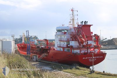
ALEYNA MERCAN
Oil/Chemical Tanker
Current Trip
| Time Travelled | 1 day |
|---|---|
| Remaining Time | --- |
| Distance Travelled | 363.42 nm |
| Remaining Distance | --- |
| AVG Speed | 9.3 Noeuds |
| MAX Speed | 12 Noeuds |
| AVG Wind | 11.5 knots |
| MAX Wind | 19.8 knots |
| MIN Temp | 11.1°C / 51.98°F |
| MAX Temp | 15.2°C / 59.36°F |
| Tirant d eau | 7.5 m |
| Position reçue | 1 m depuis |
Current Position
| Longitude | --- |
|---|---|
| Latitude | --- |
| Etat | Under way using engine |
| Vitesse | 8.1 Noeuds |
| Parcours | 229° |
| Zone | English Channel |
| Station | T-AIS |
| Position reçue | 1 m depuis |
Info
Information
The current position of ALEYNA MERCAN is in English Channel with coordinates 51.01052° / 1.34907° as reported on 2024-10-23 15:12 by AIS to our vessel tracker app. The vessel's current speed is 8.1 Noeuds and is heading at the port of LAGOS. The estimated time of arrival as calculated by MyShipTracking vessel tracking app is 2024-11-13 06:00 LT
The vessel ALEYNA MERCAN (IMO: 9296547, MMSI: 256096000) is a Oil/Chemical Tanker that was built in 2005 ( 19 Age ). It's sailing under the flag of [MT] Malta.
In this page you can find informations about the vessels current position, last detected port calls, and current voyage information. If the vessels is not in coverage by AIS you will find the latest position.
The current position of ALEYNA MERCAN is detected by our AIS receivers and we are not responsible for the reliability of the data. The last position was recorded while the vessel was in Coverage by the Ais receivers of our vessel tracking app.
The current draught of ALEYNA MERCAN as reported by AIS is 7.5 meters
Weather
| Temperature | 14.2°C / 57.56°F |
|---|---|
| Wind Speed | 7 knots |
| Direction | 188° S |
| Pressure | 1030.9 hPa |
| Humidity | 76.8 % |
| Cloud Coverage | 11 % |
Featured Company
Last Port Calls
| Port | Arrival | Departure | Time In Port |
|---|---|---|---|
| 2024-10-21 16:17 | 2024-10-21 19:01 | 2 h | |
| 2024-10-15 21:33 | 2024-10-17 11:17 | 1 d | |
| 2024-10-15 20:28 | 2024-10-15 20:47 | 19 m | |
| 2024-10-09 02:58 | 2024-10-12 09:54 | 3 d | |
| 2024-10-05 02:15 | 2024-10-06 23:32 | 1 d | |
| 2024-09-28 23:10 | 2024-09-30 00:02 | 1 d | |
| 2024-09-23 02:35 | 2024-09-24 16:33 | 1 d | |
| 2024-09-16 12:35 | 2024-09-17 12:51 | 1 d | |
| 2024-09-12 15:12 | 2024-09-12 15:54 | 41 m | |
| 2024-09-12 14:23 | 2024-09-12 14:48 | 25 m |
Most Visited Ports (Last year)
| Port | Arrivals | |
|---|---|---|
| 5 | ||
| 5 | ||
| 4 | ||
| 3 | ||
| 3 | ||
| 3 |
Last Trips
| Origin | Departure | Destination | Arrival | Distance | |
|---|---|---|---|---|---|
| 2024-10-17 14:17 | 2024-10-21 18:17 | 815.38 nm | |||
| 2024-10-15 23:47 | 2024-10-16 00:33 | 5.62 nm | |||
| 2024-10-12 11:54 | 2024-10-15 23:28 | 839.83 nm | |||
| 2024-10-07 00:32 | 2024-10-09 04:58 | 538.70 nm | |||
| 2024-09-30 01:02 | 2024-10-05 03:15 | 399.49 nm | |||
| 2024-09-24 18:33 | 2024-09-29 00:10 | 257.65 nm | |||
| 2024-09-17 13:51 | 2024-09-23 04:35 | 464.53 nm | |||
| 2024-09-12 16:54 | 2024-09-16 13:35 | 749.40 nm | |||
| 2024-09-12 15:48 | 2024-09-12 16:12 | 1.84 nm | |||
| 2024-09-10 18:31 | 2024-09-12 15:23 | 0.55 nm |
Events
| Heure | Evenement | Détails | Position/ Destination | Info |
|---|---|---|---|---|
| 2024-10-23 14:29 | Changement de zone | United Kingdom part of the English Channel United Kingdom part of the North Sea |
51.07380 / 1.47030
English Channel
NGLOS
|
Vitesse: 8.8 kn Parcours: 232° |
| 2024-10-23 10:10 | Etat Changé | Under way using engine Default |
51.63025 / 2.25393
NGLOS
|
Vitesse: 9.8 kn Parcours: 222° |
| 2024-10-23 10:06 | Etat Changé | Default Under way using engine |
51.63635 / 2.26285
NGLOS
|
Vitesse: 9.7 kn Parcours: 222° |
| 2024-10-23 09:35 | Changement de zone | United Kingdom part of the North Sea Belgian part of the North Sea |
51.70025 / 2.35670
North Sea
NGLOS
|
Vitesse: 9.7 kn Parcours: 222° |
| 2024-10-23 08:19 | Detecté en mer | Belgian part of the North Sea |
51.85088 / 2.57072
North Sea
NGLOS
|
Vitesse: 8.9 kn Parcours: 220° |
| 2024-10-23 06:09 | Etat Changé | Under way using engine Default |
52.09578 / 2.85975
NGLOS
|
Vitesse: 8 kn Parcours: 214° |
| 2024-10-23 05:55 | Dans la zone couverte |
52.09390 / 2.85775
North Sea
NGLOS
|
Vitesse: 7.9 kn Parcours: 213° |
|
| 2024-10-22 21:34 | Etat Changé | Default Under way using engine |
53.14468 / 4.34462
NGLOS
|
Vitesse: 8.6 kn Parcours: 229° |
| 2024-10-22 21:26 | Hors de la zone couverte |
53.15643 / 4.36728
North Sea
NGLOS
|
Vitesse: 8.6 kn Parcours: 229° |
|
| 2024-10-22 21:06 | Etat Changé | Under way using engine Default |
53.19347 / 4.41588
NGLOS
|
Vitesse: 8.2 kn Parcours: 199° |