
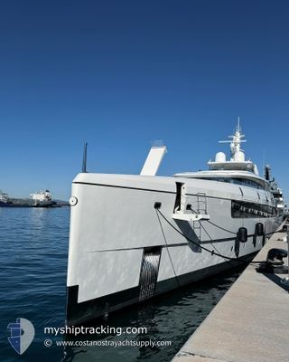
ALCHEMY
Pleasure Craft
Current Trip
ANU FH
| Time Travelled | 1 day |
|---|---|
| Remaining Time | --- |
| Distance Travelled | 6.65 nm |
| Remaining Distance | --- |
| AVG Speed | 8.3 Noeuds |
| MAX Speed | 10.7 Noeuds |
| AVG Wind | 16.3 knots |
| MAX Wind | 16.8 knots |
| MIN Temp | 25.6°C / 78.08°F |
| MAX Temp | 25.9°C / 78.62°F |
| Tirant d eau | 3.4 m |
| Position reçue | 1 d depuis |
Current Position
| Longitude | --- |
|---|---|
| Latitude | --- |
| Etat | Under way using engine |
| Vitesse | 10 Noeuds |
| Parcours | 76° |
| Zone | Caribbean Sea |
| Station | T-AIS |
| Position reçue | 1 d depuis |
Info
Information
The current position of ALCHEMY is in Caribbean Sea with coordinates 17.00659° / -61.68484° as reported on 2025-02-24 13:01 by AIS to our vessel tracker app. The vessel's current speed is 10 Noeuds
The vessel ALCHEMY (IMO: 9906659, MMSI: 319261300) is a Pleasure Craft It's sailing under the flag of [KY] Cayman Is.
In this page you can find informations about the vessels current position, last detected port calls, and current voyage information. If the vessels is not in coverage by AIS you will find the latest position.
The current position of ALCHEMY is detected by our AIS receivers and we are not responsible for the reliability of the data. The last position was recorded while the vessel was in Coverage by the Ais receivers of our vessel tracking app.
The current draught of ALCHEMY as reported by AIS is 3.4 meters
Weather
| Temperature | 26°C / 78.8°F |
|---|---|
| Wind Speed | 17 knots |
| Direction | 88° E |
| Pressure | 1017 hPa |
| Humidity | 68.7 % |
| Cloud Coverage | 27 % |
Featured Company
Last Port Calls
| Port | Arrival | Departure | Time In Port |
|---|---|---|---|
| 2025-02-18 12:00 | 2025-02-24 08:10 | 5 d | |
| 2025-01-06 13:49 | 2025-01-14 09:34 | 7 d | |
| 2024-12-23 07:50 | |||
| 2024-12-16 17:20 | 2024-12-21 14:18 | 4 d | |
| 2024-12-02 08:33 | 2024-12-08 10:23 | 6 d | |
| 2024-12-01 20:21 |
Last Trips
| Origin | Departure | Destination | Arrival | Distance | |
|---|---|---|---|---|---|
| 2025-01-14 09:34 | 2025-02-18 12:00 | 742.05 nm | |||
| 2024-12-23 07:50 | 2025-01-06 13:49 | 858.90 nm | |||
| 2024-12-08 10:23 | 2024-12-16 17:20 | 429.59 nm | |||
| 2024-12-01 20:21 | 2024-12-02 08:33 | 11.21 nm |
Events
| Heure | Evenement | Détails | Position/ Destination | Info |
|---|---|---|---|---|
| 2025-02-24 13:01 | Hors de la zone couverte |
17.00659 / -61.68484
Caribbean Sea
|
Vitesse: 10 kn Parcours: 76° |
|
| 2025-02-24 12:13 | Etat Changé | Under way using engine Moored |
17.01125 / -61.77988
ANU FH
|
Vitesse: 2 kn Parcours: 245° |
| 2025-02-24 12:10 | PORT DE DEPART |
|
17.01200 / -61.77762
ANU FH
|
Vitesse: 4.1 kn Parcours: 255° |
| 2025-02-24 12:08 | Démarrage |
17.01243 / -61.77580
[AG] ANTIGUA
|
Vitesse: 4 kn Parcours: 257° |
|
| 2025-02-23 03:44 | Dans la zone couverte |
17.01216 / -61.77199
Caribbean Sea
[AG] ANTIGUA
|
Vitesse: Parcours: 185° |
|
| 2025-02-23 00:50 | Hors de la zone couverte |
17.01224 / -61.77201
Caribbean Sea
[AG] ANTIGUA
|
Vitesse: Parcours: 143° |
|
| 2025-02-18 17:32 | Etat Changé | Moored Under way using engine |
17.01215 / -61.77197
[AG] ANTIGUA
|
Vitesse: Parcours: 245° |
| 2025-02-18 16:00 | Arret |
17.01262 / -61.77368
[AG] ANTIGUA
|
Vitesse: 0.3 kn Parcours: 359° |
|
| 2025-02-18 16:00 | Port d'arrivée |
|
17.01262 / -61.77368
[AG] ANTIGUA
|
Vitesse: 1 kn Parcours: 35° |
| 2025-02-18 15:53 | Démarrage | 0.33 nm, West of ANTIGUA |
17.01178 / -61.77848
ANU FH
|
Vitesse: 4 kn Parcours: 73° |