
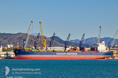
AL NAHDA
Bulk Carrier
Current Trip
ID MOW
| Time Travelled | --- |
|---|---|
| Remaining Time | --- |
| Distance Travelled | 5746.27 nm |
| Remaining Distance | --- |
| AVG Speed | 11.1 Noeuds |
| MAX Speed | 17.7 Noeuds |
| AVG Wind | 13 knots |
| MAX Wind | 34.8 knots |
| MIN Temp | 11.4°C / 52.52°F |
| MAX Temp | 31.2°C / 88.16°F |
| Tirant d eau | 13.1 m |
| Position reçue | 2025-11-30 17:19 |
Current Position
| Longitude | --- |
|---|---|
| Latitude | --- |
| Etat | Under way using engine |
| Vitesse | 12.3 Noeuds |
| Parcours | 153.8° |
| Zone | South China Sea |
| Station | T-AIS |
| Position reçue | 2025-11-30 17:19 |
Info
Information
The current position of AL NAHDA is in South China Sea with coordinates 22.59114° / 119.39277° as reported on 2025-11-30 17:19 by AIS to our vessel tracker app. The vessel's current speed is 12.3 Noeuds
The vessel AL NAHDA (IMO: 9586849, MMSI: 538009235) is a Bulk Carrier that was built in 2012 ( 14 Age ). It's sailing under the flag of [MH] Marshall Is.
In this page you can find informations about the vessels current position, last detected port calls, and current voyage information. If the vessels is not in coverage by AIS you will find the latest position.
The current position of AL NAHDA is detected by our AIS receivers and we are not responsible for the reliability of the data. The last position was recorded while the vessel was in Coverage by the Ais receivers of our vessel tracking app.
The current draught of AL NAHDA as reported by AIS is 13.1 meters
Weather
| Temperature | 24.5°C / 76.1°F |
|---|---|
| Wind Speed | 26 knots |
| Direction | 62° ENE |
| Pressure | 1012.1 hPa |
| Humidity | 74.3 % |
| Cloud Coverage | 18 % |
Featured Company
Last Port Calls
Last Trips
| Origin | Departure | Destination | Arrival | Distance |
|---|
Events
| Heure | Evenement | Détails | Position/ Destination | Info |
|---|---|---|---|---|
| 2026-01-04 08:32 | Démarrage | 1.33 nm, West of SEMIRARA |
12.05833 / 121.34834
ID MOW
|
Vitesse: 4 kn Parcours: -1° |
| 2025-12-31 23:35 | Arret | 1.07 nm, West of SEMIRARA |
12.05667 / 121.35333
ID MOW
|
Vitesse: Parcours: -1° |
| 2025-12-31 23:15 | Démarrage | 2.01 nm, West of SEMIRARA |
12.06179 / 121.33630
ID MOW
|
Vitesse: 5.1 kn Parcours: 99° |
| 2025-12-31 12:35 | Arret | 2.28 nm, West of SEMIRARA |
12.06167 / 121.33167
ID MOW
|
Vitesse: Parcours: -1° |