

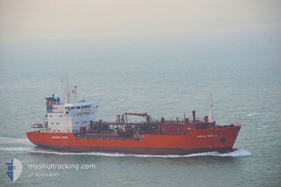
AL DIAB II
Lpg Tanker

Current Trip
| Time Travelled | 15 h, 10 mins |
|---|---|
| Remaining Time | --- |
| Distance Travelled | 141.38 nm |
| Remaining Distance | --- |
| AVG Speed | 13.9 Noeuds |
| MAX Speed | 14.6 Noeuds |
| AVG Wind | 10.2 knots |
| MAX Wind | 12.8 knots |
| MIN Temp | 20.9°C / 69.62°F |
| MAX Temp | 24.2°C / 75.56°F |
| Tirant d eau | 5 m |
| Position reçue | 7 h, 21 m depuis |
Current Position
| Longitude | --- |
|---|---|
| Latitude | --- |
| Etat | Under way using engine |
| Vitesse | 14.6 Noeuds |
| Parcours | 303.2° |
| Zone | Persian Gulf |
| Station | T-AIS |
| Position reçue | 7 h, 21 m depuis |
Information
The current position of AL DIAB II is in Persian Gulf with coordinates 25.92076° / 54.11944° as reported on 2025-02-21 19:46 by AIS to our vessel tracker app. The vessel's current speed is 14.6 Noeuds and is heading at the port of KHOR AL ZUBAIR. The estimated time of arrival as calculated by MyShipTracking vessel tracking app is 2025-02-23 12:00 LT
The vessel AL DIAB II (IMO: 9053816, MMSI: 511100397) is a Lpg Tanker that was built in 1996 ( 29 Age ). It's sailing under the flag of [PW] Palau.
In this page you can find informations about the vessels current position, last detected port calls, and current voyage information. If the vessels is not in coverage by AIS you will find the latest position.
The current position of AL DIAB II is detected by our AIS receivers and we are not responsible for the reliability of the data. The last position was recorded while the vessel was in Coverage by the Ais receivers of our vessel tracking app.
The current draught of AL DIAB II as reported by AIS is 5 meters
Weather
| Temperature | 20.9°C / 69.62°F |
|---|---|
| Wind Speed | 14 knots |
| Direction | 309° NW |
| Pressure | 1015.3 hPa |
| Humidity | 66.2 % |
| Cloud Coverage | 6 % |


Featured Company
Most Visited Ports (Last year)
| Port | Arrivals | |
|---|---|---|
| 5 | ||
| 2 | ||
| 1 | ||
| 1 |
Last Trips
| Origin | Departure | Destination | Arrival | Distance | |
|---|---|---|---|---|---|
| 2025-02-08 08:33 | 2025-02-20 16:26 | 1032.68 nm | |||
| 2025-01-31 07:44 | 2025-02-01 17:03 | 22.66 nm | |||
| 2025-01-12 08:24 | 2025-01-29 09:07 | 1035.78 nm | |||
| 2024-12-31 16:49 | 2025-01-10 18:07 | 1358.46 nm | |||
| 2024-11-23 07:44 | 2024-12-30 10:35 | 5991.45 nm |
Events
| Heure | Evenement | Détails | Position/ Destination | Info |
|---|---|---|---|---|
| 2025-02-21 19:52 | Etat Changé | Default Under way using engine |
25.93260 / 54.09917
KAZ
|
Vitesse: 14.6 kn Parcours: 303.2° |
| 2025-02-21 19:46 | Hors de la zone couverte |
25.92076 / 54.11944
Persian Gulf
KAZ
|
Vitesse: 14.6 kn Parcours: 303.2° |
|
| 2025-02-21 17:54 | Changement de zone | Iranian part of the Persian Gulf United Arab Emirates part of the Persian Gulf |
25.69414 / 54.50358
Persian Gulf
KAZ
|
Vitesse: 14.6 kn Parcours: 303.3° |
| 2025-02-21 11:57 | Etat Changé | Under way using engine Moored |
25.48515 / 55.48948
KAZ
|
Vitesse: Parcours: 159° |
| 2025-02-21 11:57 | Démarrage | 0.49 nm, North East of HAMRIYA |
25.48515 / 55.48948
KAZ
|
Vitesse: 7.5 kn Parcours: 343° |
| 2025-02-21 11:57 | PORT DE DEPART |
|
25.48515 / 55.48948
KAZ
|
Vitesse: Parcours: 159° |
| 2025-02-21 10:30 | Tirant d'eau modifié | 5 6.3 |
25.47437 / 55.49311
[AE] HAMRIYA
|
Vitesse: Parcours: 160° |
| 2025-02-21 10:30 | Changement de destination | KAZ AE HAM |
25.47437 / 55.49311
[AE] HAMRIYA
|
Vitesse: Parcours: 160° |
| 2025-02-21 10:30 | Changement d'ETA | 2025/02/23 09:00 2025/02/16 22:00 |
25.47437 / 55.49311
[AE] HAMRIYA
|
Vitesse: Parcours: 160° |
| 2025-02-21 09:21 | Etat Changé | Moored Default |
25.47433 / 55.49312
[AE] HAMRIYA
|
Vitesse: Parcours: 160° |