

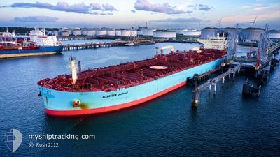
AL BATEEN
Tanker

Current Trip
| Time Travelled | 42 days |
|---|---|
| Remaining Time | --- |
| Distance Travelled | 9974.22 nm |
| Remaining Distance | --- |
| AVG Speed | 12 Noeuds |
| MAX Speed | 16.5 Noeuds |
| AVG Wind | 12 knots |
| MAX Wind | 31.2 knots |
| MIN Temp | 1.9°C / 35.42°F |
| MAX Temp | 29.6°C / 85.28°F |
| Tirant d eau | 9.2 m |
| Position reçue | 4 d depuis |
Current Position
| Longitude | --- |
|---|---|
| Latitude | --- |
| Etat | Under way using engine |
| Vitesse | 10.6 Noeuds |
| Parcours | 34.7° |
| Zone | Indian Ocean |
| Station | T-AIS |
| Position reçue | 4 d depuis |
Information
The current position of AL BATEEN is in Indian Ocean with coordinates -30.45113° / 31.96260° as reported on 2025-03-23 13:43 by AIS to our vessel tracker app. The vessel's current speed is 10.6 Noeuds and is heading at the port of FUJAIRAH. The estimated time of arrival as calculated by MyShipTracking vessel tracking app is 2025-04-04 18:00 LT
The vessel AL BATEEN (IMO: 9828376, MMSI: 636020891) is a Tanker It's sailing under the flag of [LR] Liberia.
In this page you can find informations about the vessels current position, last detected port calls, and current voyage information. If the vessels is not in coverage by AIS you will find the latest position.
The current position of AL BATEEN is detected by our AIS receivers and we are not responsible for the reliability of the data. The last position was recorded while the vessel was in Coverage by the Ais receivers of our vessel tracking app.
The current draught of AL BATEEN as reported by AIS is 9.2 meters
Weather
| Temperature | 28.5°C / 83.3°F |
|---|---|
| Wind Speed | 8 knots |
| Direction | 127° SE |
| Pressure | 1011.2 hPa |
| Humidity | 73.8 % |
| Cloud Coverage | 100 % |


Featured Company
Last Trips
Events
| Heure | Evenement | Détails | Position/ Destination | Info |
|---|---|---|---|---|
| 2025-03-23 13:48 | Etat Changé | Default Under way using engine |
-30.44058 / 31.97086
AE FJR
|
Vitesse: 10.6 kn Parcours: 34.7° |
| 2025-03-23 13:43 | Hors de la zone couverte |
-30.45113 / 31.96260
Indian Ocean
AE FJR
|
Vitesse: 10.6 kn Parcours: 34.7° |
|
| 2025-03-23 13:42 | Etat Changé | Under way using engine Default |
-30.45360 / 31.96063
AE FJR
|
Vitesse: 10.6 kn Parcours: 34° |
| 2025-03-23 13:32 | Dans la zone couverte |
-30.45113 / 31.96260
Indian Ocean
AE FJR
|
Vitesse: 10.6 kn Parcours: 34.7° |
|
| 2025-03-23 12:38 | Etat Changé | Default Under way using engine |
-30.60734 / 31.82615
AE FJR
|
Vitesse: 10.9 kn Parcours: 37.9° |
| 2025-03-23 12:34 | Hors de la zone couverte |
-30.61524 / 31.81870
Indian Ocean
AE FJR
|
Vitesse: 10.9 kn Parcours: 37.9° |
|
| 2025-03-23 12:33 | Etat Changé | Under way using engine Default |
-30.61831 / 31.81587
AE FJR
|
Vitesse: 10.8 kn Parcours: 39° |
| 2025-03-23 12:24 | Etat Changé | Default Under way using engine |
-30.63958 / 31.79634
AE FJR
|
Vitesse: 10.7 kn Parcours: 38.7° |
| 2025-03-23 11:42 | Etat Changé | Under way using engine Default |
-30.73872 / 31.70679
AE FJR
|
Vitesse: 10.9 kn Parcours: 39° |
| 2025-03-23 11:40 | Etat Changé | Default Under way using engine |
-30.74455 / 31.70130
AE FJR
|
Vitesse: 10.7 kn Parcours: 36.1° |