

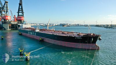
AL AGAILA
Tanker

Current Trip
| Time Travelled | 8 days |
|---|---|
| Remaining Time | 3 days |
| Distance Travelled | 2281.83 nm |
| Remaining Distance | 1350.93 nm |
| AVG Speed | 11.5 Noeuds |
| MAX Speed | 13.8 Noeuds |
| AVG Wind | 5.1 knots |
| MAX Wind | 12 knots |
| MIN Temp | 24.4°C / 75.92°F |
| MAX Temp | 28.9°C / 84.02°F |
| Tirant d eau | 16.3 m |
| Position reçue | 1 d depuis |
Current Position
| Longitude | --- |
|---|---|
| Latitude | --- |
| Etat | Under way using engine |
| Vitesse | 11.6 Noeuds |
| Parcours | 103.9° |
| Zone | Laccadive Sea |
| Station | T-AIS |
| Position reçue | 1 d depuis |
Information
The current position of AL AGAILA is in Laccadive Sea with coordinates 5.71441° / 80.33794° as reported on 2025-03-16 23:50 by AIS to our vessel tracker app. The vessel's current speed is 11.6 Noeuds and is heading at the port of TANJUNG PELEPAS. The estimated time of arrival as calculated by MyShipTracking vessel tracking app is 2025-03-22 11:53 LT
The vessel AL AGAILA (IMO: 9415404, MMSI: 642122016) is a Tanker It's sailing under the flag of [LY] Libya.
In this page you can find informations about the vessels current position, last detected port calls, and current voyage information. If the vessels is not in coverage by AIS you will find the latest position.
The current position of AL AGAILA is detected by our AIS receivers and we are not responsible for the reliability of the data. The last position was recorded while the vessel was in Coverage by the Ais receivers of our vessel tracking app.
The current draught of AL AGAILA as reported by AIS is 16.3 meters
Weather
| Temperature | 28.6°C / 83.48°F |
|---|---|
| Wind Speed | 6 knots |
| Direction | 84° E |
| Pressure | 1010.3 hPa |
| Humidity | 75.4 % |
| Cloud Coverage | 100 % |


Featured Company
Last Port Calls
| Port | Arrival | Departure | Time In Port |
|---|---|---|---|
| 2025-03-09 21:08 | 2025-03-10 23:53 | 1 d | |
| 2025-02-26 23:36 | 2025-02-28 20:20 | 1 d |
Last Trips
| Origin | Departure | Destination | Arrival | Distance | |
|---|---|---|---|---|---|
| 2025-02-28 20:20 | 2025-03-09 21:08 | 744.06 nm | |||
| 2024-12-19 14:43 | 2025-02-26 23:36 | 12023.21 nm |
Events
| Heure | Evenement | Détails | Position/ Destination | Info |
|---|---|---|---|---|
| 2025-03-16 23:50 | Etat Changé | Default Under way using engine |
5.71418 / 80.33899
MY TPP
|
Vitesse: 11.6 kn Parcours: 103.9° |
| 2025-03-16 23:50 | Hors de la zone couverte |
5.71441 / 80.33794
Laccadive Sea
MY TPP
|
Vitesse: 11.6 kn Parcours: 103.9° |
|
| 2025-03-16 23:28 | Etat Changé | Under way using engine Default |
5.76990 / 80.29461
MY TPP
|
Vitesse: 12.5 kn Parcours: 153° |
| 2025-03-16 23:24 | Etat Changé | Default Under way using engine |
5.78489 / 80.28691
MY TPP
|
Vitesse: 12.4 kn Parcours: 151.7° |
| 2025-03-16 20:46 | Changement de zone | Sri Lankan part of the Laccadive Sea Indian part of the Laccadive Sea |
5.95558 / 80.04059
Laccadive Sea
MY TPP
|
Vitesse: 10.8 kn Parcours: 105° |
| 2025-03-16 20:46 | Etat Changé | Under way using engine Default |
5.95607 / 80.03864
MY TPP
|
Vitesse: 10.2 kn Parcours: 104° |
| 2025-03-16 20:34 | Dans la zone couverte |
5.95558 / 80.04059
Laccadive Sea
MY TPP
|
Vitesse: 10.8 kn Parcours: 105° |
|
| 2025-03-16 06:26 | Etat Changé | Default Under way using engine |
6.80860 / 77.14891
MY TPP
|
Vitesse: 12.7 kn Parcours: 116.3° |
| 2025-03-16 06:24 | Hors de la zone couverte |
6.81176 / 77.14253
Laccadive Sea
MY TPP
|
Vitesse: 12.7 kn Parcours: 116.3° |
|
| 2025-03-16 06:07 | Etat Changé | Under way using engine Default |
6.84011 / 77.08591
MY TPP
|
Vitesse: 12.6 kn Parcours: 118° |