
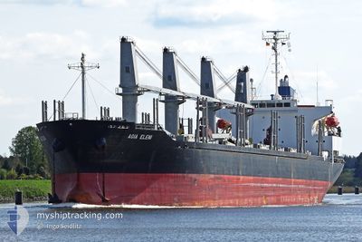
AGIA ELENI
Bulk Carrier
Current Trip
ARBUE
| Time Travelled | 7 days |
|---|---|
| Remaining Time | --- |
| Distance Travelled | 0.45 nm |
| Remaining Distance | --- |
| AVG Speed | --- |
| MAX Speed | --- |
| AVG Wind | 11 knots |
| MAX Wind | 11 knots |
| MIN Temp | 29.3°C / 84.74°F |
| MAX Temp | 30.5°C / 86.9°F |
| Tirant d eau | 8.4 m |
| Position reçue | 8 d depuis |
Current Position
| Longitude | --- |
|---|---|
| Latitude | --- |
| Etat | Under way using engine |
| Vitesse | 11.5 Noeuds |
| Parcours | 269° |
| Zone | Rio de La Plata |
| Station | T-AIS |
| Position reçue | 8 d depuis |
Info
Information
The current position of AGIA ELENI is in Rio de La Plata with coordinates -35.16672° / -56.43678° as reported on 2025-02-10 02:54 by AIS to our vessel tracker app. The vessel's current speed is 11.5 Noeuds
The vessel AGIA ELENI (IMO: 9370317, MMSI: 538007701) is a Bulk Carrier that was built in 2008 ( 17 Age ). It's sailing under the flag of [MH] Marshall Is.
In this page you can find informations about the vessels current position, last detected port calls, and current voyage information. If the vessels is not in coverage by AIS you will find the latest position.
The current position of AGIA ELENI is detected by our AIS receivers and we are not responsible for the reliability of the data. The last position was recorded while the vessel was in Coverage by the Ais receivers of our vessel tracking app.
The current draught of AGIA ELENI as reported by AIS is 8.4 meters
Weather
| Temperature | 16.5°C / 61.7°F |
|---|---|
| Wind Speed | 5 knots |
| Direction | 125° SE |
| Pressure | 1020 hPa |
| Humidity | 38.5 % |
| Cloud Coverage | 7 % |
Featured Company
Last Port Calls
| Port | Arrival | Departure | Time In Port |
|---|---|---|---|
| 2025-02-10 10:28 | 2025-02-10 11:15 | 46 m | |
| 2025-01-13 19:48 | 2025-01-13 21:03 | 1 h | |
| 2025-01-11 00:30 | 2025-01-11 00:35 | 4 m | |
| 2025-01-07 12:57 | |||
| 2025-01-07 12:31 | |||
| 2024-12-28 15:10 | 2025-01-03 14:01 | 5 d | |
| 2024-12-18 23:42 | 2024-12-22 21:06 | 3 d | |
| 2024-12-16 15:06 |
Last Trips
| Origin | Departure | Destination | Arrival | Distance | |
|---|---|---|---|---|---|
| 2025-01-13 21:03 | 2025-02-10 10:28 | 7199.77 nm | |||
| 2025-01-11 00:35 | 2025-01-13 19:48 | 588.63 nm | |||
| 2025-01-07 12:31 | 2025-01-11 00:30 | 377.16 nm | |||
| 2025-01-03 14:01 | 2025-01-07 12:57 | 758.69 nm | |||
| 2024-12-22 21:06 | 2024-12-28 15:10 | 830.47 nm | |||
| 2024-12-16 15:06 | 2024-12-18 23:42 | 626.26 nm |
Events
| Heure | Evenement | Détails | Position/ Destination | Info |
|---|---|---|---|---|
| 2025-02-10 14:53 | Arret | 4.24 nm, South of BUENOS AIRES |
-34.65563 / -58.34021
ARBUE
|
Vitesse: 0.1 kn Parcours: 315° |
| 2025-02-10 14:15 | PORT DE DEPART |
|
-34.64825 / -58.33987
ARBUE
|
Vitesse: 0.8 kn Parcours: 345° |
| 2025-02-10 13:28 | Port d'arrivée |
|
-34.63184 / -58.34300
[AR] BUENOS AIRES
|
Vitesse: 6.6 kn Parcours: 239° |
| 2025-02-10 02:54 | Etat Changé | Default Under way using engine |
-35.16672 / -56.43742
ARBUE
|
Vitesse: 11.5 kn Parcours: 269° |
| 2025-02-10 02:54 | Etat Changé | Under way using engine Default |
-35.16672 / -56.43678
ARBUE
|
Vitesse: 11.6 kn Parcours: 267° |
| 2025-02-10 02:54 | Hors de la zone couverte |
-35.16672 / -56.43678
Rio de La Plata
|
Vitesse: 11.5 kn Parcours: 269° |
|
| 2025-02-10 02:42 | Dans la zone couverte |
-35.16672 / -56.43678
Rio de La Plata
|
Vitesse: 11.5 kn Parcours: 269° |
|
| 2025-02-10 01:46 | Etat Changé | Default Under way using engine |
-35.14228 / -56.17246
ARBUE
|
Vitesse: 10.9 kn Parcours: 248° |
| 2025-02-10 01:41 | Hors de la zone couverte |
-35.13556 / -56.15290
Rio de La Plata
|
Vitesse: 10.9 kn Parcours: 248° |
|
| 2025-02-10 01:36 | Etat Changé | Under way using engine Default |
-35.12932 / -56.13771
ARBUE
|
Vitesse: 9.1 kn Parcours: 228° |