
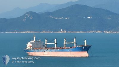
AE MARS
Bulk Carrier
Current Trip
| Time Travelled | 5 days |
|---|---|
| Remaining Time | 4 days |
| Distance Travelled | 1492.94 nm |
| Remaining Distance | 1491.90 nm |
| AVG Speed | 11.3 Noeuds |
| MAX Speed | 12.6 Noeuds |
| AVG Wind | 10.2 knots |
| MAX Wind | 15 knots |
| MIN Temp | 27.3°C / 81.14°F |
| MAX Temp | 32.7°C / 90.86°F |
| Tirant d eau | 12.5 m |
| Position reçue | 1 d depuis |
Current Position
| Longitude | 77.40654° |
|---|---|
| Latitude | 7.40579° |
| Etat | Under way using engine |
| Vitesse | 12.4 Noeuds |
| Parcours | 121.6° |
| Zone | Laccadive Sea |
| Station | T-AIS |
| Position reçue | 1 d depuis |
Info
Information
The current position of AE MARS is in Laccadive Sea with coordinates 7.40579° / 77.40654° as reported on 2024-05-07 08:29 by AIS to our vessel tracker app. The vessel's current speed is 12.4 Noeuds and is heading at the port of SINGAPORE. The estimated time of arrival as calculated by MyShipTracking vessel tracking app is 2024-05-13 13:02 LT
The vessel AE MARS (IMO: 9330111, MMSI: 636022154) is a Bulk Carrier that was built in 2006 ( 18 Age ). It's sailing under the flag of [LR] Liberia.
In this page you can find informations about the vessels current position, last detected port calls, and current voyage information. If the vessels is not in coverage by AIS you will find the latest position.
The current position of AE MARS is detected by our AIS receivers and we are not responsible for the reliability of the data. The last position was recorded while the vessel was in Coverage by the Ais receivers of our vessel tracking app.
The current draught of AE MARS as reported by AIS is 12.5 meters
Weather
| Temperature | 29.4°C / 84.92°F |
|---|---|
| Wind Speed | 7 knots |
| Direction | 193° SSW |
| Pressure | 1008.8 hPa |
| Humidity | 77.1 % |
| Cloud Coverage | 75 % |
Featured Company
Last Trips
Events
| Heure | Evenement | Détails | Position/ Destination | Info |
|---|---|---|---|---|
| 2024-05-07 09:05 | Etat Changé | Default Under way using engine |
7.34054 / 77.51377
SGSIN
|
Vitesse: 12.4 kn Parcours: 121.6° |
| 2024-05-07 08:29 | Hors de la zone couverte |
7.40579 / 77.40654
Laccadive Sea
SGSIN
|
Vitesse: 12.4 kn Parcours: 121.6° |
|
| 2024-05-07 03:09 | Tirant d'eau modifié | 12.5 12.8 |
7.97309 / 76.49303
SGSIN
|
Vitesse: 11.2 kn Parcours: 123.8° |
| 2024-05-07 03:09 | Changement de destination | SGSIN PIPAVAV |
7.97309 / 76.49303
SGSIN
|
Vitesse: 11.2 kn Parcours: 123.8° |
| 2024-05-07 03:09 | Changement d'ETA | 2024/05/14 05:30 2024/04/25 05:00 |
7.97309 / 76.49303
SGSIN
|
Vitesse: 11.2 kn Parcours: 123.8° |
| 2024-05-07 02:35 | Dans la zone couverte |
8.01355 / 76.42848
Laccadive Sea
|
Vitesse: 11 kn Parcours: 121.6° |
|
| 2024-05-07 01:12 | Hors de la zone couverte |
8.15445 / 76.20326
Laccadive Sea
|
Vitesse: 11.5 kn Parcours: 123° |
|
| 2024-05-07 00:56 | Etat Changé | Under way using engine Default |
8.18111 / 76.15997
PIPAVAV
|
Vitesse: 11.6 kn Parcours: 121° |
| 2024-05-07 00:56 | Dans la zone couverte |
8.18111 / 76.15997
Laccadive Sea
|
Vitesse: 11.7 kn Parcours: 122.3° |
|
| 2024-05-06 23:27 | Hors de la zone couverte |
8.33247 / 75.91235
Laccadive Sea
|
Vitesse: 11.4 kn Parcours: 119.8° |