
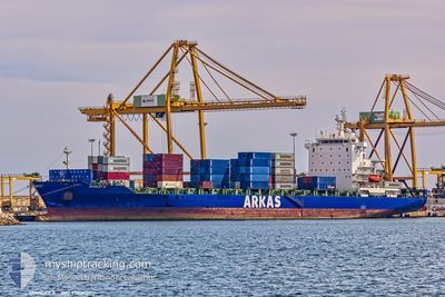
STANLEY A
Container Ship
Current Trip
| Time Travelled | 2 days |
|---|---|
| Remaining Time | --- |
| Distance Travelled | 777.05 nm |
| Remaining Distance | 482.87 nm |
| AVG Speed | 15.9 Noeuds |
| MAX Speed | 19.9 Noeuds |
| AVG Wind | 11.6 knots |
| MAX Wind | 21 knots |
| MIN Temp | 13.5°C / 56.3°F |
| MAX Temp | 17.2°C / 62.96°F |
| Tirant d eau | 9 m |
| Position reçue | 11 h, 39 m depuis |
Current Position
| Longitude | --- |
|---|---|
| Latitude | --- |
| Etat | Under way using engine |
| Vitesse | 16.5 Noeuds |
| Parcours | 122.8° |
| Zone | Mediterranean Sea - Eastern Basin |
| Station | T-AIS |
| Position reçue | 11 h, 39 m depuis |
Info
Information
The current position of STANLEY A is in Mediterranean Sea - Eastern Basin with coordinates 37.52858° / 12.31642° as reported on 2026-01-05 08:42 by AIS to our vessel tracker app. The vessel's current speed is 16.5 Noeuds and is heading at the port of PIRAEUS. The estimated time of arrival as calculated by MyShipTracking vessel tracking app is 2026-01-07 12:00 LT
The vessel STANLEY A (IMO: 9303807, MMSI: 256547000) is a Container Ship that was built in 2006 ( 20 Age ). It's sailing under the flag of [MT] Malta.
In this page you can find informations about the vessels current position, last detected port calls, and current voyage information. If the vessels is not in coverage by AIS you will find the latest position.
The current position of STANLEY A is detected by our AIS receivers and we are not responsible for the reliability of the data. The last position was recorded while the vessel was in Coverage by the Ais receivers of our vessel tracking app.
The current draught of STANLEY A as reported by AIS is 9 meters
Weather
| Temperature | 17.3°C / 63.14°F |
|---|---|
| Wind Speed | 16 knots |
| Direction | 226° SW |
| Pressure | 1007.1 hPa |
| Humidity | 83.7 % |
| Cloud Coverage | --- |
Featured Company
Last Port Calls
| Port | Arrival | Departure | Time In Port |
|---|---|---|---|
| 2026-01-03 02:12 | 2026-01-03 19:29 | 17 h | |
| 2025-12-30 17:38 | 2025-12-31 11:20 | 17 h | |
| 2025-12-28 13:20 | 2025-12-29 03:04 | 13 h | |
| 2025-12-23 13:02 | 2025-12-24 11:46 | 22 h | |
| 2025-12-21 01:47 | 2025-12-21 10:00 | 8 h | |
| 2025-12-20 08:18 | 2025-12-20 20:40 | 12 h | |
| 2025-12-19 11:32 | 2025-12-20 03:57 | 16 h | |
| 2025-12-17 16:08 | 2025-12-18 09:15 | 17 h | |
| 2025-12-13 12:55 | 2025-12-14 01:10 | 12 h | |
| 2025-12-11 17:41 | 2025-12-12 13:01 | 19 h |
Last Trips
| Origin | Departure | Destination | Arrival | Distance | |
|---|---|---|---|---|---|
| 2025-12-31 11:20 | 2026-01-03 02:12 | 197.65 nm | |||
| 2025-12-29 03:04 | 2025-12-30 17:38 | 240.88 nm | |||
| 2025-12-24 11:46 | 2025-12-28 13:20 | 1299.36 nm | |||
| 2025-12-21 10:00 | 2025-12-23 13:02 | 346.71 nm | |||
| 2025-12-20 20:40 | 2025-12-21 01:47 | 72.28 nm | |||
| 2025-12-20 03:57 | 2025-12-20 08:18 | 55.11 nm | |||
| 2025-12-18 09:15 | 2025-12-19 11:32 | 371.66 nm | |||
| 2025-12-14 01:10 | 2025-12-17 16:08 | 1204.51 nm | |||
| 2025-12-12 13:01 | 2025-12-13 12:55 | 156.72 nm | |||
| 2025-12-11 14:14 | 2025-12-11 17:41 | 43.89 nm |
Events
| Heure | Evenement | Détails | Position/ Destination | Info |
|---|---|---|---|---|
| 2026-01-05 08:49 | Etat Changé | Default Under way using engine |
37.51230 / 12.35058
GRPIR
|
Vitesse: 16.5 kn Parcours: 122.8° |
| 2026-01-05 08:42 | Hors de la zone couverte |
37.52858 / 12.31642
Mediterranean Sea - Eastern Basin
GRPIR
|
Vitesse: 16.5 kn Parcours: 122.8° |
|
| 2026-01-05 08:40 | Etat Changé | Under way using engine Default |
37.53300 / 12.30769
GRPIR
|
Vitesse: 16.4 kn Parcours: 121° |
| 2026-01-05 08:33 | Etat Changé | Default Under way using engine |
37.55092 / 12.27157
GRPIR
|
Vitesse: 16.5 kn Parcours: 120.7° |
| 2026-01-05 08:16 | Etat Changé | Under way using engine Default |
37.59046 / 12.18685
GRPIR
|
Vitesse: 16.7 kn Parcours: 121° |
| 2026-01-05 08:09 | Etat Changé | Default Under way using engine |
37.60712 / 12.15169
GRPIR
|
Vitesse: 16.4 kn Parcours: 120.6° |
| 2026-01-05 07:58 | Detecté en mer | Italian part of the Mediterranean Sea - Eastern Basin |
37.63106 / 12.10039
Mediterranean Sea - Eastern Basin
GRPIR
|
Vitesse: 16.2 kn Parcours: 120.4° |
| 2026-01-05 07:13 | Changement de zone | Italian part of the Mediterranean Sea - Western Basin Spanish part of the Balearic Sea |
37.72102 / 11.86444
Mediterranean Sea - Western Basin
GRPIR
|
Vitesse: 16.6 kn Parcours: 110.6° |
| 2026-01-05 07:12 | Etat Changé | Under way using engine Default |
37.72348 / 11.85623
GRPIR
|
Vitesse: 16.6 kn Parcours: 109° |
| 2026-01-05 06:57 | Dans la zone couverte |
37.72102 / 11.86444
Mediterranean Sea - Western Basin
GRPIR
|
Vitesse: 16.6 kn Parcours: 110.6° |