
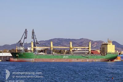
AAL MERKUR
General Cargo
Current Trip
| Time Travelled | 2 days |
|---|---|
| Remaining Time | --- |
| Distance Travelled | 69.16 nm |
| Remaining Distance | --- |
| AVG Speed | 11 Noeuds |
| MAX Speed | 13.7 Noeuds |
| AVG Wind | 10.2 knots |
| MAX Wind | 15.8 knots |
| MIN Temp | 29.9°C / 85.82°F |
| MAX Temp | 31.6°C / 88.88°F |
| Tirant d eau | 6.7 m |
| Position reçue | 11 d depuis |
Current Position
| Longitude | 104.24769° |
|---|---|
| Latitude | 1.27130° |
| Etat | Under way using engine |
| Vitesse | 15 Noeuds |
| Parcours | 77.5° |
| Zone | Singapore Strait |
| Station | T-AIS |
| Position reçue | 11 d depuis |
Info
Information
The current position of AAL MERKUR is in Singapore Strait with coordinates 1.27130° / 104.24769° as reported on 2024-05-25 18:37 by AIS to our vessel tracker app. The vessel's current speed is 15 Noeuds
The vessel AAL MERKUR (IMO: 9509695, MMSI: 636016912) is a General Cargo that was built in 2010 ( 14 Age ). It's sailing under the flag of [LR] Liberia.
In this page you can find informations about the vessels current position, last detected port calls, and current voyage information. If the vessels is not in coverage by AIS you will find the latest position.
The current position of AAL MERKUR is detected by our AIS receivers and we are not responsible for the reliability of the data. The last position was recorded while the vessel was in Coverage by the Ais receivers of our vessel tracking app.
The current draught of AAL MERKUR as reported by AIS is 6.7 meters
Weather
| Temperature | 29.5°C / 85.1°F |
|---|---|
| Wind Speed | 15 knots |
| Direction | 150° SSE |
| Pressure | 1011.7 hPa |
| Humidity | 71.9 % |
| Cloud Coverage | 10 % |
Featured Company
Last Port Calls
| Port | Arrival | Departure | Time In Port |
|---|---|---|---|
| 2024-06-01 03:44 | 2024-06-03 19:43 | 2 d | |
| 2024-05-12 23:14 | 2024-05-17 05:59 | 4 d |
Most Visited Ports (Last year)
| Port | Arrivals | |
|---|---|---|
| 3 | ||
| 2 | ||
| 2 | ||
| 2 | ||
| 2 | ||
| 1 |
Last Trips
| Origin | Departure | Destination | Arrival | Distance | |
|---|---|---|---|---|---|
| 2024-05-17 05:59 | 2024-06-01 03:44 | 2653.74 nm | |||
| 2024-03-31 06:53 | 2024-05-12 23:14 | 11130.40 nm |
Events
| Heure | Evenement | Détails | Position/ Destination | Info |
|---|---|---|---|---|
| 2024-06-03 12:43 | PORT DE DEPART |
|
10.56277 / 107.01247
SGSIN PEBGA
|
Vitesse: 8.7 kn Parcours: 220° |
| 2024-06-03 12:31 | Démarrage |
10.58615 / 107.02655
[VN] PHU MY
|
Vitesse: 5.5 kn Parcours: 188° |
|
| 2024-05-31 20:44 | Arret |
10.59219 / 107.02655
[VN] PHU MY
|
Vitesse: Parcours: 149° |
|
| 2024-05-31 20:44 | Port d'arrivée |
|
10.59219 / 107.02655
[VN] PHU MY
|
Vitesse: 0.7 kn Parcours: 2° |
| 2024-05-31 16:50 | Démarrage | 11.34 nm, South of VUNG TAU |
10.21057 / 107.06076
SGSIN PEBGA
|
Vitesse: 6.6 kn Parcours: 61° |
| 2024-05-27 14:33 | Arret | 11.53 nm, South of VUNG TAU |
10.20755 / 107.05984
SGSIN PEBGA
|
Vitesse: 0.1 kn Parcours: 265° |