
A NEPITA
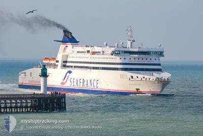
Ro-Ro/Passenger Ship
Current Trip
| Time Travelled | 44 mins |
|---|---|
| Remaining Time | --- |
| Distance Travelled | 10.19 nm |
| Remaining Distance | --- |
| AVG Speed | 18.2 Noeuds |
| MAX Speed | 18.3 Noeuds |
| AVG Wind | 4.4 knots |
| MAX Wind | 5.9 knots |
| MIN Temp | 19.4°C / 66.92°F |
| MAX Temp | 20.1°C / 68.18°F |
| Tirant d eau | 6 m |
| Position reçue | 2 m depuis |
Current Position
| Longitude | 8.64526° |
|---|---|
| Latitude | 41.71379° |
| Etat | Under way using engine |
| Vitesse | 18.1 Noeuds |
| Parcours | 299.9° |
| Zone | Mediterranean Sea - Western Basin |
| Station | T-AIS |
| Position reçue | 2 m depuis |
Info
Information
The current position of A NEPITA is in Mediterranean Sea - Western Basin with coordinates 41.71379° / 8.64526° as reported on 2024-04-30 17:10 by AIS to our vessel tracker app. The vessel's current speed is 18.1 Noeuds
The vessel A NEPITA (IMO: 9211511, MMSI: 226269000) is a Ro-Ro/Passenger Ship that was built in 2002 ( 22 Age ). It's sailing under the flag of [FR] France.
In this page you can find informations about the vessels current position, last detected port calls, and current voyage information. If the vessels is not in coverage by AIS you will find the latest position.
The current position of A NEPITA is detected by our AIS receivers and we are not responsible for the reliability of the data. The last position was recorded while the vessel was in Coverage by the Ais receivers of our vessel tracking app.
The current draught of A NEPITA as reported by AIS is 6 meters
Weather
| Temperature | 19.6°C / 67.28°F |
|---|---|
| Wind Speed | 6 knots |
| Direction | 126° SE |
| Pressure | 1008.7 hPa |
| Humidity | 54 % |
| Cloud Coverage | 78 % |
Featured Company
Last Port Calls
| Port | Arrival | Departure | Time In Port |
|---|---|---|---|
| 2024-04-30 05:24 | 2024-04-30 16:28 | 11 h | |
| 2024-04-29 05:39 | 2024-04-29 16:41 | 11 h | |
| 2024-04-28 17:04 | 2024-04-28 18:41 | 1 h | |
| 2024-04-28 05:09 | 2024-04-28 07:42 | 2 h | |
| 2024-04-26 05:39 | 2024-04-26 17:13 | 11 h | |
| 2024-04-25 05:36 | 2024-04-25 16:16 | 10 h | |
| 2024-04-24 05:29 | 2024-04-24 16:43 | 11 h | |
| 2024-04-23 05:29 | 2024-04-23 16:08 | 10 h | |
| 2024-04-22 05:29 | 2024-04-22 17:15 | 11 h | |
| 2024-04-21 17:26 | 2024-04-21 18:48 | 1 h |
Last Trips
| Origin | Departure | Destination | Arrival | Distance | |
|---|---|---|---|---|---|
| 2024-04-29 18:41 | 2024-04-30 07:24 | 195.62 nm | |||
| 2024-04-28 20:41 | 2024-04-29 07:39 | 188.68 nm | |||
| 2024-04-28 09:42 | 2024-04-28 19:04 | 184.17 nm | |||
| 2024-04-26 19:13 | 2024-04-28 07:09 | 381.58 nm | |||
| 2024-04-25 18:16 | 2024-04-26 07:39 | 190.71 nm | |||
| 2024-04-24 18:43 | 2024-04-25 07:36 | 198.10 nm | |||
| 2024-04-23 18:08 | 2024-04-24 07:29 | 198.44 nm | |||
| 2024-04-22 19:15 | 2024-04-23 07:29 | 195.66 nm | |||
| 2024-04-21 20:48 | 2024-04-22 07:29 | 189.10 nm | |||
| 2024-04-21 09:27 | 2024-04-21 19:26 | 183.77 nm |
Events
| Heure | Evenement | Détails | Position/ Destination | Info |
|---|---|---|---|---|
| 2024-04-30 17:10 | Changement de destination | FR MRR P.115 FR PRO |
41.71379 / 8.64526
FR MRR P.115
|
Vitesse: 18.1 kn Parcours: 299.9° |
| 2024-04-30 17:10 | Changement d'ETA | 2024/05/01 05:15 2024/04/30 05:10 |
41.71379 / 8.64526
FR MRR P.115
|
Vitesse: 18.1 kn Parcours: 299.9° |
| 2024-04-30 16:50 | Etat Changé | Under way using engine Default |
41.68438 / 8.76595
FR PRO
|
Vitesse: 14 kn Parcours: -1° |
| 2024-04-30 16:35 | Dans la zone couverte |
41.68438 / 8.76595
Mediterranean Sea - Western Basin
|
Vitesse: 18.3 kn Parcours: 275.1° |
|
| 2024-04-30 16:28 | PORT DE DEPART |
|
41.68333 / 8.86500
FR PRO
|
Vitesse: Parcours: 52° |
| 2024-04-30 05:24 | Port d'arrivée |
|
41.67833 / 8.90167
[FR] PROPRIANO
|
Vitesse: 11 kn Parcours: 91° |
| 2024-04-30 05:06 | Etat Changé | Default Under way using engine |
41.68167 / 8.83833
FR PRO
|
Vitesse: 15.1 kn Parcours: 86.8° |
| 2024-04-30 04:55 | Hors de la zone couverte |
41.67840 / 8.77730
Mediterranean Sea - Western Basin
[FR] PROPRIANO
|
Vitesse: 15.1 kn Parcours: 86.8° |
|
| 2024-04-30 02:17 | Etat Changé | Under way using engine Default |
41.99286 / 7.97126
FR PRO
|
Vitesse: 16 kn Parcours: 122° |
| 2024-04-30 01:56 | Etat Changé | Default Under way using engine |
42.03739 / 7.87004
FR PRO
|
Vitesse: 15.7 kn Parcours: 121.8° |